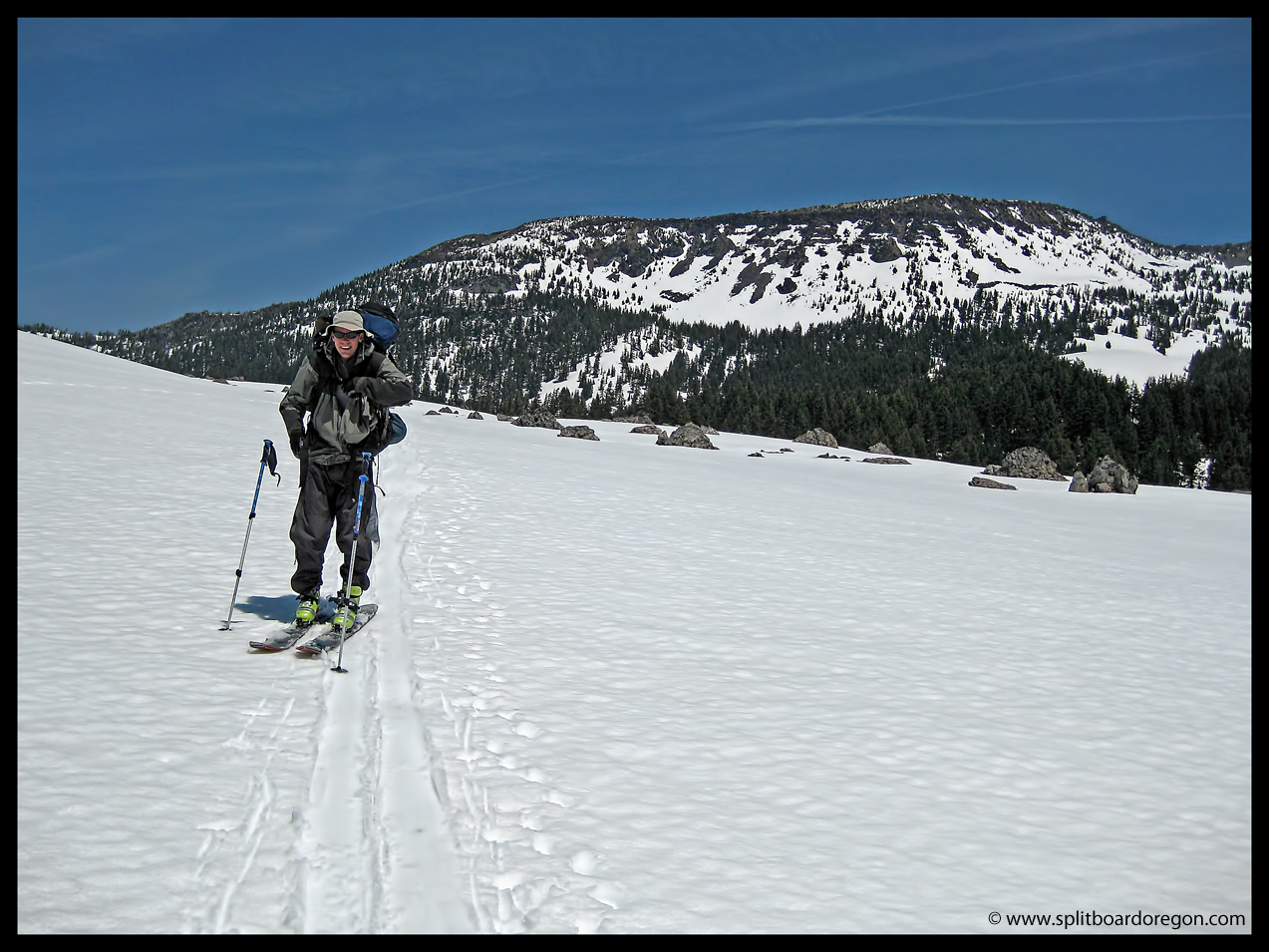
Todd and I left work early to get some evening turns in at Willamette Pass for the first of what would become an annual event -an after work April Dusk Patrol. The drive up Highway 58 went quickly and the weather was nice and sunny when we arrived in the parking lot. The resort has been closed for a few weeks now, but there’s still good coverage for those willing to earn their turns. We shouldered our packs and started skinning up By George around 5:30 pm. Skinning up was pleasant in the afternoon sunshine, but it was quite warm. At the top of By George, we traversed over to Timbur and were able to skin about 1/2 the way up before switching to booting for the last pitch since the snow had mostly melted out on the South exposure.
Hiking near the top of Timbur
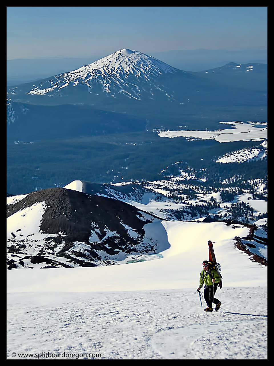
Standing on the top of Eagle Peak at 6,666′ by 6:45 pm, we enjoyed some Deschutes Cinder Cone beers along with the views south to Odell Lake and Diamond Peak. I love hanging out at the top of the Pass after ski season is over, it’s so peaceful and serene, and there’s never anyone around!
Looking off towards Odell Lake & beyond
After about 20 minutes of relaxing, the sun began to set to the West and it was time to begin the descent to the truck. We did snap this photo of both of us with Todd’s before we headed down though……
Matt & Todd atop Eagle Peak on a great April evening
The ride down was decent, as the snow had firmed up quite a bit from earlier. Most of our pictures didn’t turn out because there wasn’t enough light, but take my word for it – it was fun! We made turns all the way to the parking lot and had the whole mountain to ourselves. There’s something very enjoyable about skipping out on an afternoon’s work to head to the mountain and make evening turns, and the tradition of an April Dusk Patrol has begun!
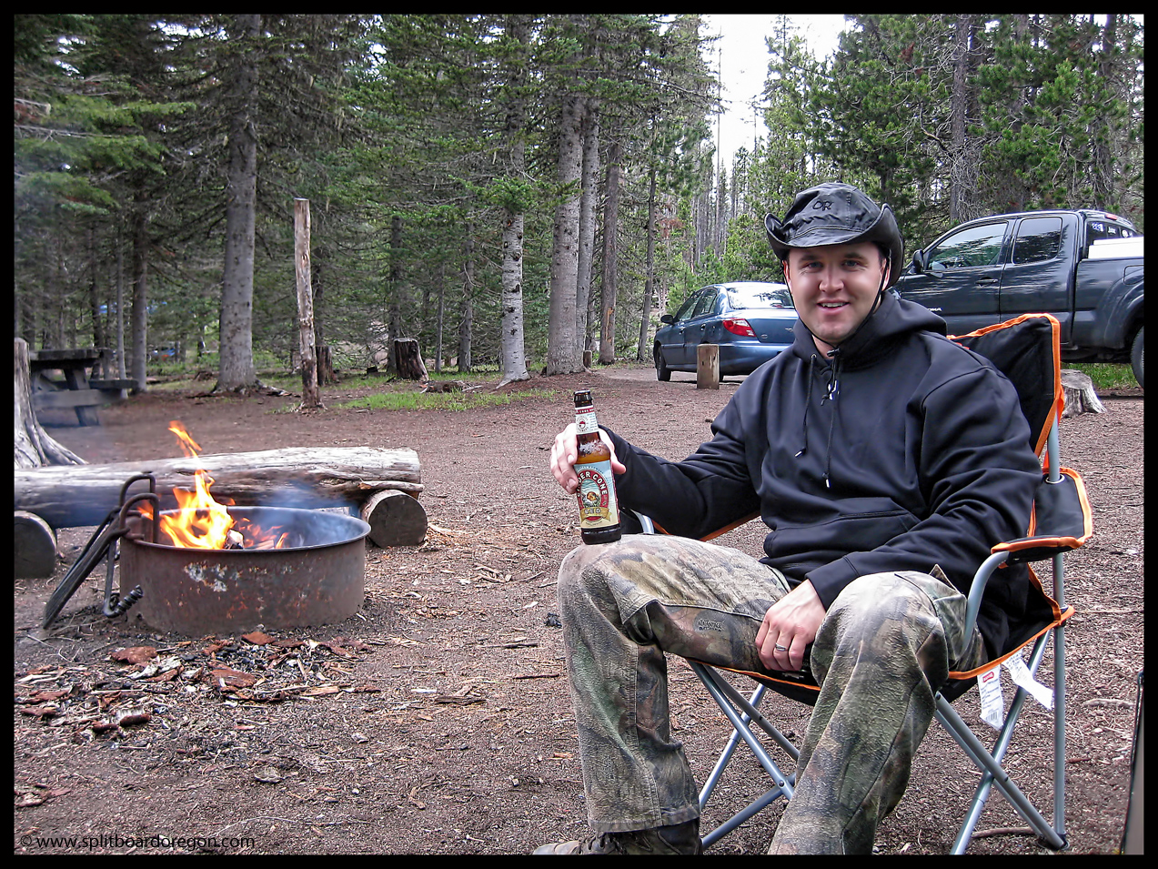
It’s hard to beat life living in Oregon in June! The snowpack is still decent and the trout fishing is starting to pick up. The prime window for both activities is just too short. Anyway, Todd and I headed out from work early to find a camping spot somewhere close to Mt. Bachelor on the Cascade Lakes Highway. Original plans to hit Tam McArthur Rim or Diamond Peak were thwarted due to weather and the Sisters Rodeo/Circus. So instead, we chose Mt. Bachelor, which has been closed for about a month. The weather didn’t look promising, with 70% showers forecast, and lightening and hail also likely. It’s been a really cloudy rainy June down here, making it difficult to get any quality turns in.
Enjoying my all time favorite beer
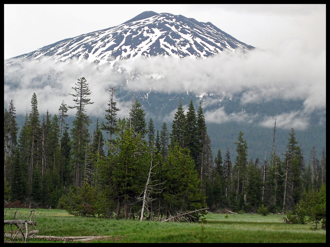
Camp was at Hosmer Lake, and we soon had a nice fire going and tarp set-up. It rained off and on. Here’s a photo of our objective from the south side taken from the Lake (we hit the north side)….
Bachelor’s southeast side
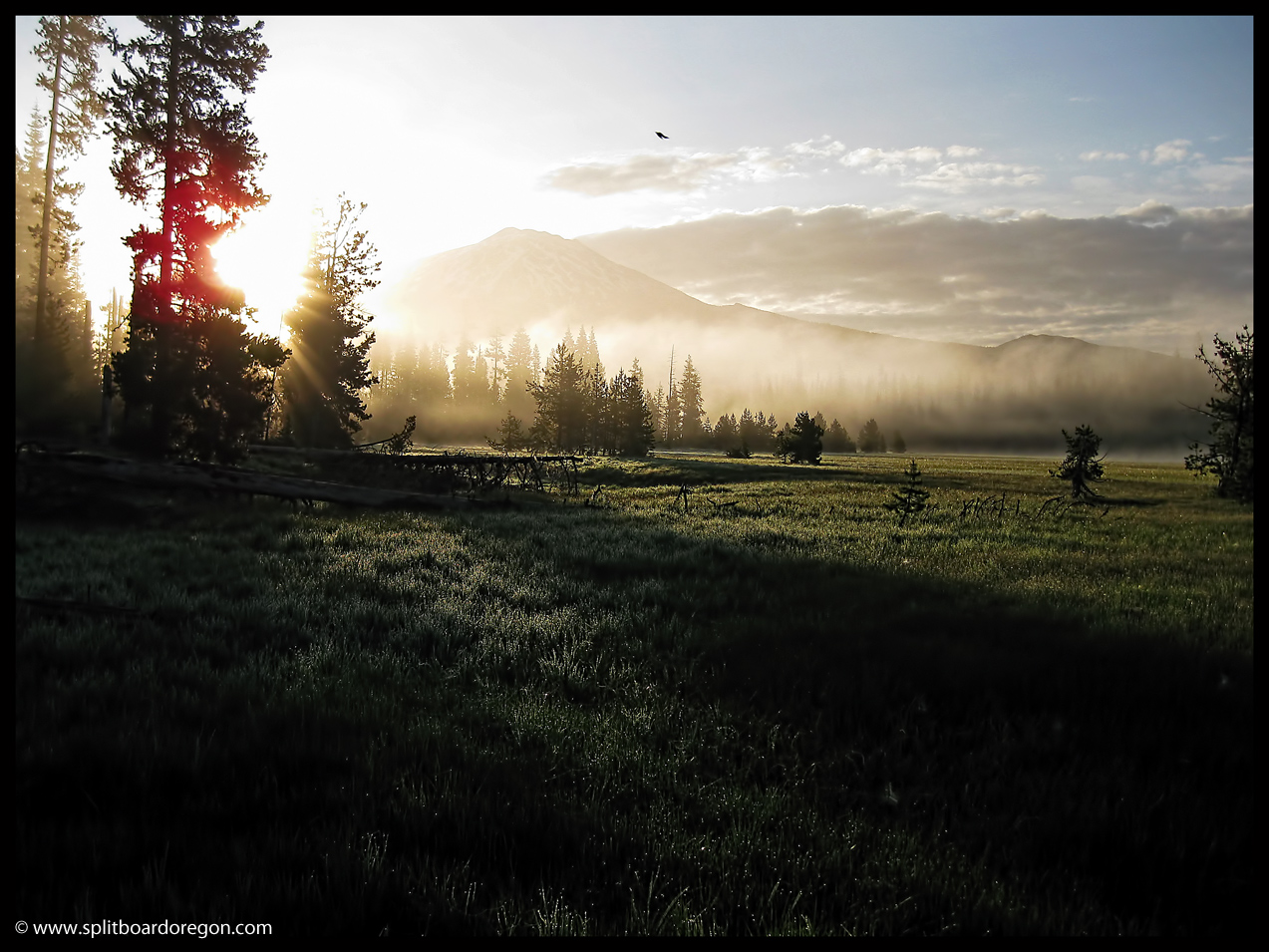
After a few beers and lots of bs by the fire, we hit the sack with a slight rain moving in. To our surprise, the next morning dawned clear. Here’s the view from a few feet away from the bivy sack….
Early morning sunrise
We headed up to the mountain, but soon turned around to get our poles which we had left to support out tarp. By 7:45 or so we were skinning up under the Pine Martin lift. Above the Pine, the clouds started building big time. Big boiling thunderheads and dark skies sent us down the mountain w/o hitting the summit and getting the goods in the Cirque Bowl. The turns were still nice, and we got 1500 feet of good riding in. We waited at the parking lot for a bit, but the weather didn’t subside.
Upon returning to camp, we made some more firewood. After making friends with several resident chipmunks, we headed to Lava Lake to get a few supplies. I needed to be home for some family stuff on Sunday, so I headed out at 2pm and went back to the mountain for another try. The weather was still menacing, but I was able to get up the Cinder Cone and make some turns. I literally ran up the mountain, hot footing it not wanting the weather to change or the lurking thunderhead to get me. I made it in time and the ride down was cream corn. Total vertical for the day was around 2200 feet. Here’s a shot from the top of the Cone showing the South Sister and Broken Top. I’m pretty sure there wasn’t anyone on the South Sister today because of the recent weather, but it still has some good lines on it.
The view from the Cone
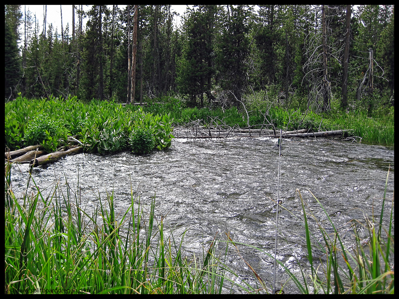
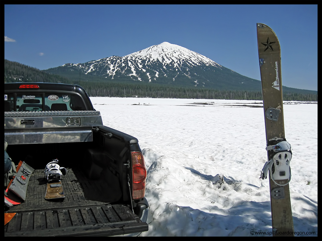
Back at the parking lot, I celebrated with a Cinder Cone brew from Deschutes Brewing Company. On the way back to the valley, I had an hour or two to kill, so I fished a stretch of the Deschutes River upstream of Crane Prairie. It’s been awhile since I’ve fished up here and it was a good time. I used my little ultralight rod and reel and only lost a couple of lures. Here’s a pic of the stretch I fished….
Upper Deschutes Rainbow
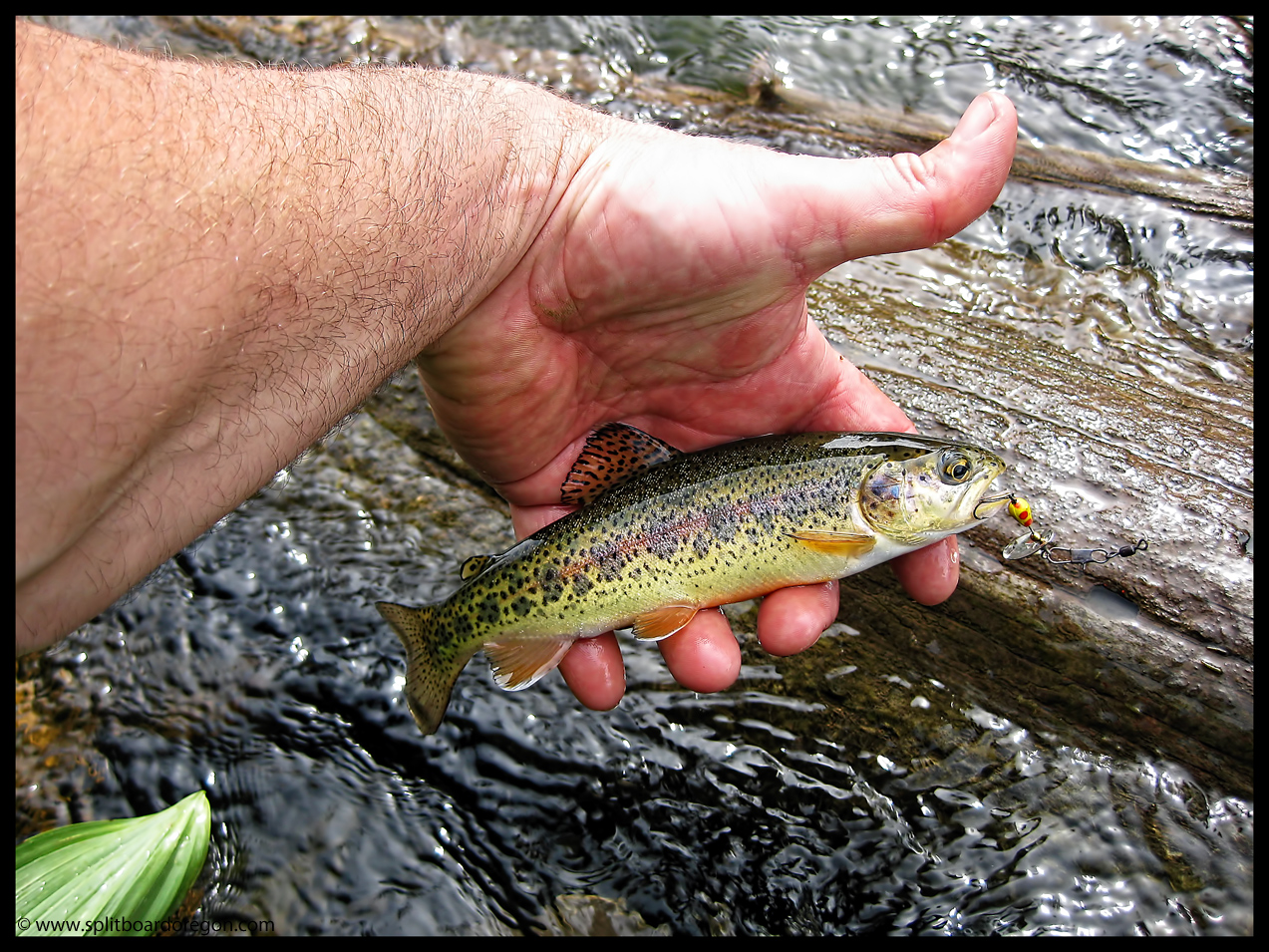
I caught several small rainbows like this one that I threw back – they sure have pretty color to them…..
Upper Deschutes Rainbow
Overall it was a nice trip, given the unstable weather we’ve been having here in the PNW lately. I’m really looking forward to my next outing in the Oregon Cascades, and can’t wait until my little one is ready to tag along for at least the fishing portion of the trip!!!
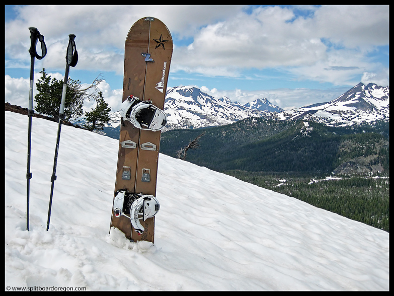
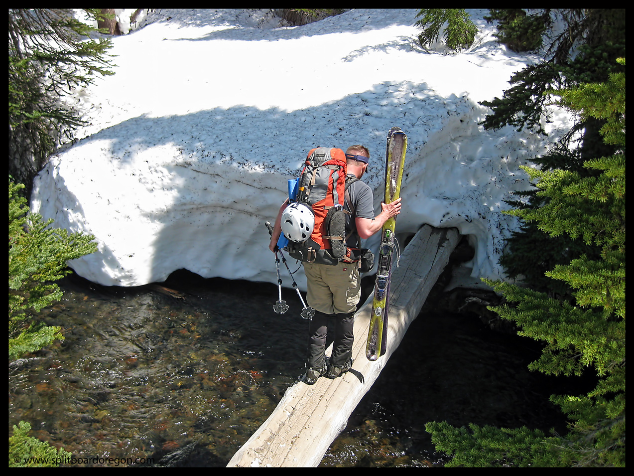
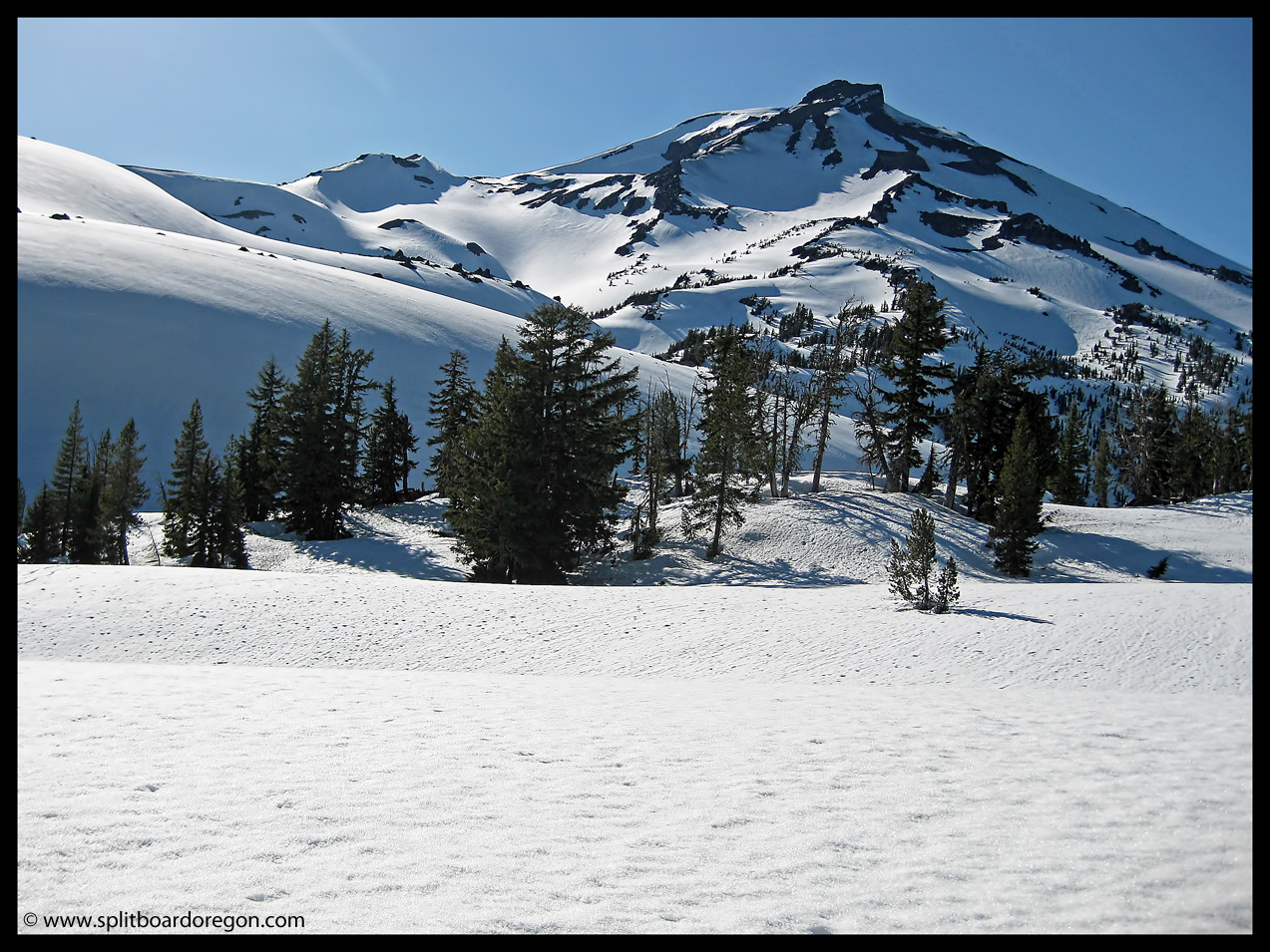
I left the Willamette Valley in the mid-morning with plans to skin into Green Lakes for a weekend of riding on the South Sister. The drive over was pleasant, and I soon met Todd at the Green Lakes trailhead on the recently opened Cascade Lakes Highway. We started skinning the 4 miles into Green Lakes at about noon, and planned on meeting up with Buell to ride the South Sister the following day. The skin in to Green Lakes went nicely, and there was still ample snow in the Fall River drainage. The only time we needed to take off the skis was the lone creek crossing…
Todd crossing the Fall River
About 3:30 or so we found Buell and made camp just south of Green Lakes. Dinner followed after discussing plans for the next morning’s assault. The evening sun setting on Broken Top to the east made for a nice picture, just feet from where I dug the snow pit for my bivy sack.
Broken Top’s West Face
The view of the South Sister from our camp site wasn’t too bad either…..there’s some nice looking lines off the Hodgecrest that I will return to ride someday…
The view from camp
The next morning, I awoke to an icy bivy sack and cold hard snow. After a quick breakfast, we started climbing at 4:30. The snow was set up pretty hard, and crampons and axes were mandatory in the steeper sections.
Buell & Todd climbing above Green Lakes
We hooked up with the south side route at about 8:00 and continued upward. Todd gassed out around 8000 feet and headed back down complaining of a headache and general tiredness. It turned out later he had some sort of virus, so I guess that was a good enough excuse:). Here’s a shot of Buell and Todd below the Lewis Glacier and link-up with the standard south side route…
Hiking below the Lewis Glacier
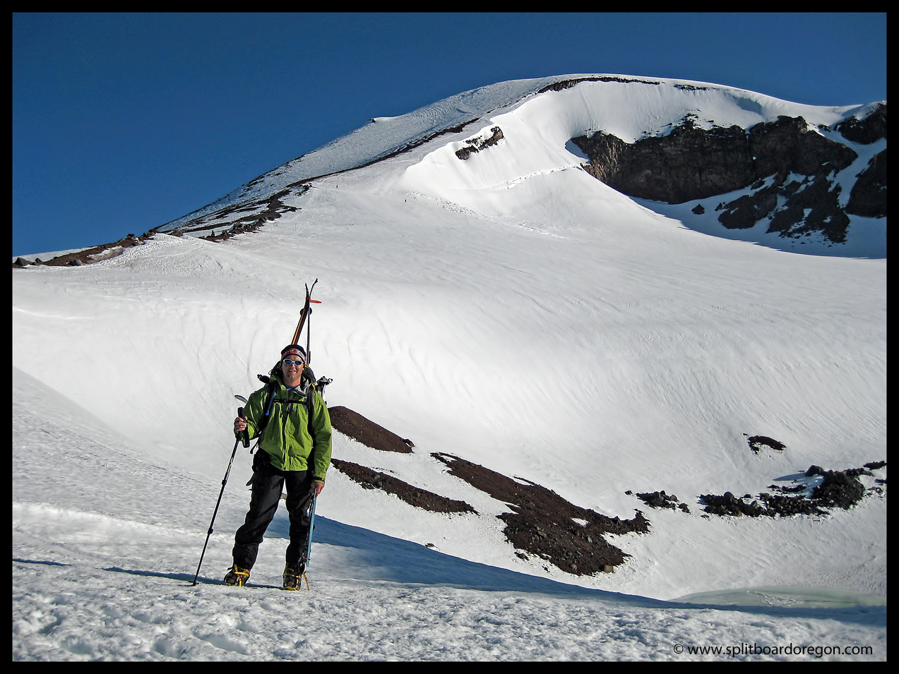
Buell and I continued up the ridge next to the Lewis Glacier, keeping the boards on our backs and using the crampons due to the hard snow conditions.
Matt & the Lewis Glacier
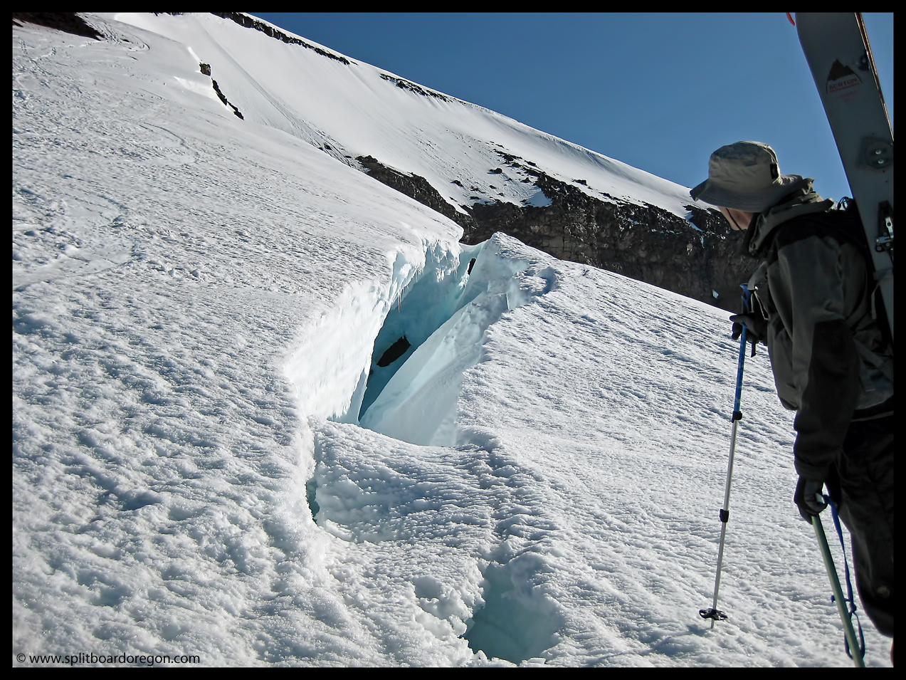
Other than a large bergschrund near the top of the Lewis, the glacier was nicely filled in and crevasse free. Buell moved in closer for a better look at the big crack in the ice…
Peering into the BergyClimbing the final pitch to the summit plateau
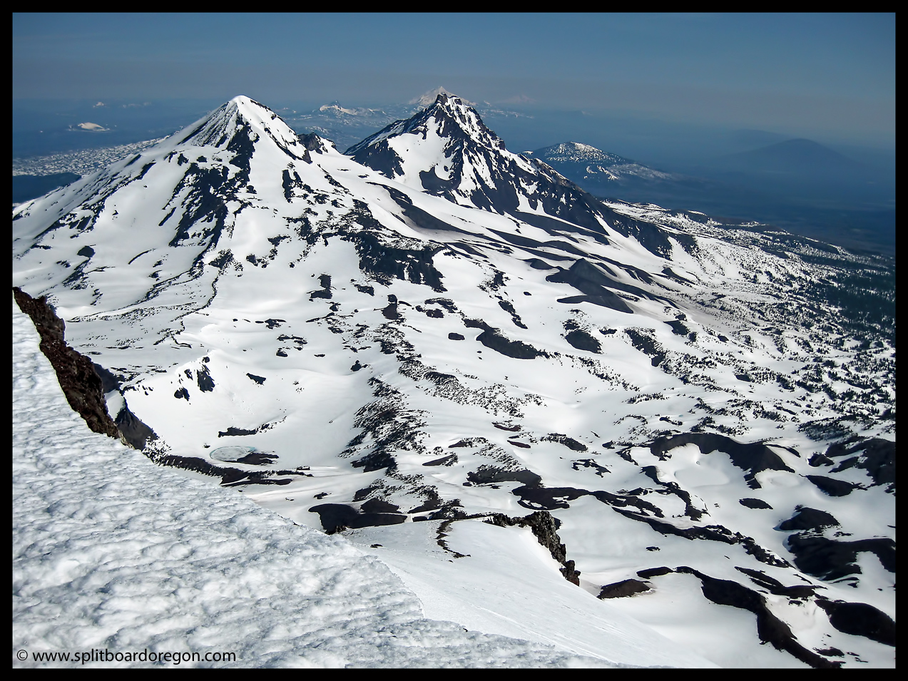
We reached the summit plateau, and hiked the quarter mile across the flats to the actual summit on the north side of the mountain. Here’s a shot of the summit photo showing the North and Middle Sisters, Mt Jefferson, and others in the distance…..
The view from the summit of South Sister
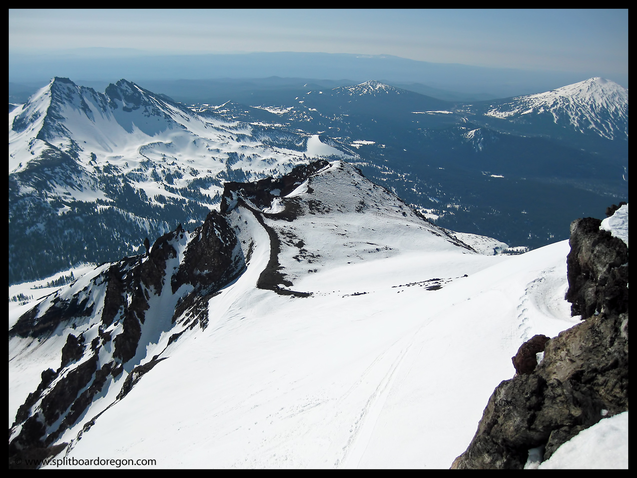
The view looking down the Prouty Glacier looked promising, but after further inspection by Buell, we headed down towards Green Lakes riding an easterly aspect. Here’s a shot looking east/southeast with Broken Top and Mt. Bachelor in the background….
Looking down to the Hodgecrest
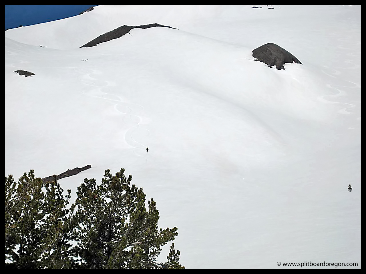
After waiting around with a few other enthusiasts on the summit for the snow to to soften, we started our descent around 11:00. Buell and I took slightly different lines going down, so we didn’t get many good riding pictures. Buell headed down towards the Hodgecrest/Lewis Glacier, and I rode the Clark Glacier snowfield, then traversed around the mountain to drop into the big bowl above Green Lakes. The conditions were perfect Spring corn, and the terrain was excellent. Here’s a shot of me in the large bowl above Green Lakes, with Buell’s tracks visible to the right of the picture……
Riding the bowl above Green Lakes
The turns around the large lava flow above camp were really nice, even though a bit slushy….
Taking a break at the top of the lava flow
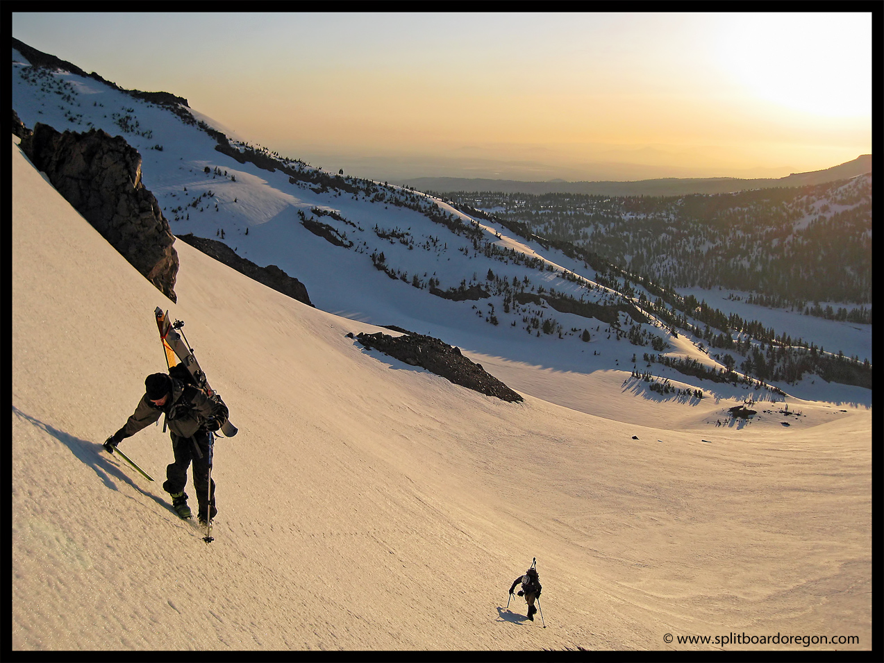
Back at camp, we cooked a quick lunch and then packed up the gear for the long skin out. We took a few photos of the skin out with the different volcanic peaks in the background…..
Buell heading outSkinning out to the trailhead
After 2.5 hours of skinning downhill in “ski” mode on the splitboards, we finally made it to the car. Overall, this was a great trip and definitely worth repeating (and combining with a Broken Top ascent/descent)!
Sometimes things go exactly to plan on a ski tour, but often times, when looking to make turns in the Oregon cascades, having a backup plan in case things go awry is a good idea. Such was the case for this trip to the South Sister.
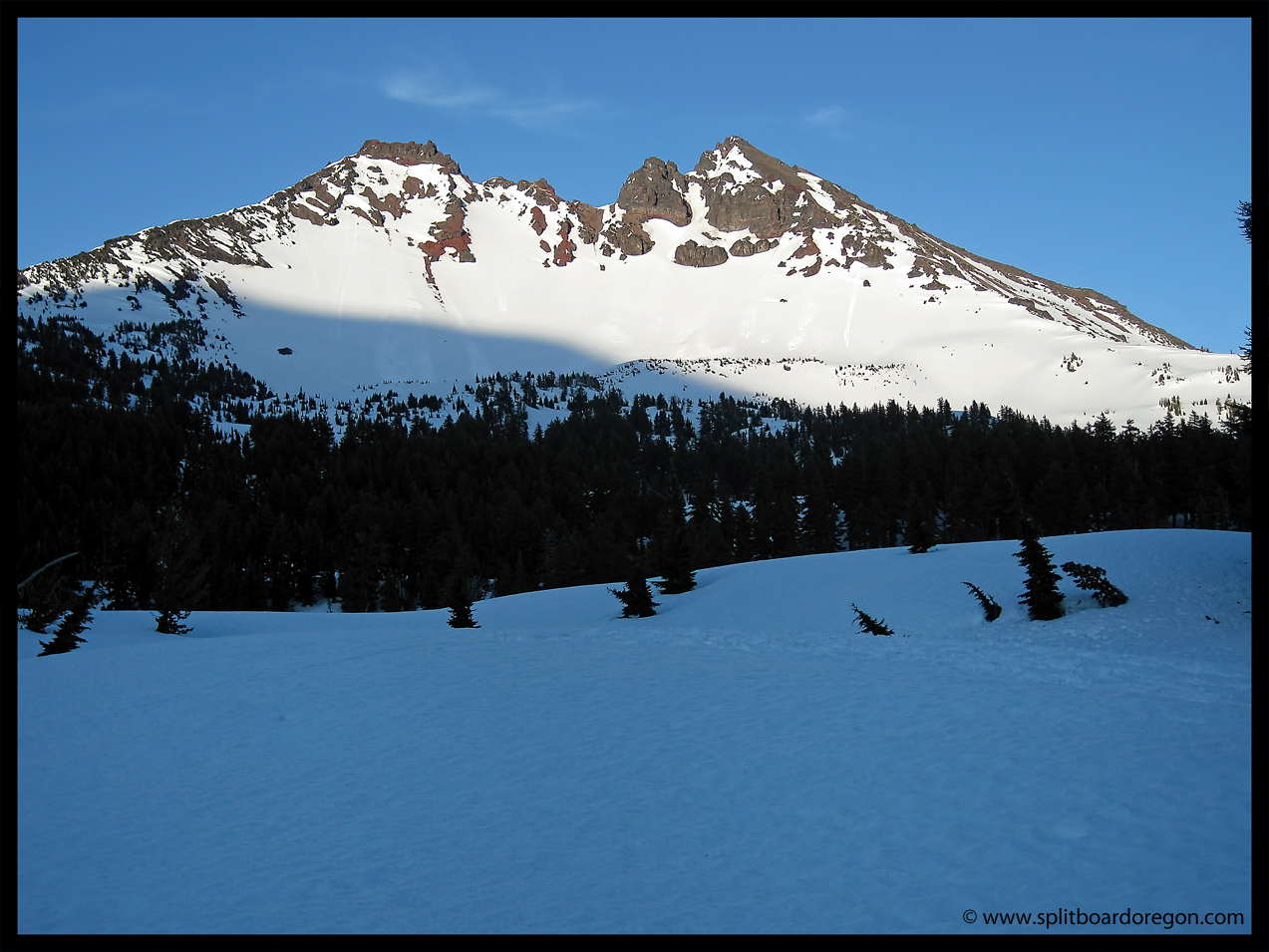
I left work around 3:00pm with the temperature near 90 degrees. The weather forecast called for continued sunny skies, with possible thunderstorms Saturday night. The drive over from the valley was pleasant, and I met Todd at the Devils Lake trailhead around 6:30pm. After quickly going through our packs, we were on the trail by 7:00pm. It was a bit humid for the skin up Hell Creek. We reached the big plateau shortly after 8:00, where the setting sun made for some nice pictures….
Broken Top in the evening light
We skinned across the flat section above Moraine Lake, and headed west to find a suitable campsite. Looking up at the mountain, there was still plenty of coverage to link turns from the top all the way back to the car…
Skinning above Moraine Lake
There were some sun cups on the long flat section, but the snow up higher looked prime. By 9:00pm, we had found a nice campsite about a quarter mile off of the main trail near 6700 feet. Camp consisted of an open patch of bare ground, where we pitched the bivies. We were treated to great views to the south, as well as the South Sister itself right from our campsite. The next morning we awoke at 4:15am, melted water and had breakfast. The skies were partly cloudy but the summit looked nice. We were skinning by 5:10am and made good time up the hill.
South Sister in the early morning
Off in the distance, thunder clouds had been building for some time and now looked menacing. Here’s a shot looking to the south/southwest…..
Looking south towards Diamond Peak
Mt Bachelor to the southeast looked surprisingly calm however….
Mt Bachelor from the South Sister
By 6:30 am, we had reached 8500 feet and were nearing the summit ridge and Lewis Glacier. Continuing up, a dark black cloud that had earlier kept its distance approached. Up until this point, we hadn’t seen anyone else on the mountain, and still couldn’t see anyone below. I started wondering if they knew something about the weather that we didn’t. Then, a huge flash of lightening followed immediately by a loud rumble shook the entire mountain. I don’t know how far the bolt was from us, but it too close for comfort, and we motored to the nearest small tree cover. So much for “afternoon” thunderstorms. Todd headed down, and I ripped my skins off my split board and quickly put it together and rode down. We rode down to about 7500 feet and assessed the situation. The weather continued to play games, so we decided to ski back to camp. The turns were nice and steep, but a bit slushy.
Rocks, snow & clouds…
On the way down, I broke one of my Leki poles in half trying to push on a traverse. Back at camp, we toyed with the idea of going back up, but the snow was getting pretty sticky and the weather remained unstable. Damn – we would have been on the summit by 8:30am or sooner! Maybe we should have summited the night before and bivied in the summit crater? The weather stayed so-so, and with a broken pole, I didn’t know how easy it would be to skin all the way back up. We made some coffee at camp, and decided to run a few laps on Little Broken Top to the east. It was literally 5 minutes from our camp, and though short, provided nice playful turns and several laps.
Little Broken Top
After lunch, we packed up camp and were able to link turns all the way back down to the car, 3000 vertical feet below. The snow in Hell Creek can be challenging at times, but always makes for an interesting ride….
Skiing the trees back to the car
The ski out to the road will probably be good for another week or so, but it’s going fast down low. The Deschutes Brewery beers were still nice and cold at the car when we returned.
Todd and I headed out to Hoodoo for the 2nd consecutive weekend and it did not disappoint. We arrived in the parking lot just after 7am with nobody around, slapped the skins on the boards, and headed up. The weather was cloudy and about 17 degrees, with sun breaks. Breaking trail wasn’t too bad, but it was several feet deep in places which made it kind of grueling at times. I was on my Never Summer Titan 164 and Todd was on teles. Towards the top, the snow got pretty deep and the skinning became more of a hassle. Upon reaching the summit, we were rewarded with this view of Three Fingered Jack and Mt. Jefferson…
Mt Jefferson & Three Fingered Jack
We ripped off our skins and headed down to one of the best runs I’ve had in a few years. Todd and I shot mostly video, so I had to pull a few stills out since I didn’t have pictures. Here’s a shot of the blower…..
Early season pow!
We were able to make two laps before a few other people arrived. The snowpack elsewhere is still thin in the Oregon cascades, so Hoodoo is the place to be right now. We met a few other splitters and skiers before heading down for lap 2. One was Sam from the UO outdoor program. Nice to meet you Sam.
First rooster tail of the season…
After riding the main bowl, we elected to head down to the truck for a beer and some grub. The whole ride down was pow turn after pow turn. Lunch went down fast, and it was a no-brainer to go back for another round. Skinning this time was quite a bit easier now that the track was packed down like a highway. We gained the summit in less than an hour. More pow turns followed….including this white room shot
White room…
After a run in with an arrogant cat driver named Ray, we headed to the top for yet another lap, and I snapped a few photos (videos) of Todd…
Todd making early season pow turns…More pow turns…
Finally, we rode the powder down to the truck and cracked open a beer to finish off an epic day. It doesn’t get much better than this. Early season deep powder, bluebird and beer!