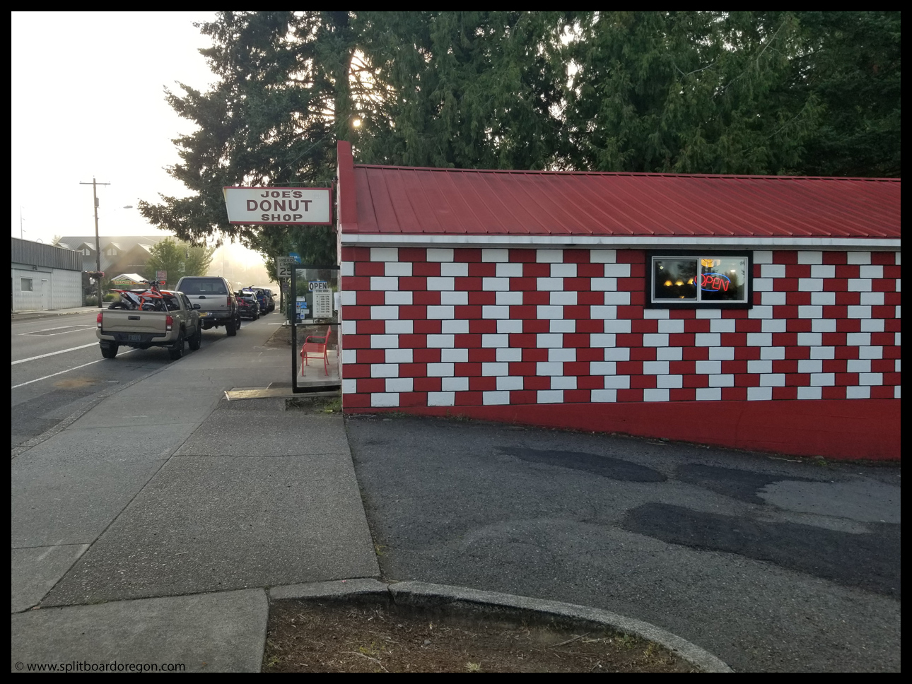
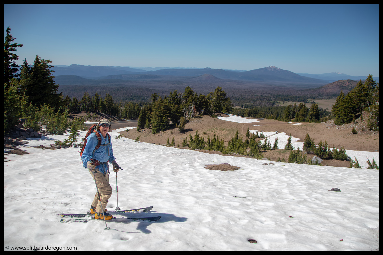
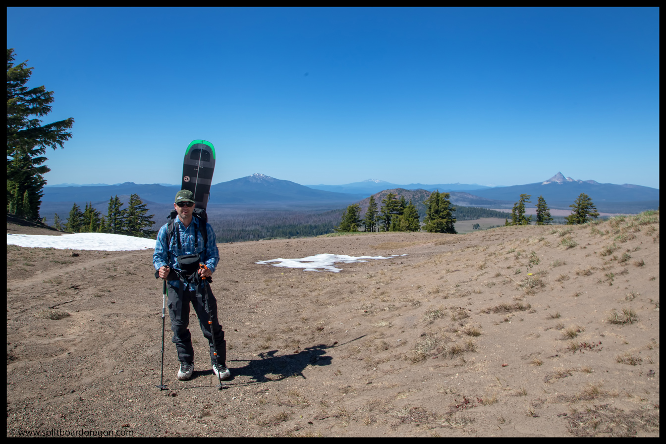
Somehow the summer had blown by, and before I knew it the calendar said August, which meant it was time to head up to Hood for some turns. Joe and Dan were game, so agreed to give Saturday a go. Dan and I met Joe at the cop shop in Albany a few minutes before 6:00 am, and we headed north on I5. We made a quick pit stop for some breakfast items at Joe’s Donut shop in Sandy, and arrived at Timberline a little after 8:30
Joe’sHood from the climbers lot
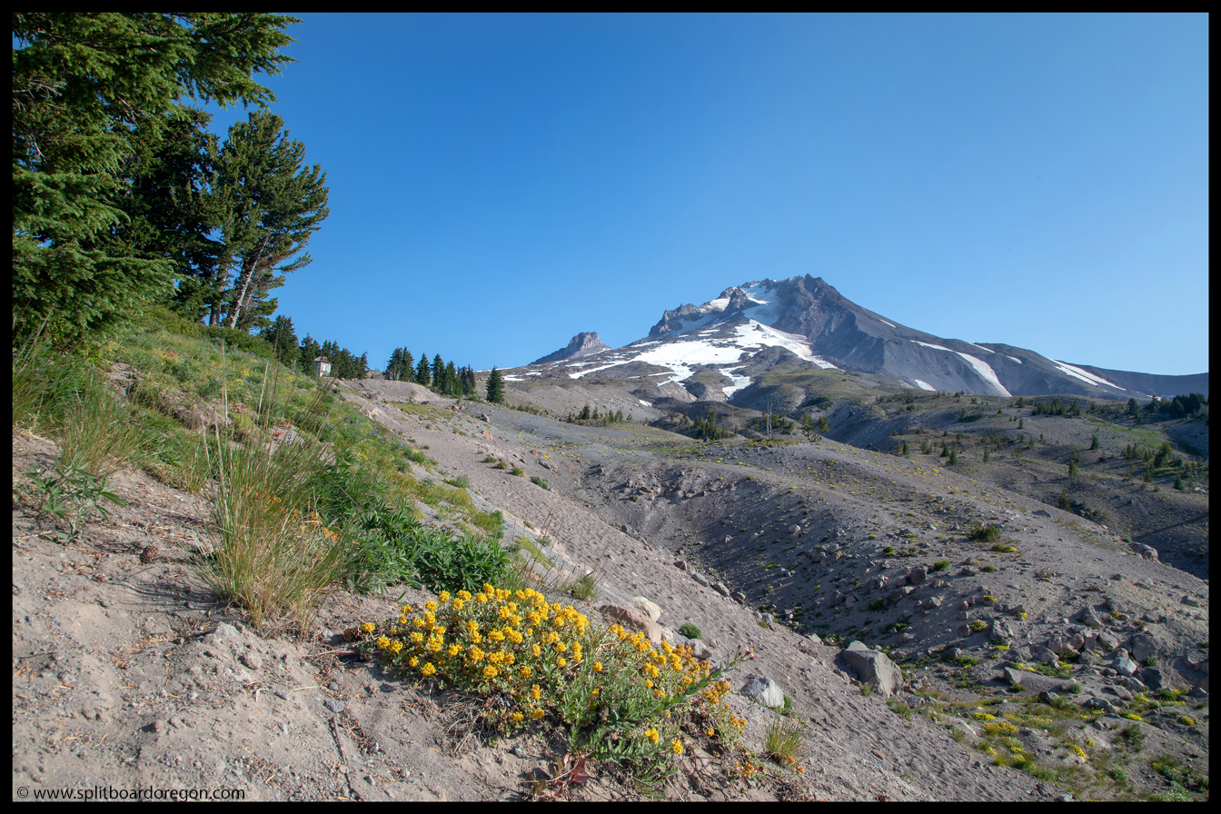
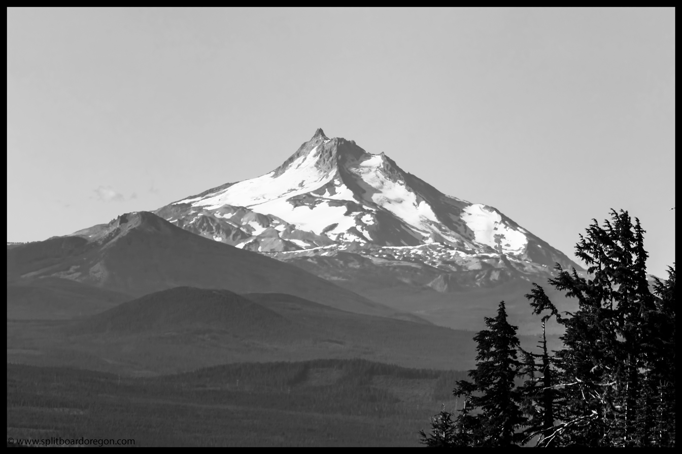
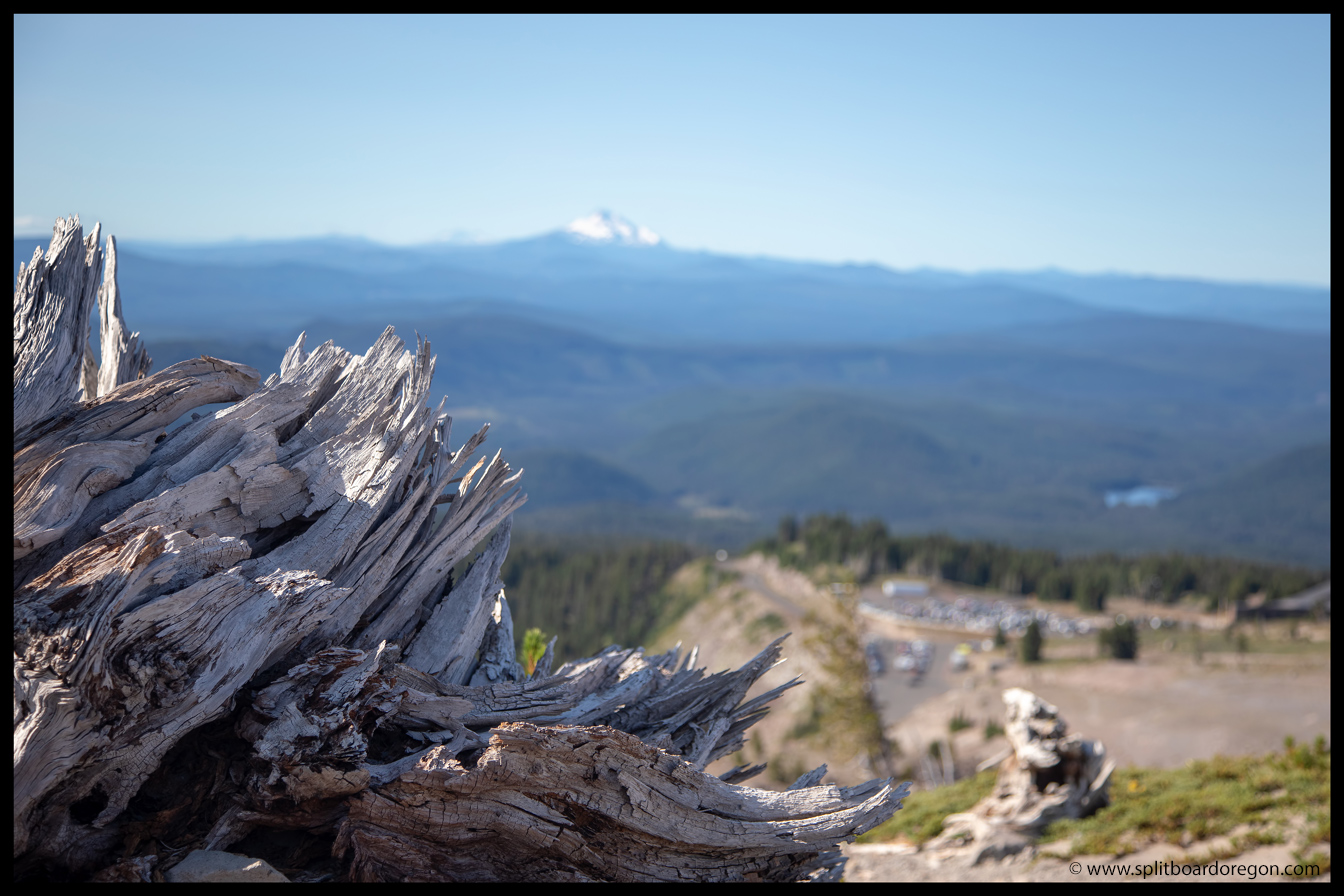
We organized gear, loaded packs, and set out up the trail from the climbers lot. The climbers lot was as packed as I’d ever seen it, and it was nice to get away from all the commotion. I snapped a picture of Mt Jefferson to the south before we headed out, and then a pic of Hood with some wildflowers shortly up the trail…
Mt Jefferson’s north sideFlowers on Mt Hood
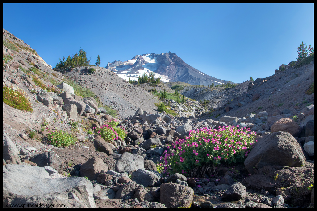
We worked our way up the trail, putting some distance between ourselves and the parking lot below. The morning was warm, and any concerns we had about the snow turning to corn were pretty much gone by 9:30. The wildflowers were readily abundant, indicating it had rained some in the past couple of weeks, and made the hike really pleasant.
An old stump on Mt HoodHiking through the flowers
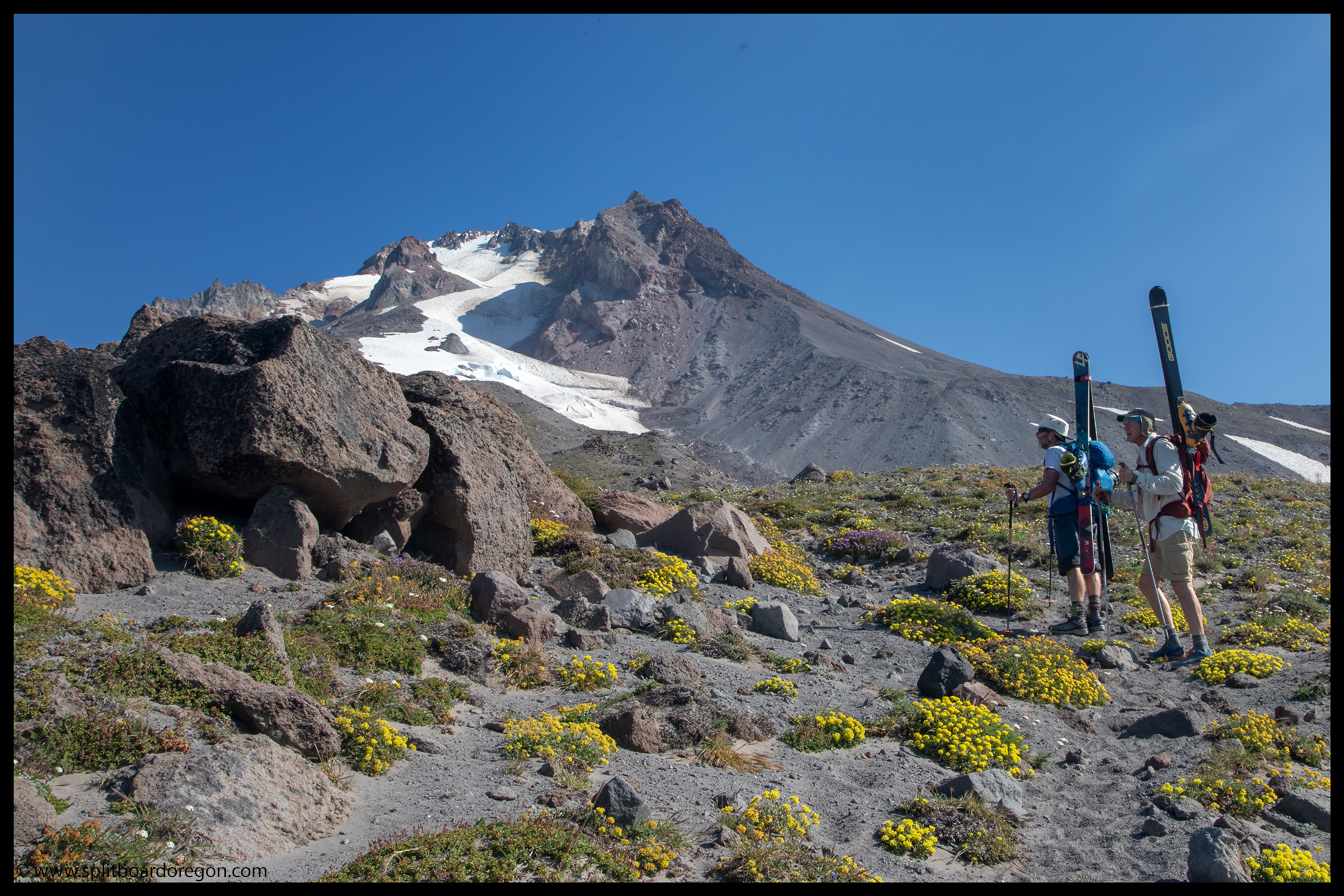
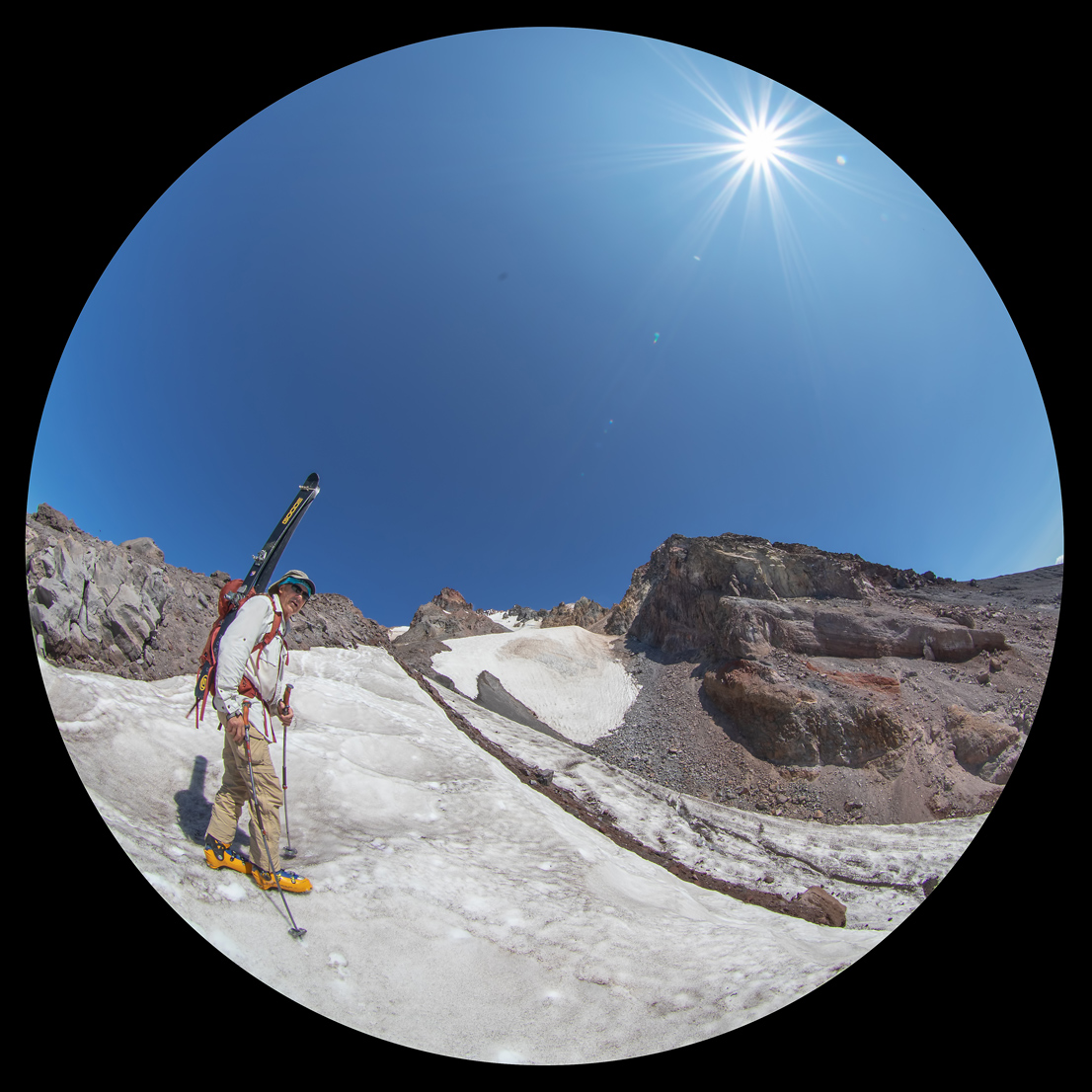
We made it to the top of the Palmer in just under two hours, and hiked a few feet above the area where a few folks were practicing self arrest as part of a group. We pushed on a bit further, then decided switching from tennis shoes to boots would be a good idea before heading further up the snowfield.
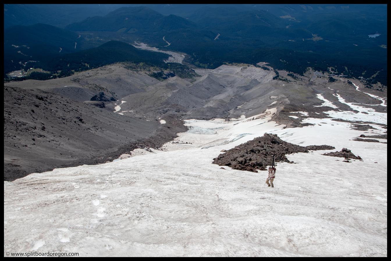
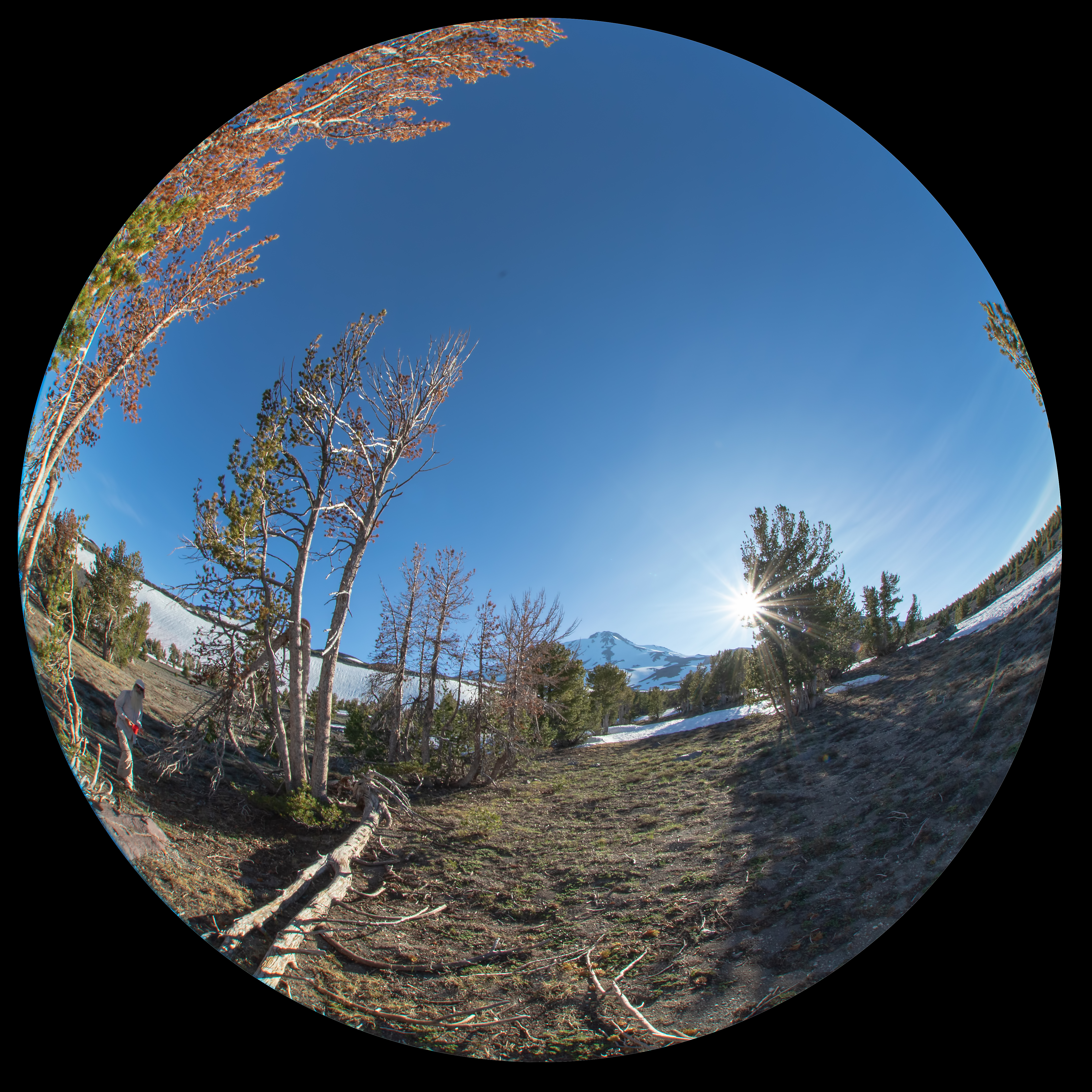
Wide angle view of the White River GlacierJoe hiking the White River snowfield
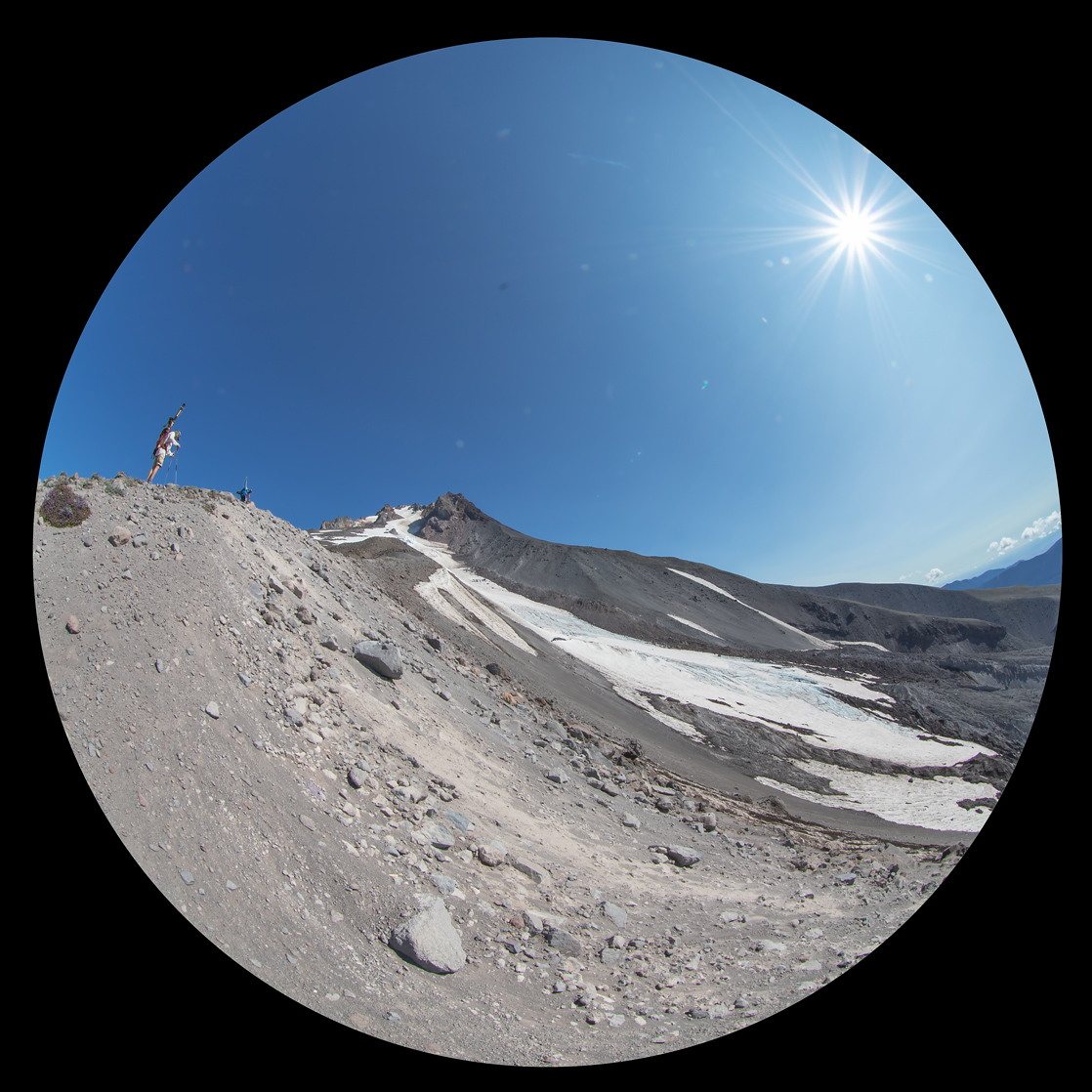
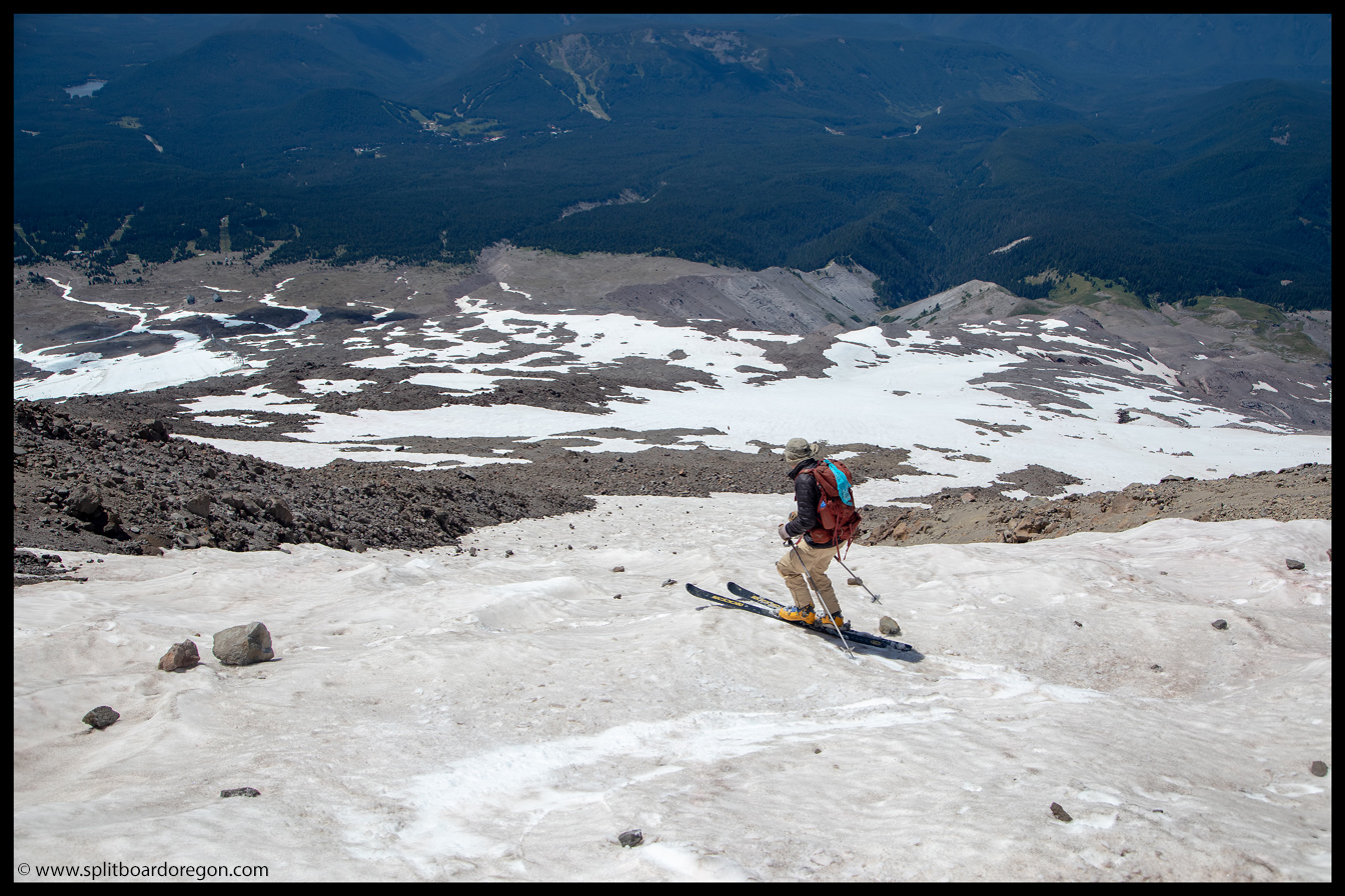
It didn’t take too long to hike to the top of the White River triangle, near the base of the White River headwall. From there, we decided we may as well hike further up towards Crater Rock and see what type of condition the snow finger was — if nothing else it would make for a long descent down onto the Zigzag…
Dan hiking the White River GlacierWide angle view towards the summit
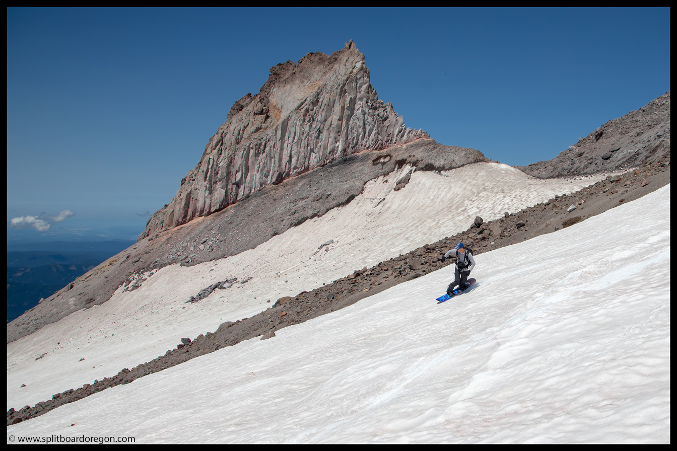
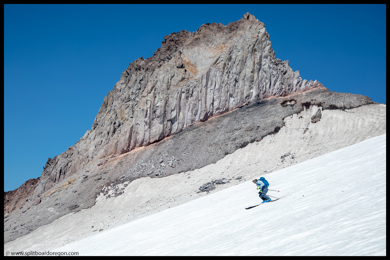
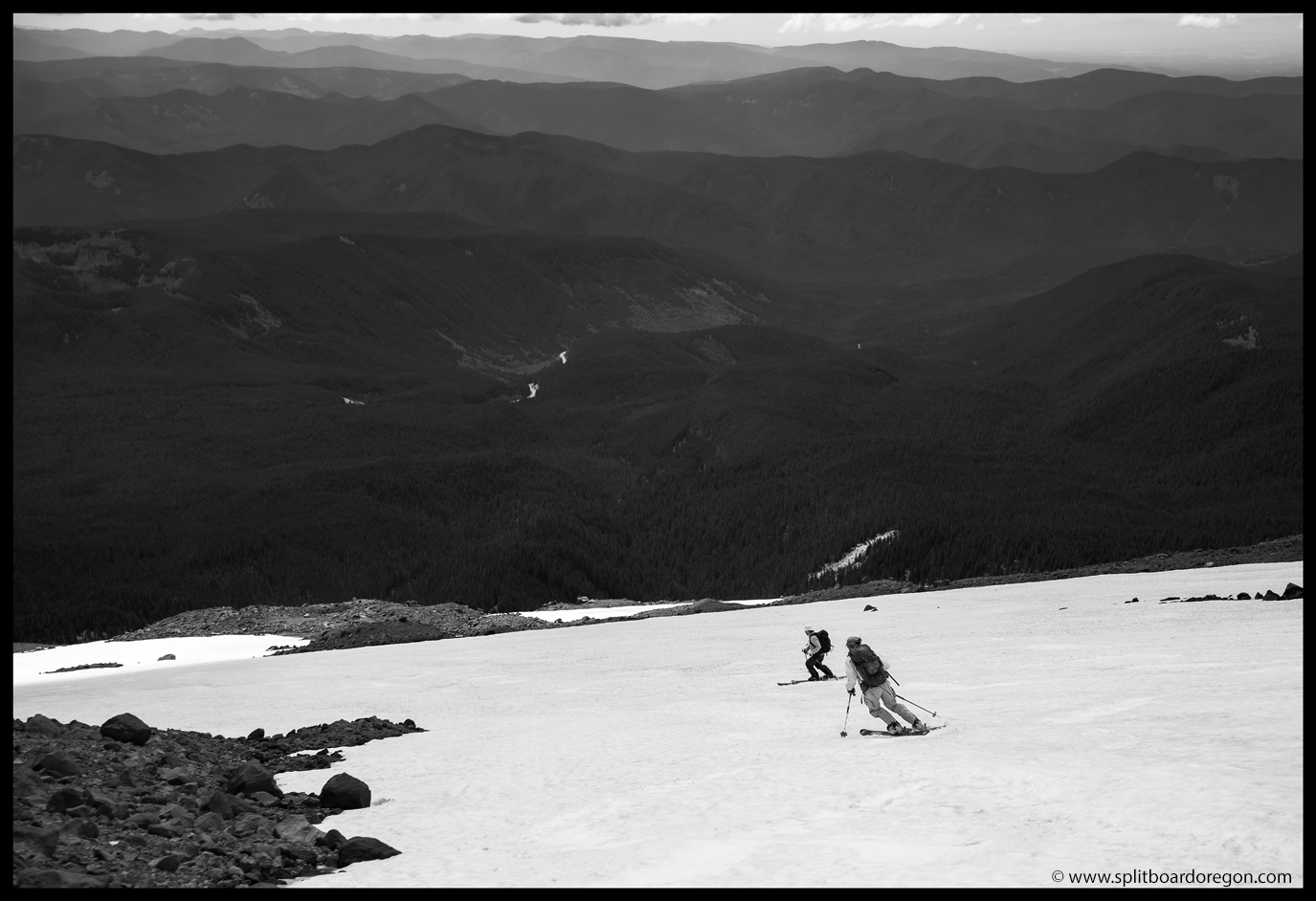
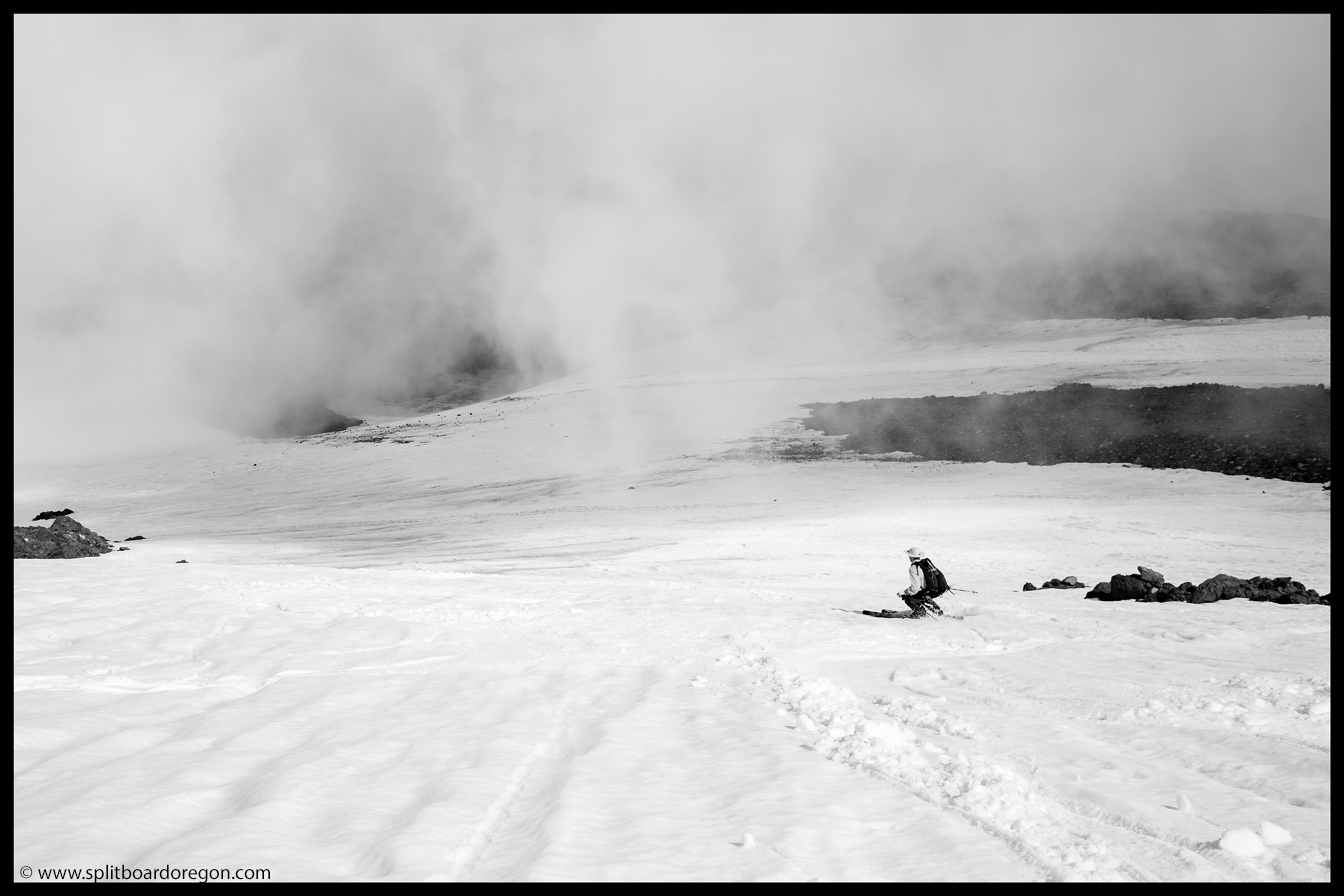
We crossed over the rocks towards the finger, and soon got a glimpse of the snow —- and it was pretty rough. There were quite a few rocks on the surface, and it was dominated by large suncups. We hung out for awhile up top, taking a needed break to refuel, and then decided there was no way in hell we were going to hike back down, so we dropped in…
Dan dropping into the fingerJoe skiing above Illumination Rock
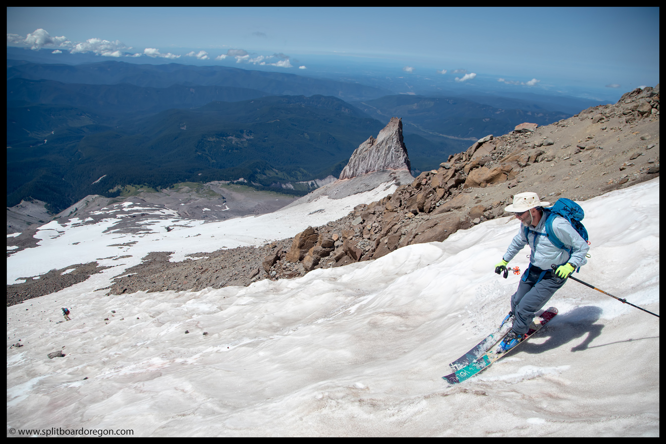
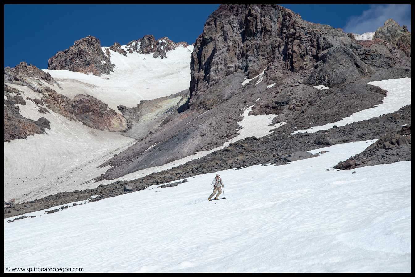
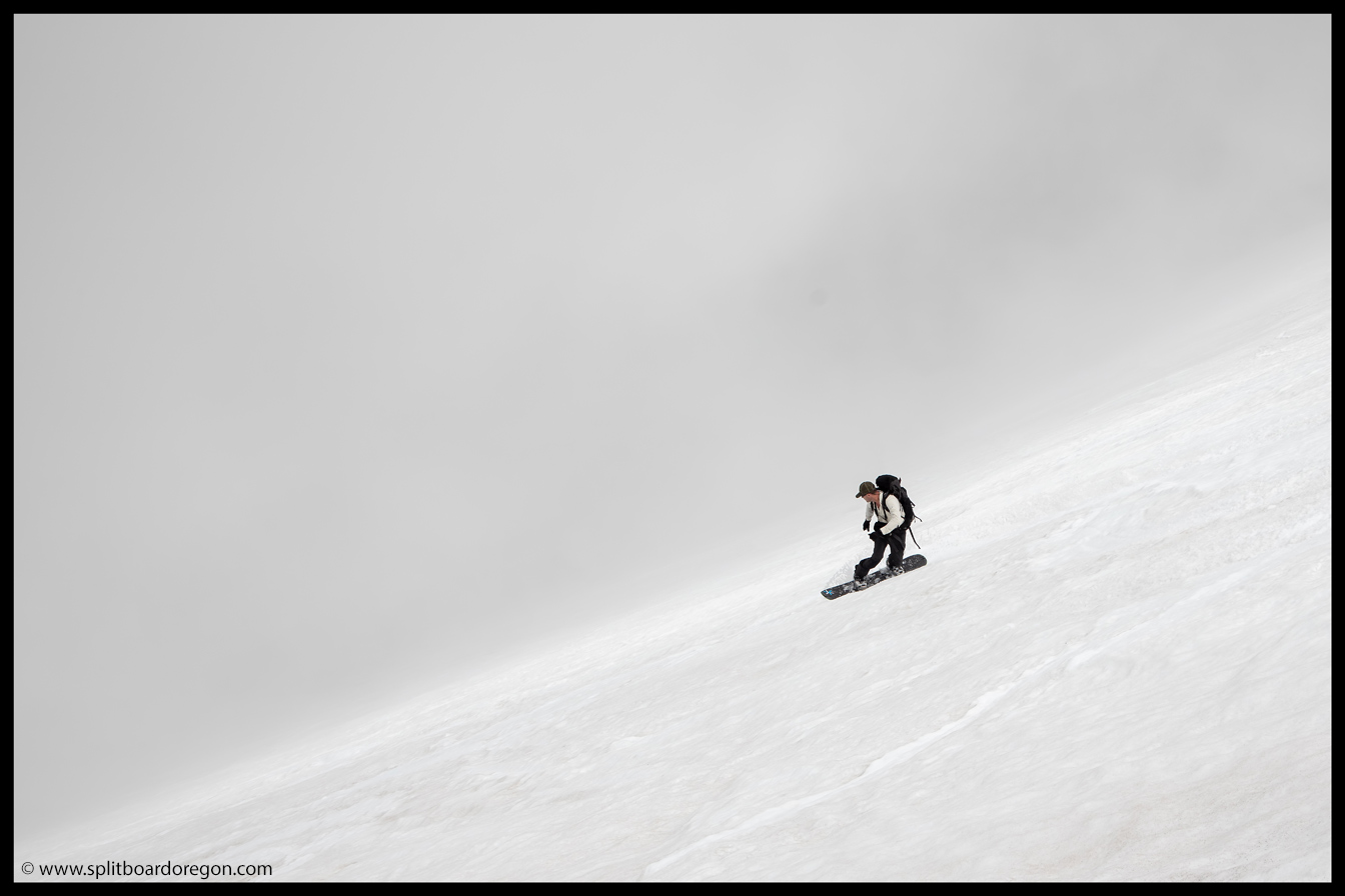
There were a few decent turns, mixed with mostly garbage, but it was still better than hiking down. That said, none of us were considering heading back up for more. Eventually we worked our way on to the Zigzag snowfield, where the snow smoothed out and the turns became pretty nice…
Matt riding the upper reaches of the ZigzagSkiing below Crater Rock
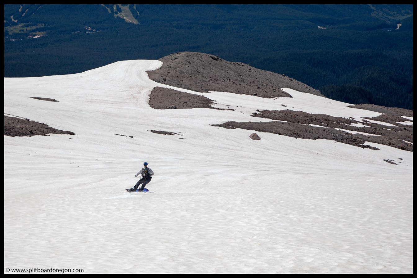
We continued down the slope, ripping turns on the perfect corn. Ironically, given all the unconsolidated snow we’d skied this season, this was some of the best corn of the year. I snapped some pics of the skiers as they came down by and below Illumination Rock…
August turns on the ZigzagThe skiers descending the Ziggy
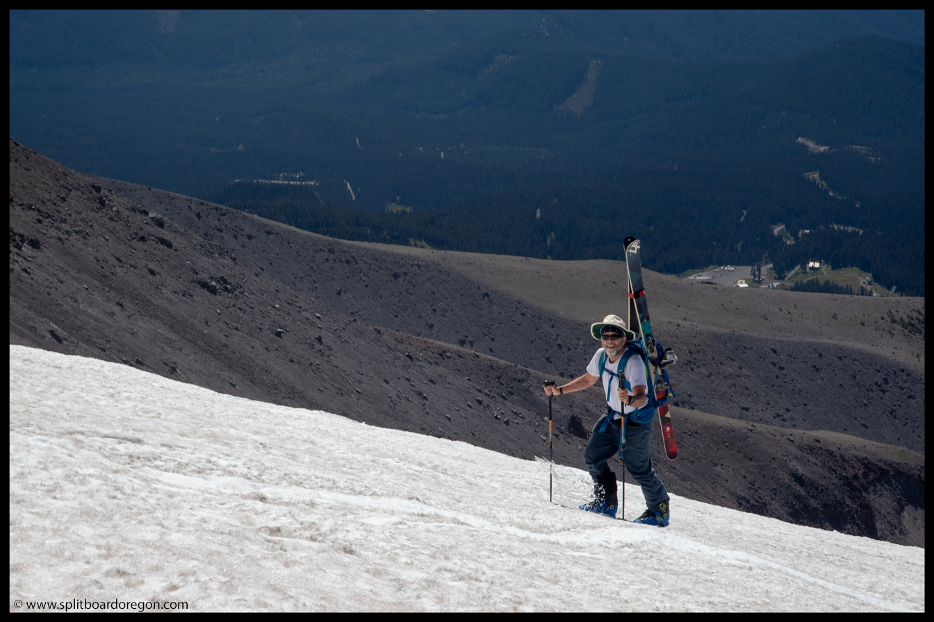
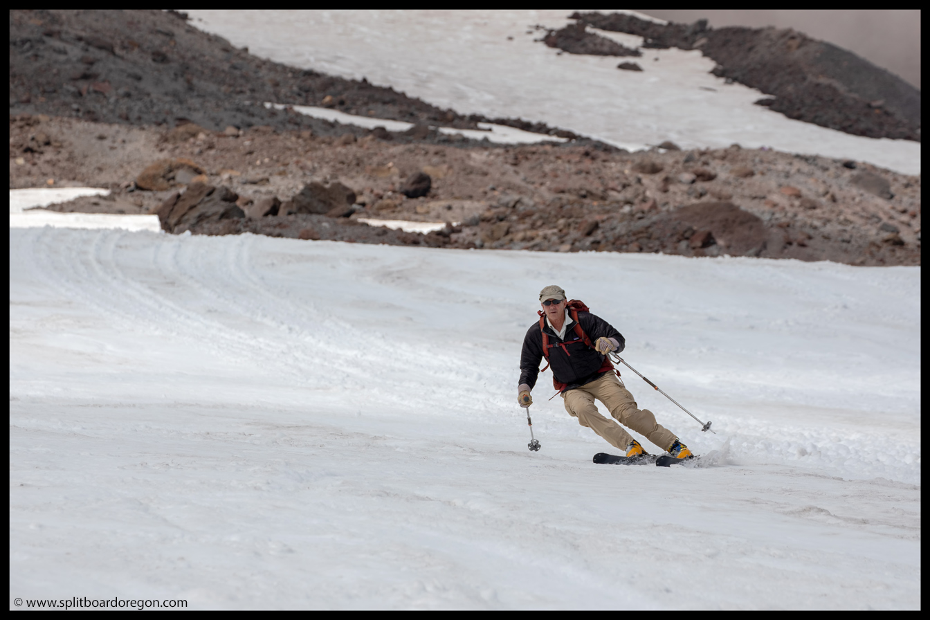
The lower we went, the better the snow became. From 8,500 feet on down, we found the best snow of the day, and were stoked to keep on going. Dan snapped a few shots of me as we continued on….
Descending down the Zigzag GlacierHarvesting some August corn
We milked turns down to the bottom of the snowfield, near 7,700 feet — not bad, considering we’d started around 10,000. I caught a few shots of Dan and Joe skiing down the last sections…
Dan skiing the lower snowfieldJoe milking the final turns
At the bottom, the clouds were starting to build higher on the mountain, so we wasted little time transitioning over and started hiking back up the snow. The hike up the Zigzag is always a bit on the mundane side, but soon we were ready to make the traverse back over to the Palmer…
Hiking back up the ZigzagReady to ski back towards the Palmer
As luck would have it, we were able to ski a short pitch before the traverse, so we made the most of it. I snapped a shot of the skiers heading down, and then it was a short hike back over to the top of the Palmer for a well deserved cold beverage….
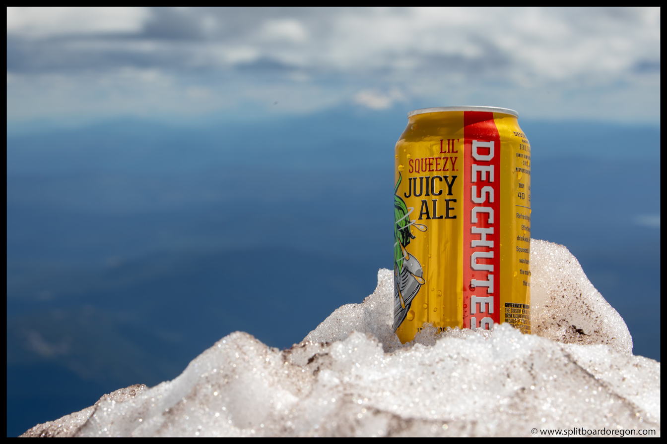
Skiing a pitch between the Zigzag and PalmerA new favorite from Deschutes
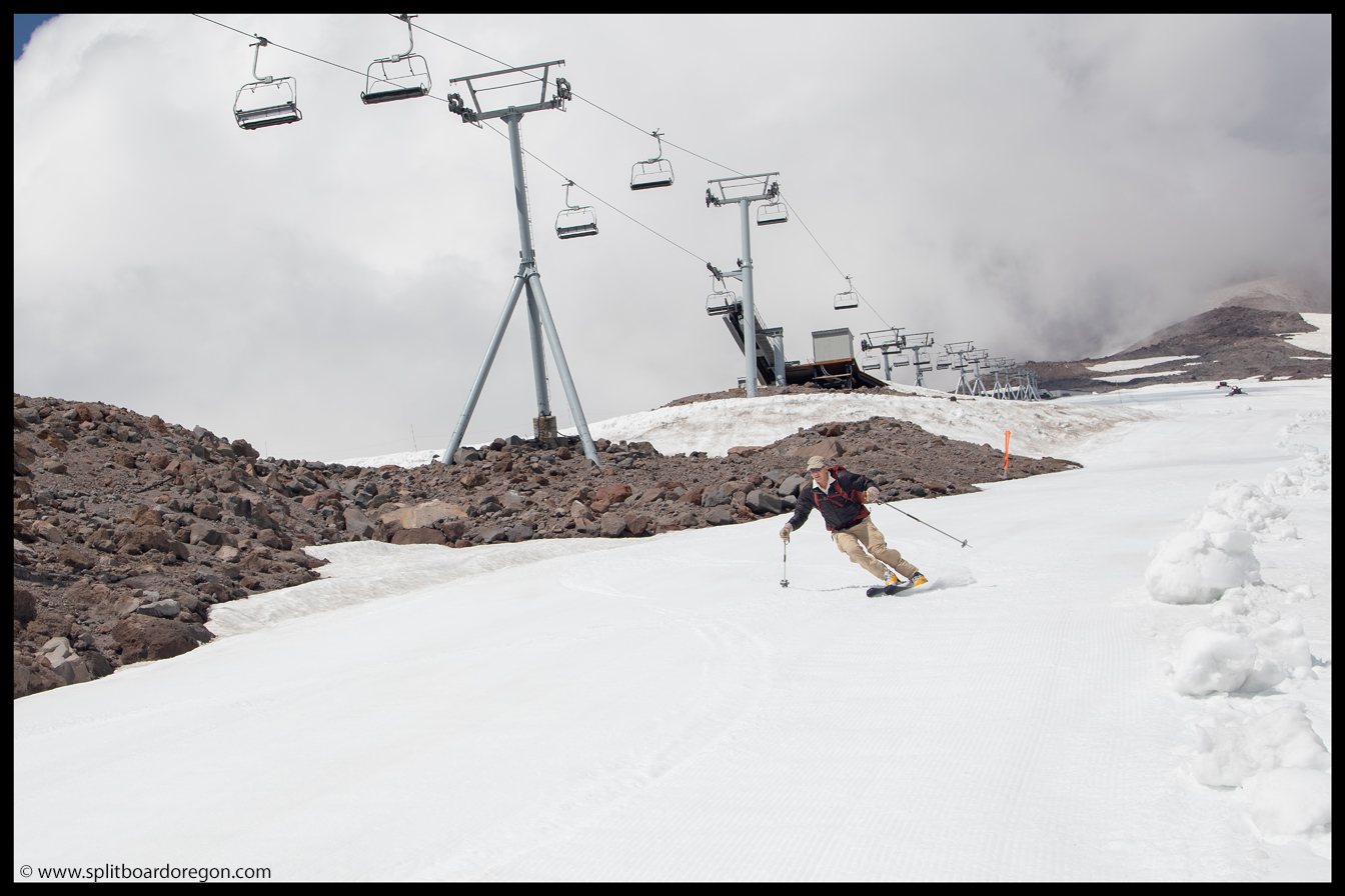
While sitting at the top of the Palmer and enjoying a new favorite hazy IPA from Deschutes Brewing, we heard the familiar hum of a couple snowcats coming from below. Soon, one of the cats was moving a healthy dose of snow a few feet away from us on the road above the top of the Palmer. 20 minutes later when his work was done, he headed down and they began grooming the glacier for the next day of skiing — score! We headed down and ripped the smooth snow, enjoying every turn!
Dan working down the PalmerRipping turns down the Palmer
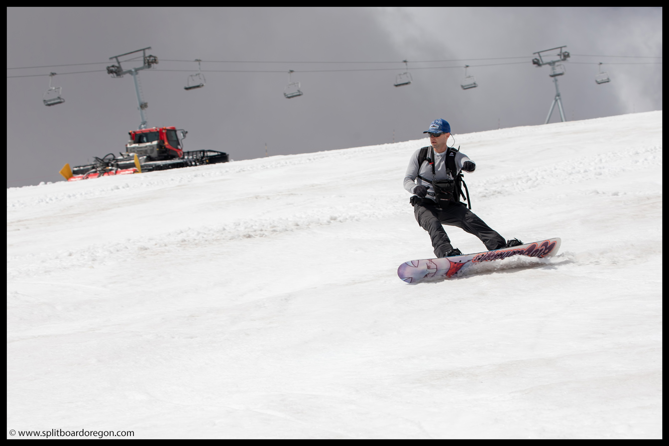
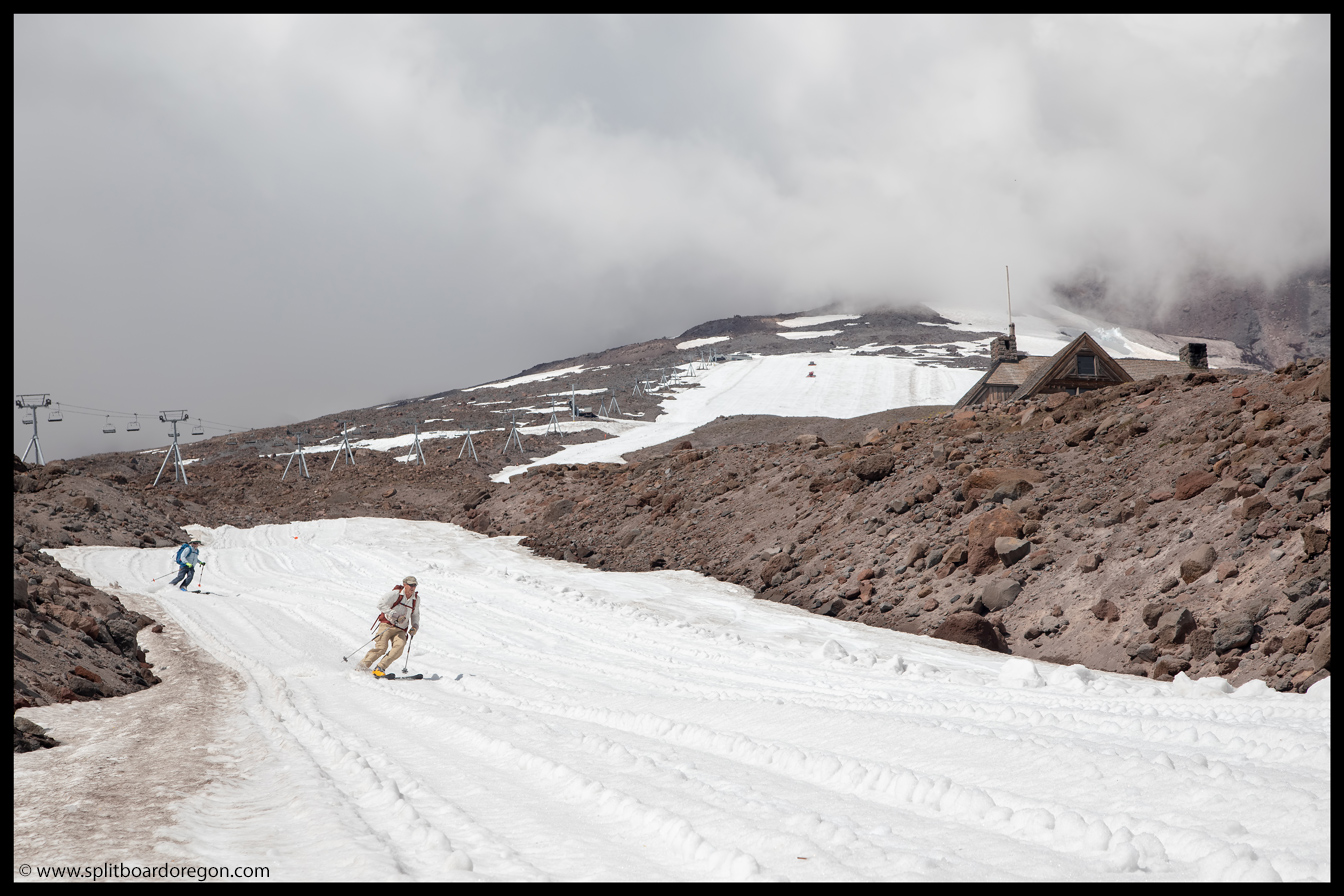
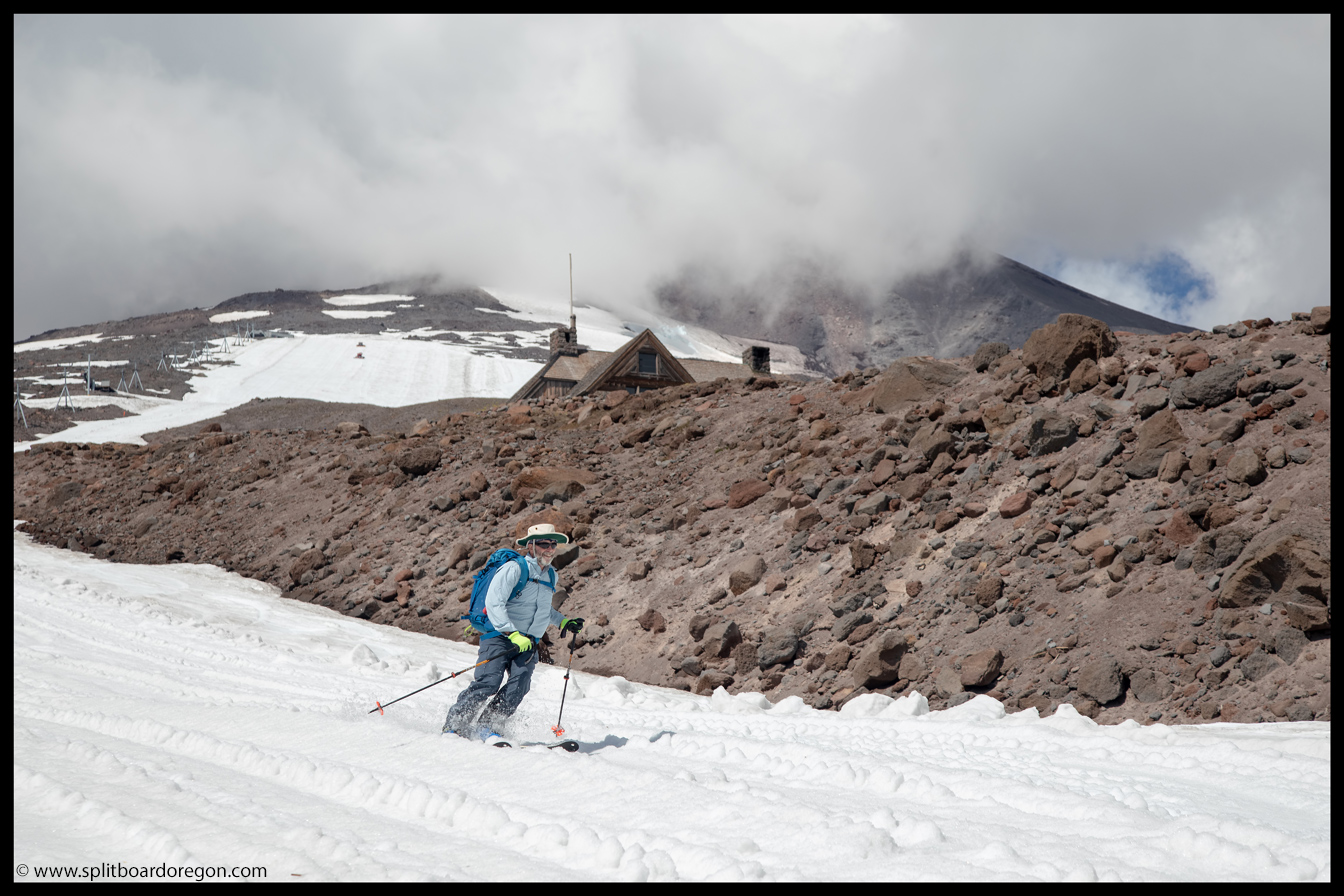
Below the mid-station, the corduroy was extra nice — pretty much hero snow. It didn’t take long to make short work of the groomer and get down to Silcox Hut…
Dan skiing below the mid-stationSlashing the corn in the Palmer Canyon
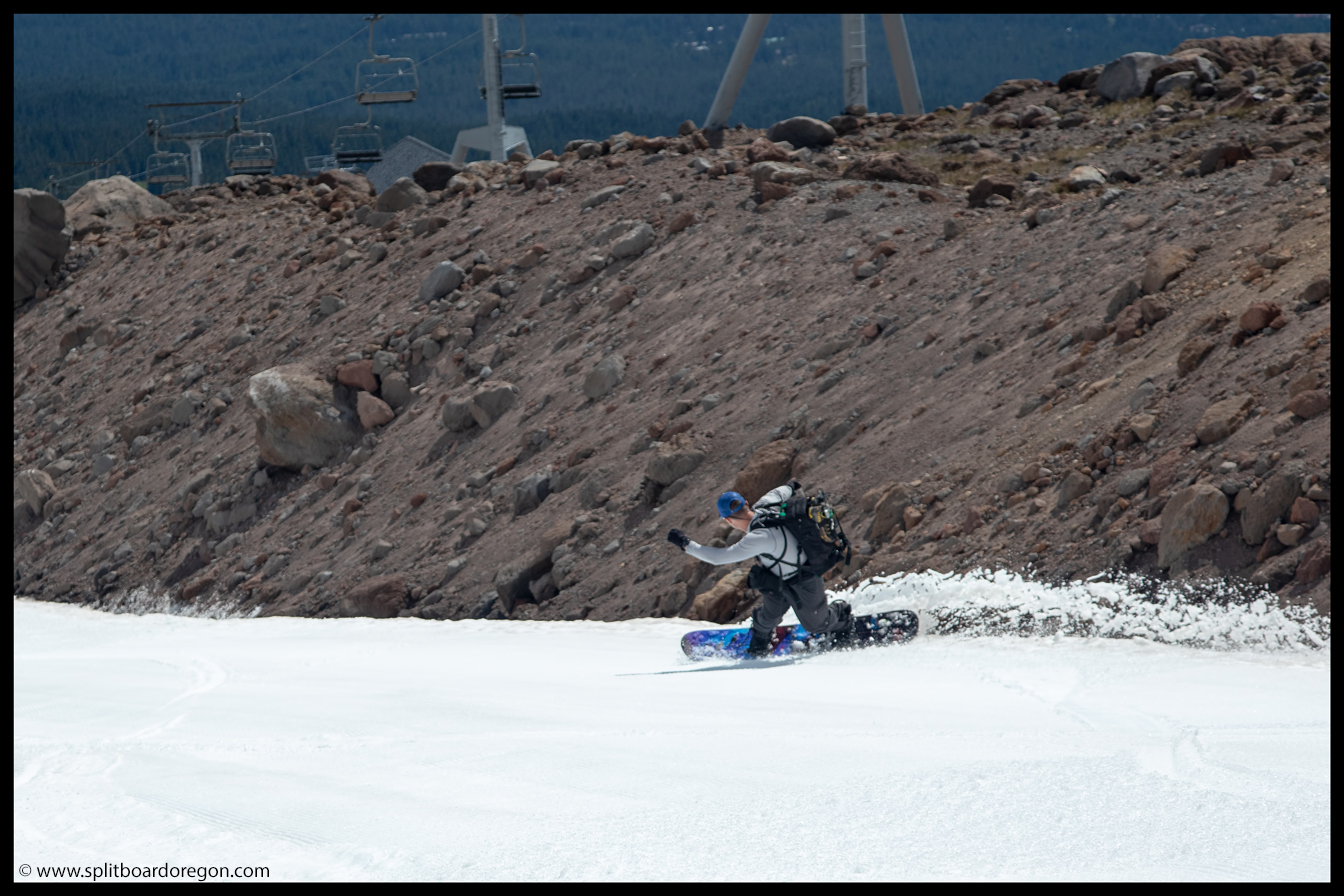
The snow in the Mile Canyon was tracked out by the snowcats, but it still skied pretty nicely because it was plenty soft. We were able to ski down below the cats, and ultimately to a few hundred feet above the lodge, making for a pretty decent sum of 5,000 feet of vertical on the day…
Turns below SilcoxJoe skiing the cat tracks in the Mile Canyon
At the end of the snow, we shouldered our packs and made the short trek down the trail and back the car, where cold beer, garden fresh chips and salsa, and fresh garden salads were waiting. Sitting in the parking lot enjoying the feast, all of us were stoked on the day, and already looking forward to what September would bring. Until then, here’s a parting shot from the day…
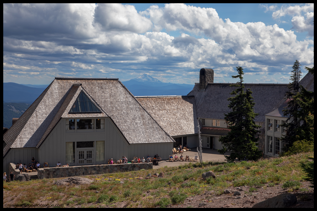
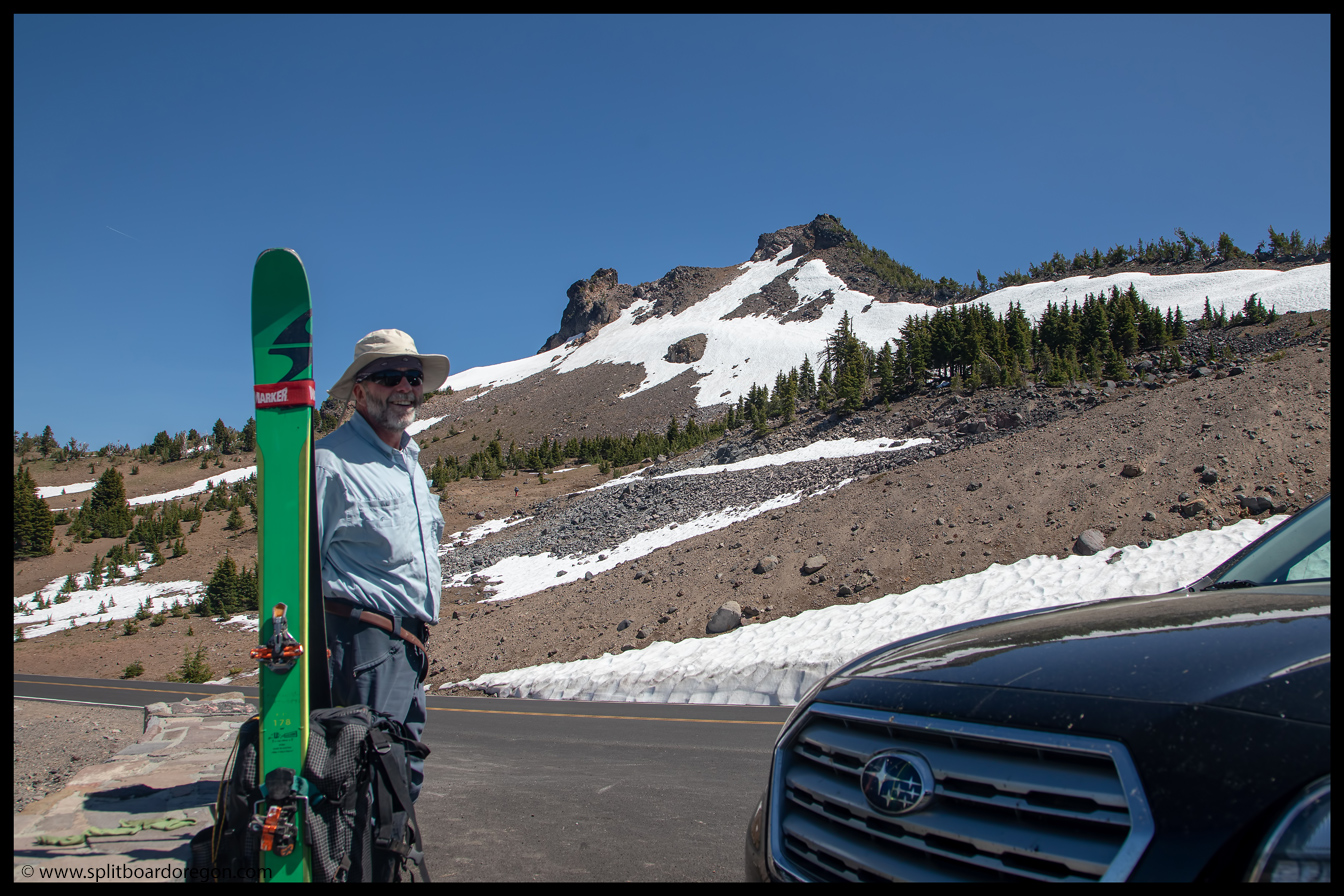
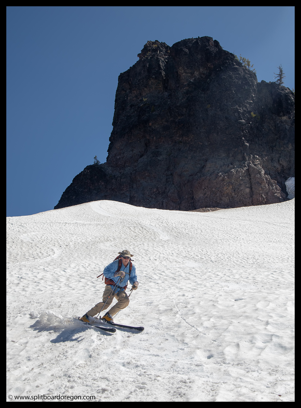
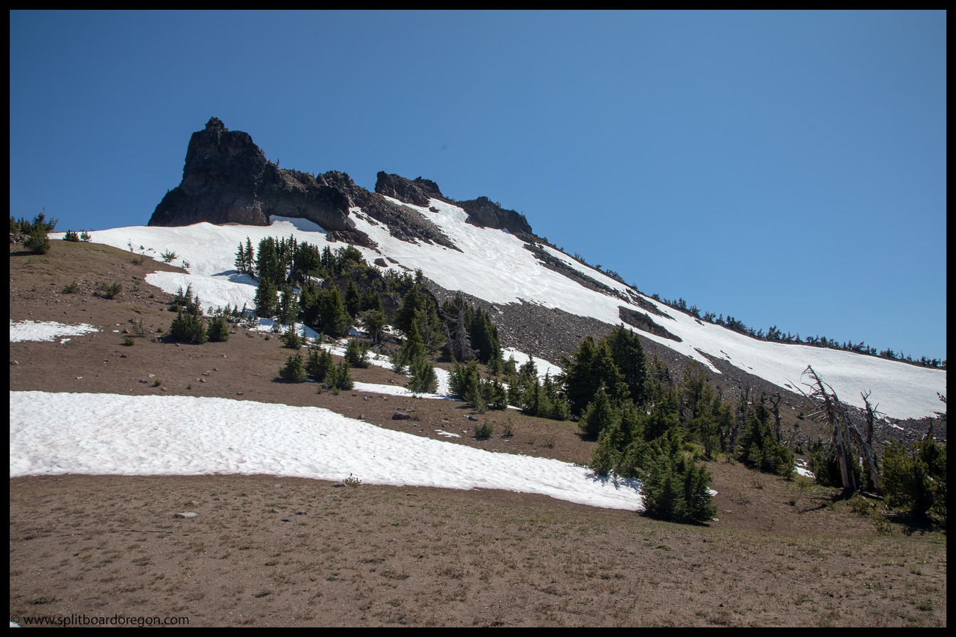
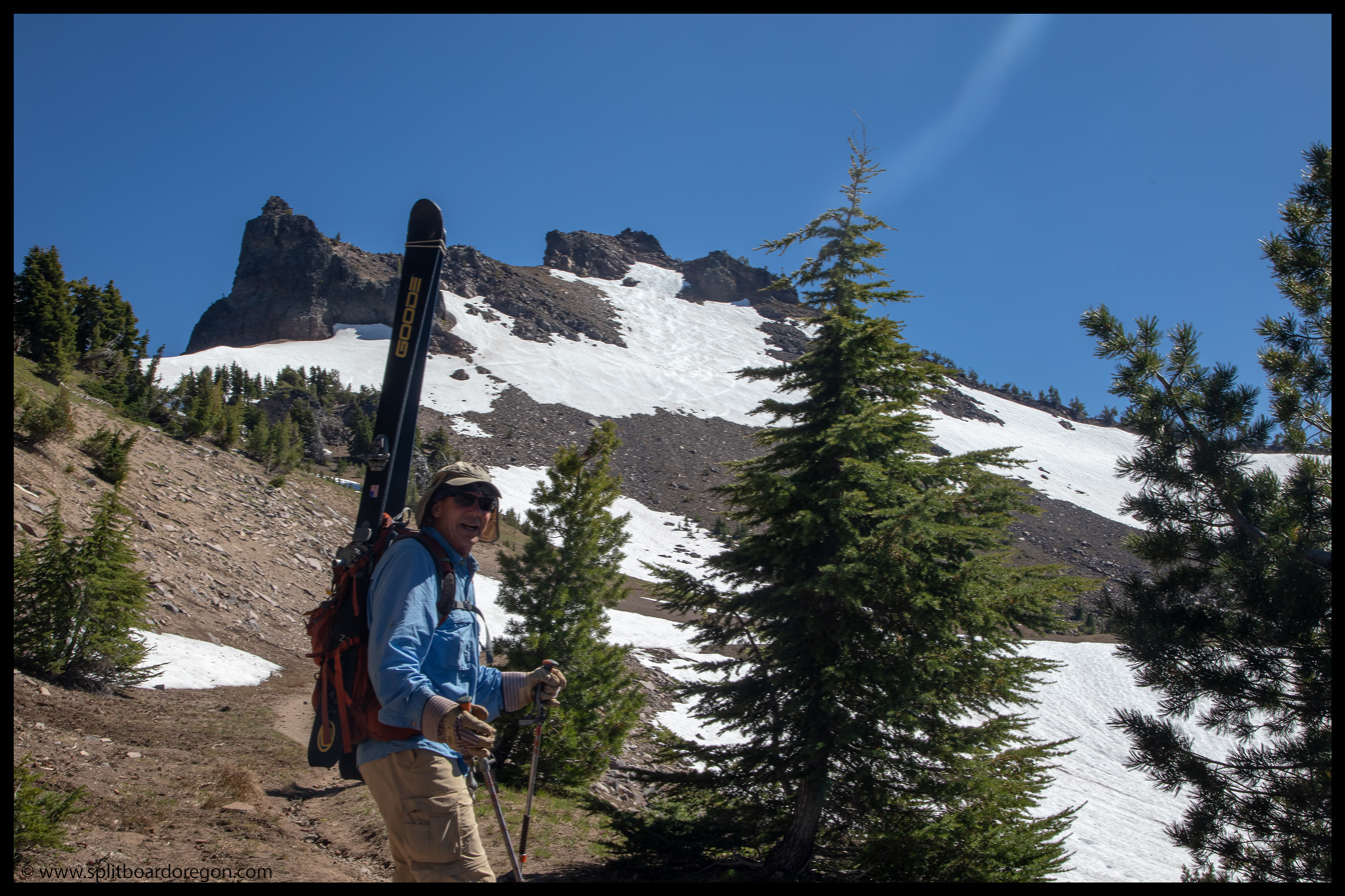
“I hope there’s enough snow to eek out some turns” was what Joe, John, Dan and I were all discussing as we headed north on Highway 97 with the hopes of making turns in our second state on the same day. After a pretty sweet trip to Shasta, we were hoping the north face of Hillman Peak was holding enough snow to have a little fun. A few hours later, as we entered the Park from the south, it wasn’t looking terribly promising as there only the smallest of patches remaining on Garfield Peak. A few minutes later, after fighting the crowds of tourists on the road, we made it to the pullout adjacent to Hillman.
Joe and Hillman
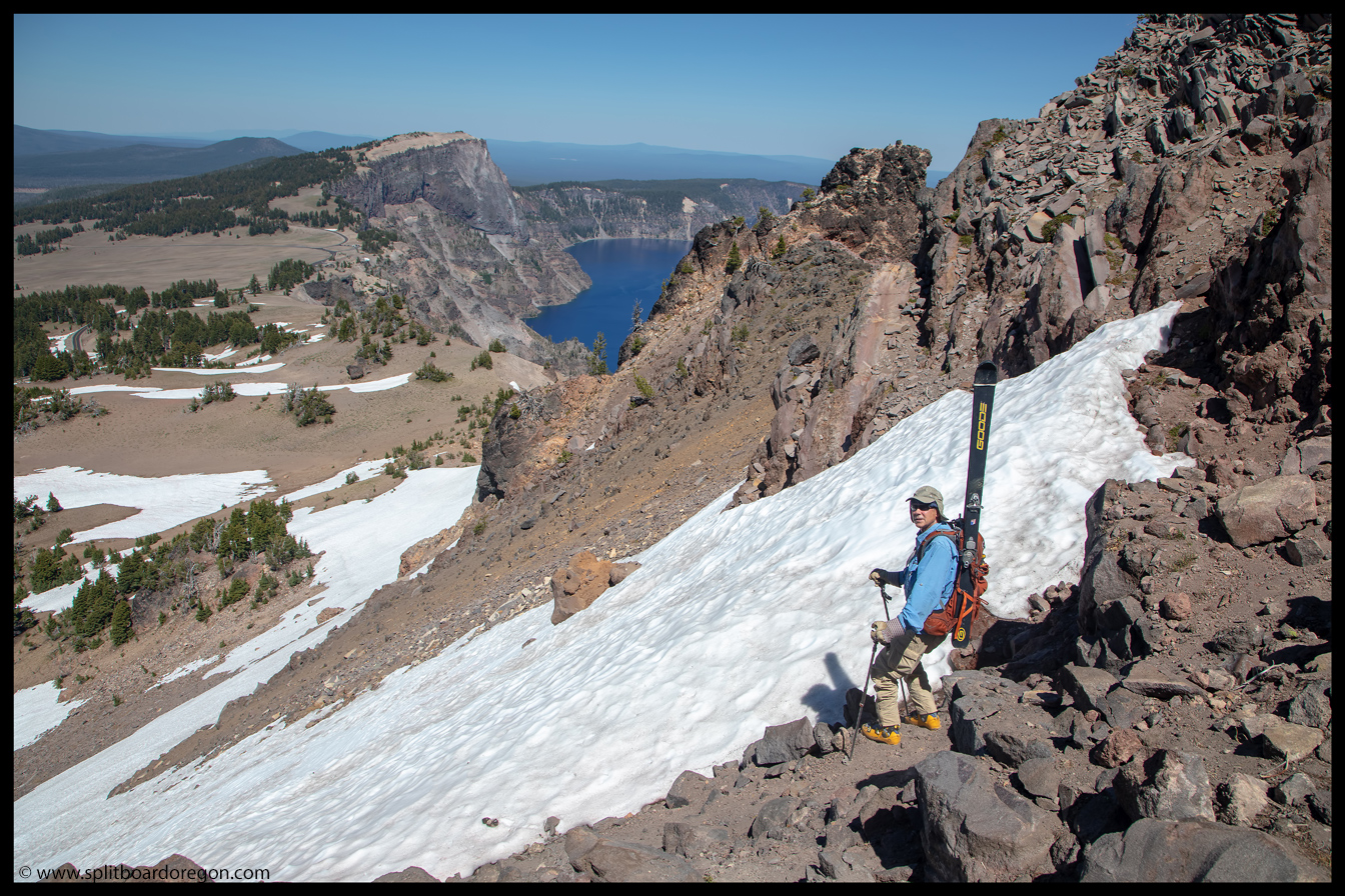
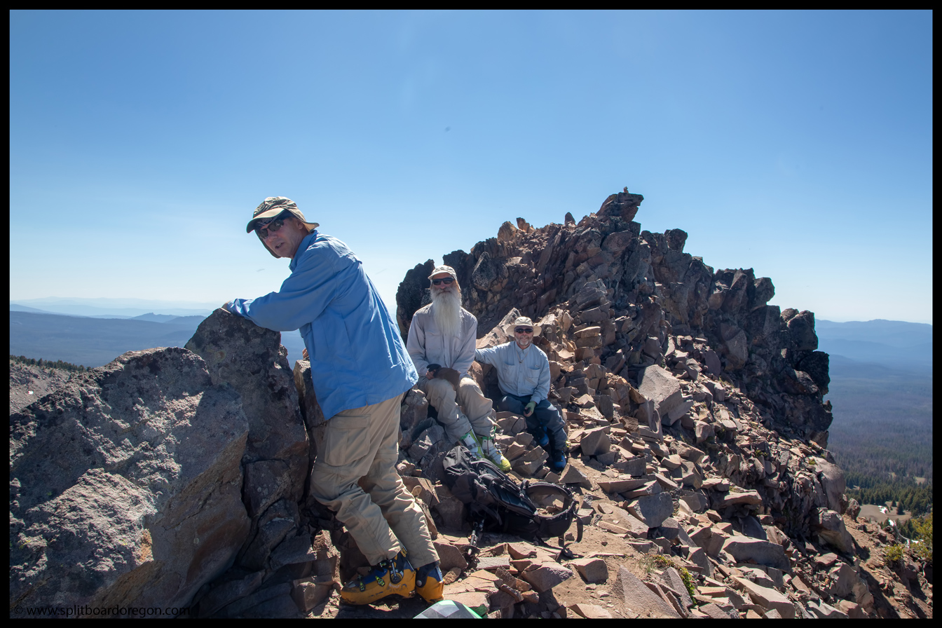
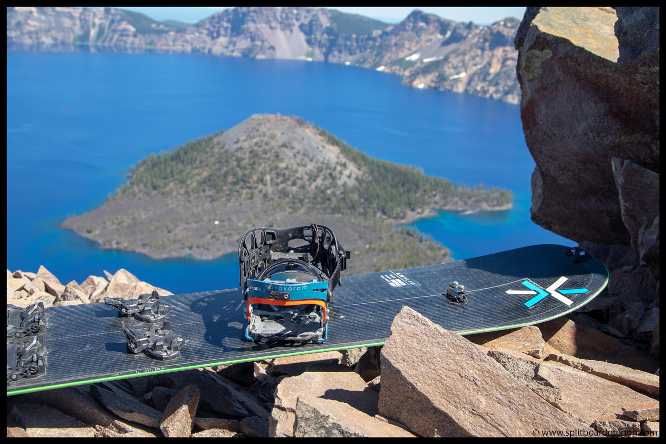
Although it didn’t look great, it looked like we’d be able to ski most of the peak via a connecting snow patch on the northeast side. Stoked, we headed out with super light packs. A quick hike up the ridge brought us the top of the snow, fifty or so feet from the actual summit. A quick scramble put us on top, with a commanding view of the lake….
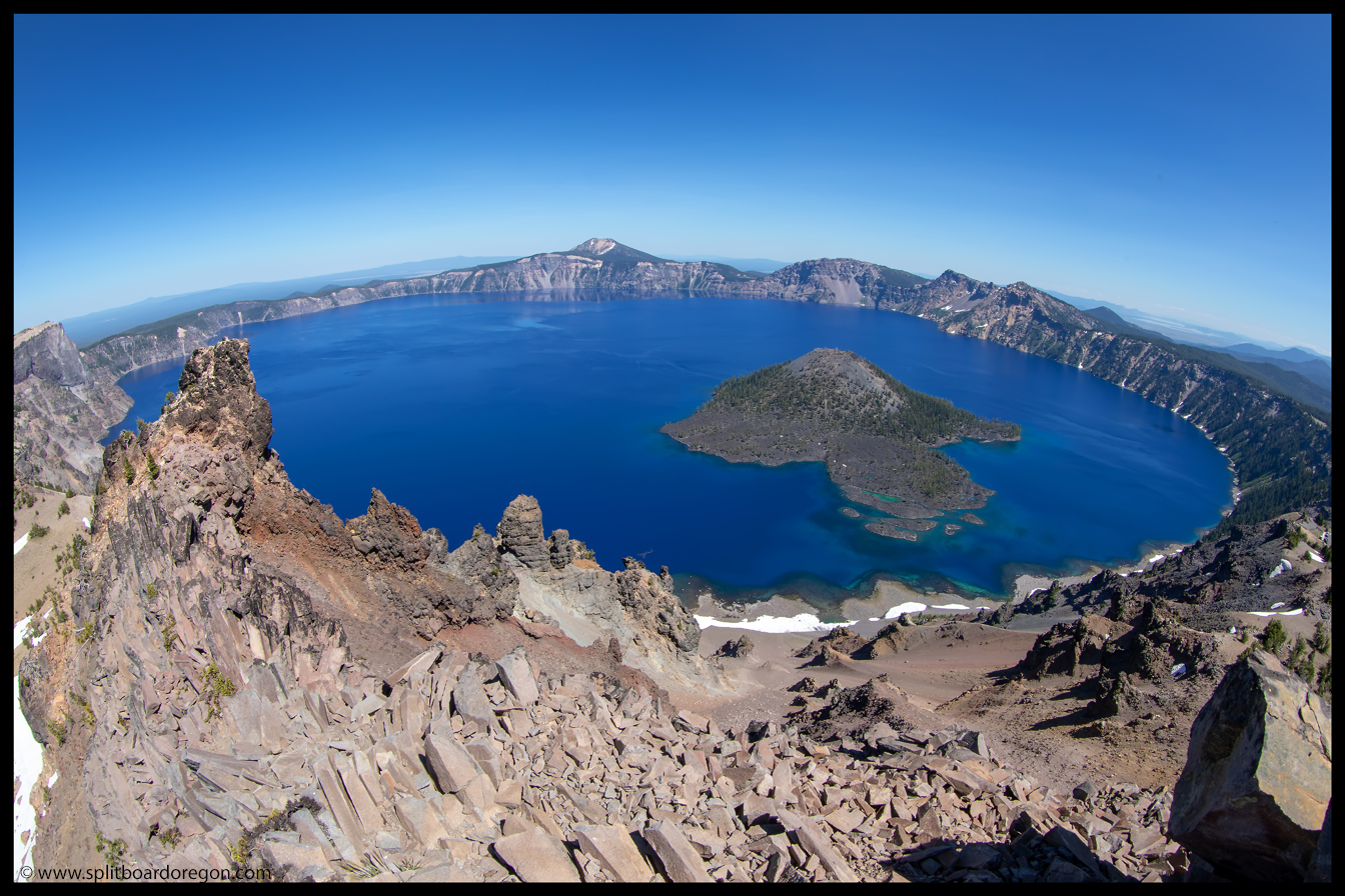
Dan at the summit saddleFisheye view of Crater Lake
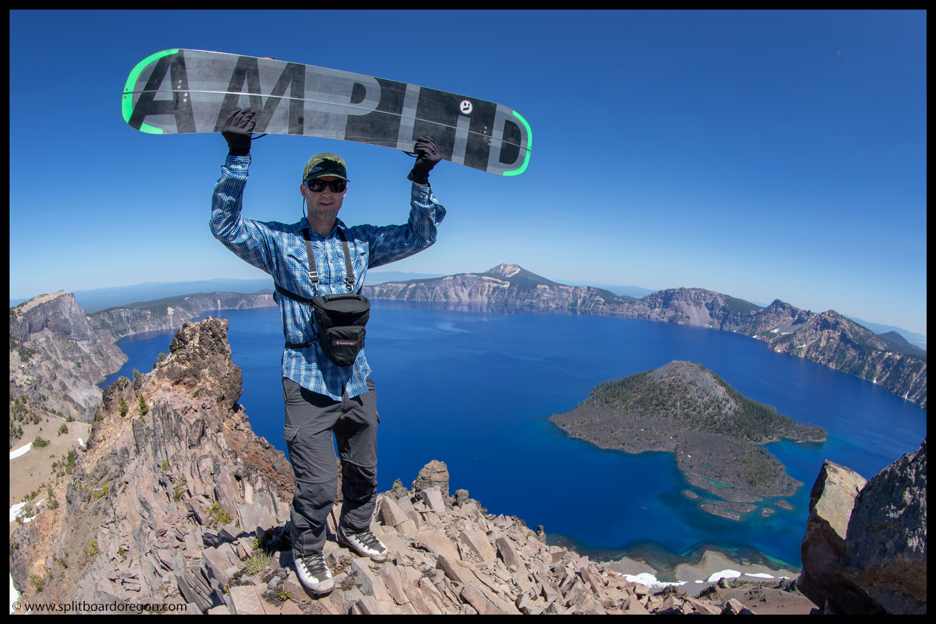
I convinced the rest of the crew to come to the top with me, and we all agreed the views were definitely worth it. We hung out up top for 15 minutes or so, soaking in the views, before scrambling back down to our stashed beers which were chilling in the snow…
The crew on top of HillmanMilligram split and Wizard Island
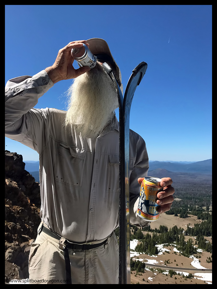
Back down at the snow, we pounded the beers before strapping in, and Dan captured the below shot of John double fisting, which has got to be one of my favorite all time photos of the Fish!
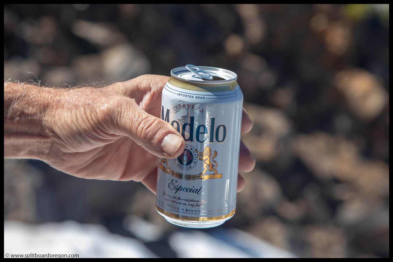
The Fish pounding one downThe beer of choice for the afternoon
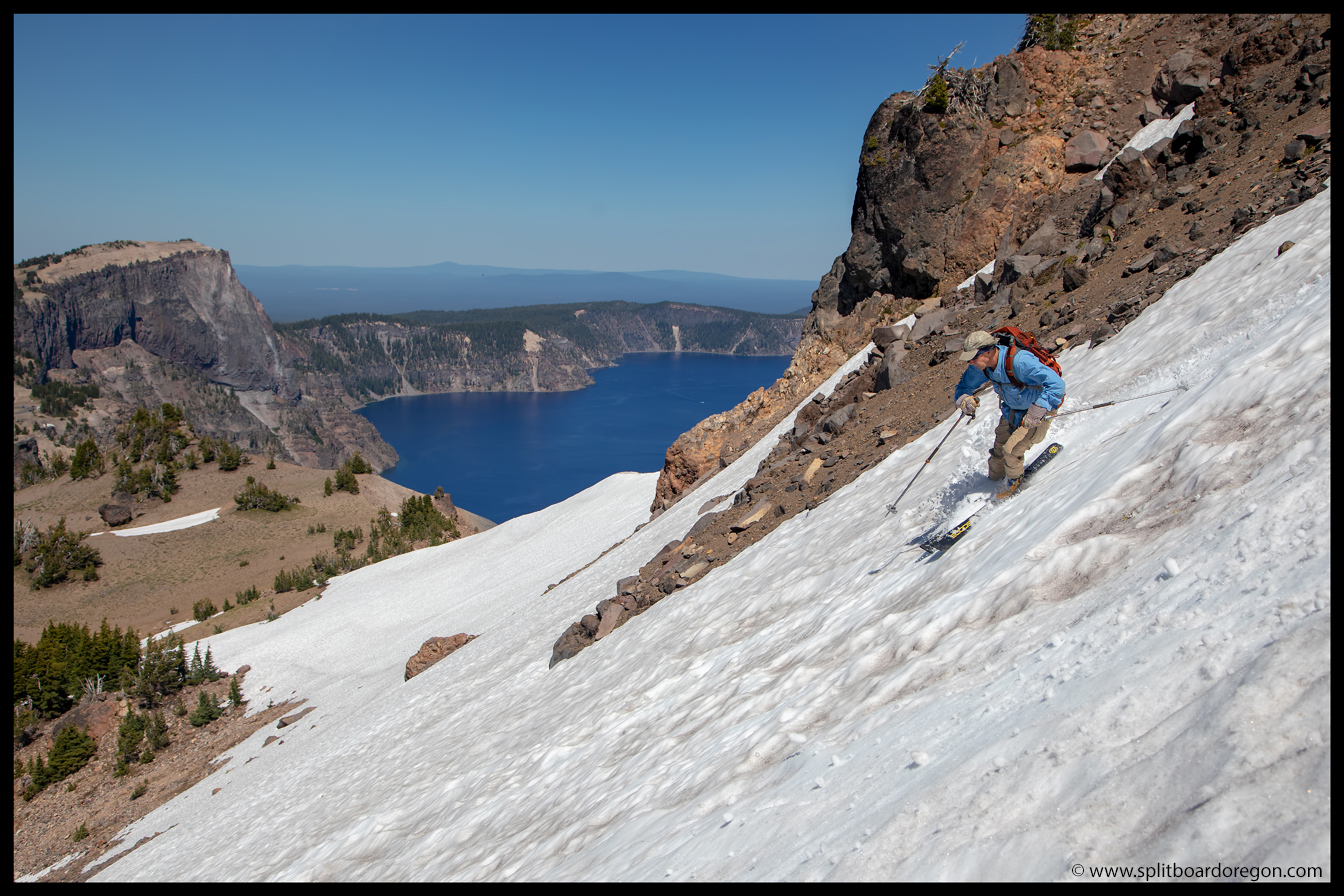
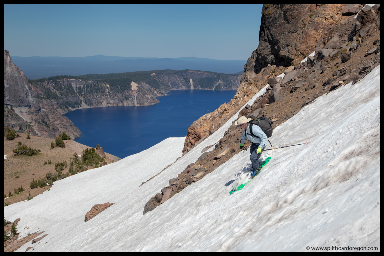
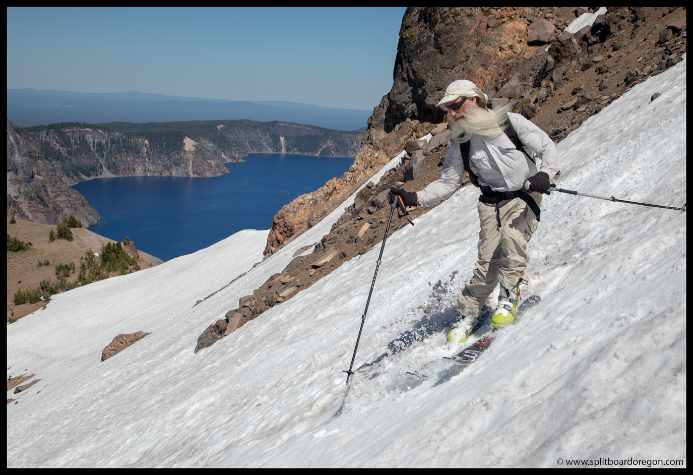
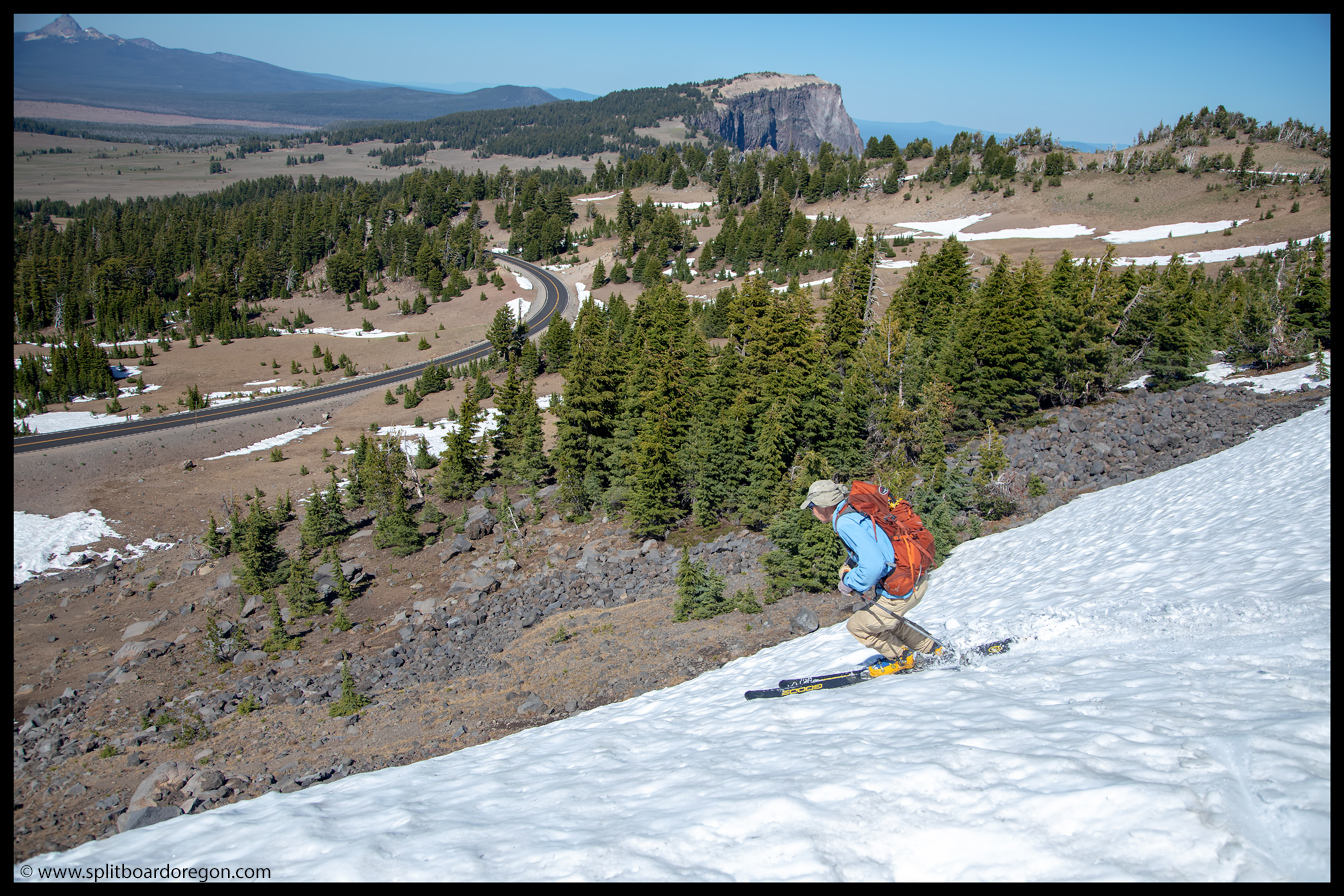
With the beers drank and stashed in our packs, it was time to strap in and rip a few turns. I dropped in first, made a few jump turns over the lip, and enjoyed some nice corn turns, before setting up to shoot a few shots of the skiers coming down…
Dan with Crater Lake as a backdropJoe skiing Hillman’s steep pitch
Shooting pics out to the east with the lake in the background always makes for a decent photo, so I continued snapping as Joe and John came down…
Joe enjoying the cornThe Fish, his beard, and the lake
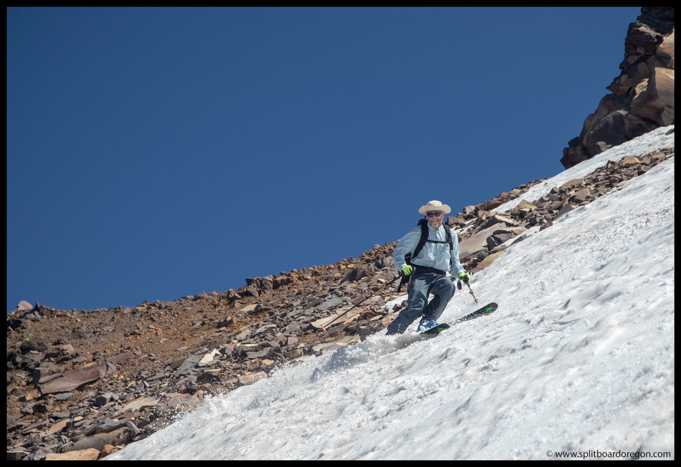
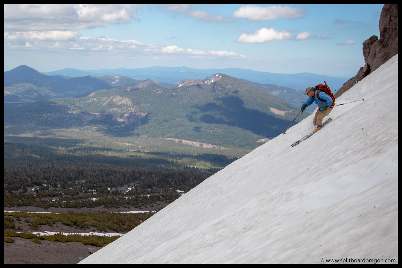
After a couple hundred feet, we worked our way skier’s right, and were able to thread the needle on a thin patch of snow and continue working our way down without having to take the sticks off our feet.
Dan skiing the lower pitchesLooking back at the peak
Eventually we had to take the boards off and walk across a patch of dirt, but the last connector took us right down to the trail and nearly to the elevation of the road. Not too bad for mid-July.
Looking down the last patch
At the bottom of the snow, we loaded the boards on our packs, and it was a short hike back to the car via the trail.
Hiking back towards the carDan on the hike back
Before we made it to the car, we all agreed one more ski of the slope closest to the car was in order. It was a less than five minute hike to the top, and the turns, although short, were fun back down to the road. I captured the below shot of Dan as he dropped in.
Dan heading down for a last lap
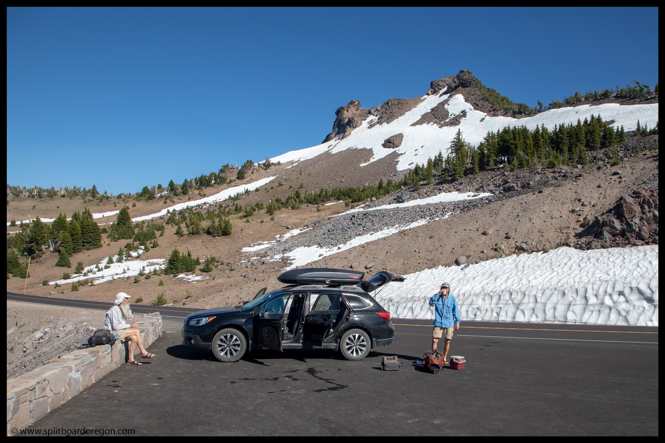
Dan had to make one more run, while Joe, John and I headed back to the car to load gear and get ready for the drive home. We had the skis in the roof box by the time Dan came back, and he had a big grin on his face.
The parking lot scene
We enjoyed one more cold one while hanging out on the warm asphalt, and then it was time to load up and head out. On the drive home, we were all pretty stoked on the trip, and agreed that the final turns of our three day trip at Hillman were icing on the cake. Below is a parting shot of the day looking out over the lake from the summit of Hillman.
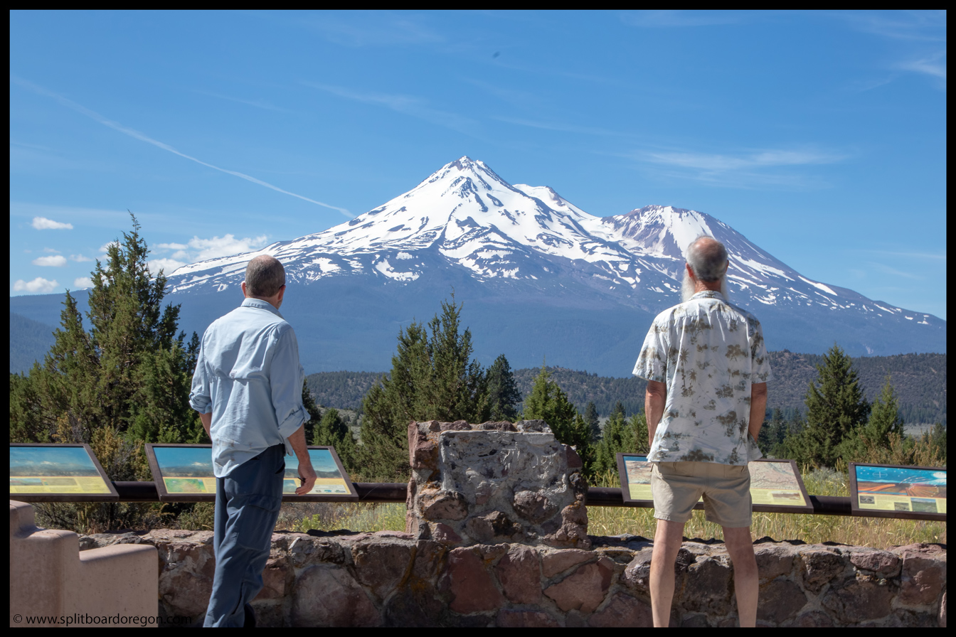
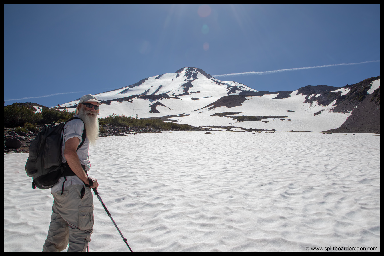
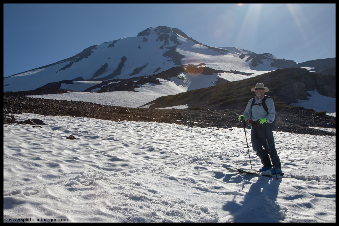
“It hasta be Shasta” John said in his email reply after checking the latest weather forecast. The four of us (Dan, Joe, John and I) were looking forward to camping and skiing on the Middle Sister, but the weather had different plans in store. It looked like the forecast to the south was holding, and it didn’t take much arm twisting for everyone to agree that Shasta was the spot. We met at Dan’s house at 6:00 am, loaded gear and skis into my Outback, and hit the road. The drive up 58 went quickly, and soon we were cruising down highway 97. Before we hit Klamath, we could see the white dome of Mt Shasta on the horizon, and from that distance the coverage looked awesome. After a quick stop just north of Klamath so John could score some beer, we crossed the state line and pulled over at an overlook to get a good look at the mountain. The view and the coverage didn’t disappoint…
Joe and John staring at the Bolam Glacier on Shasta’s north side
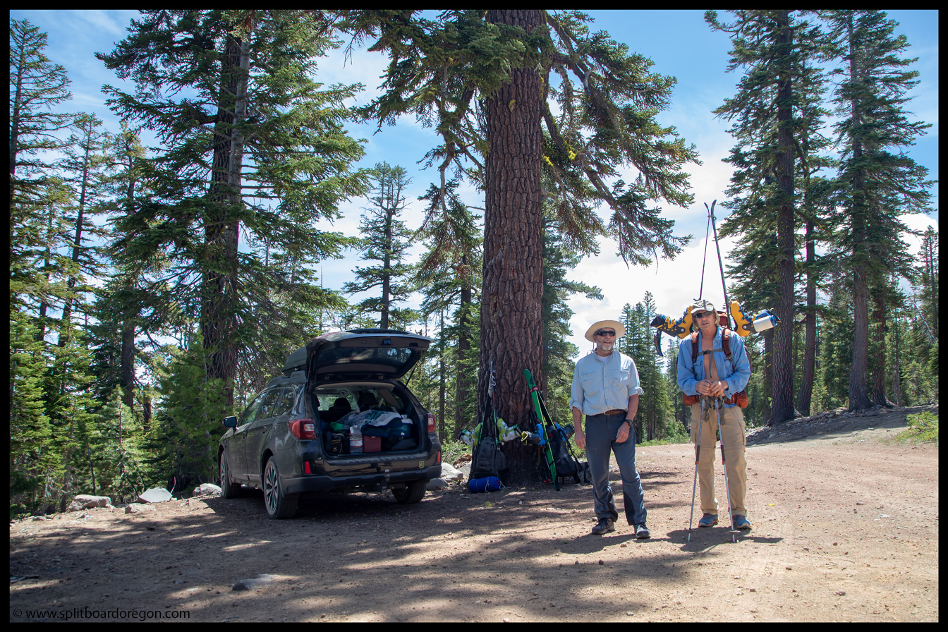
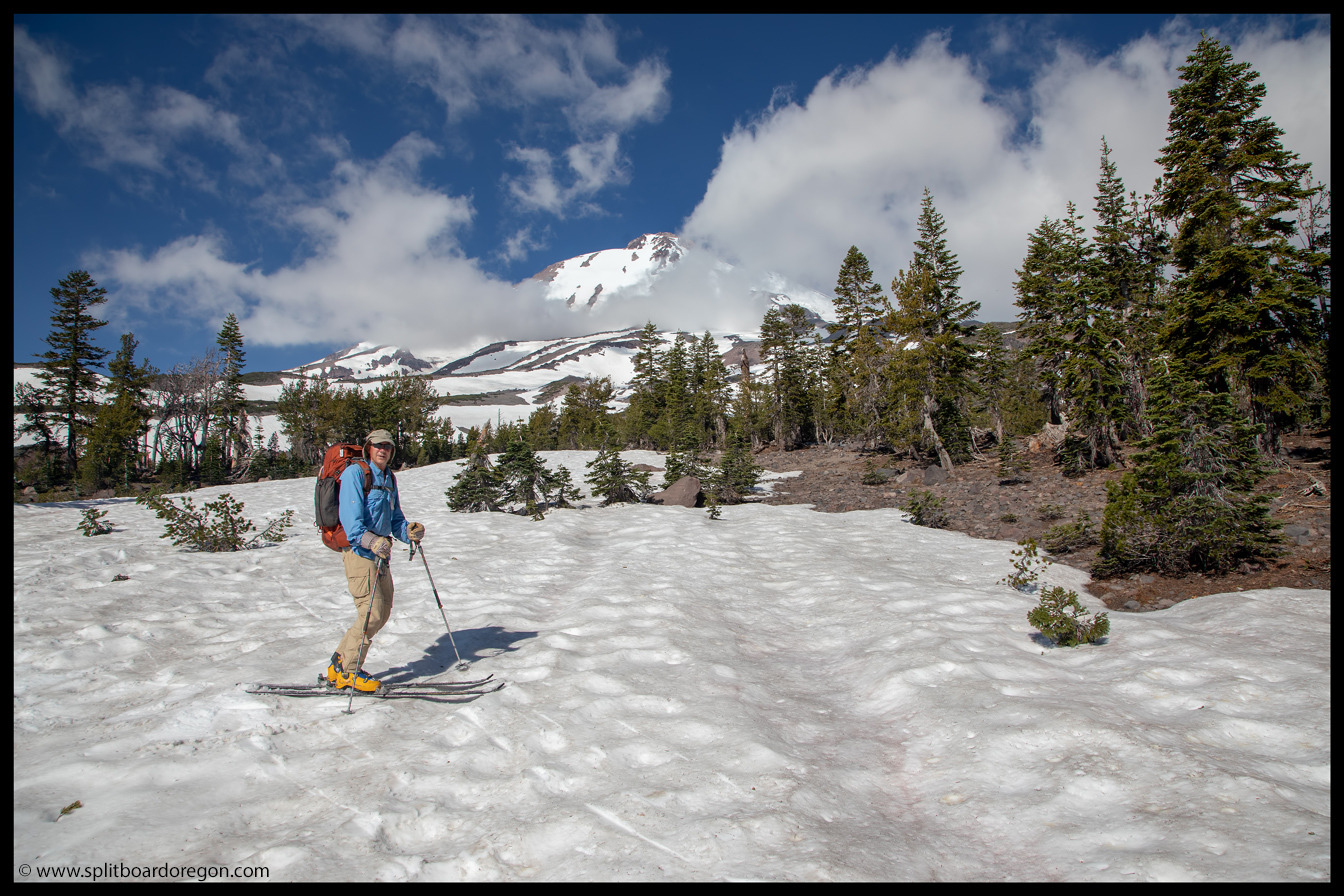
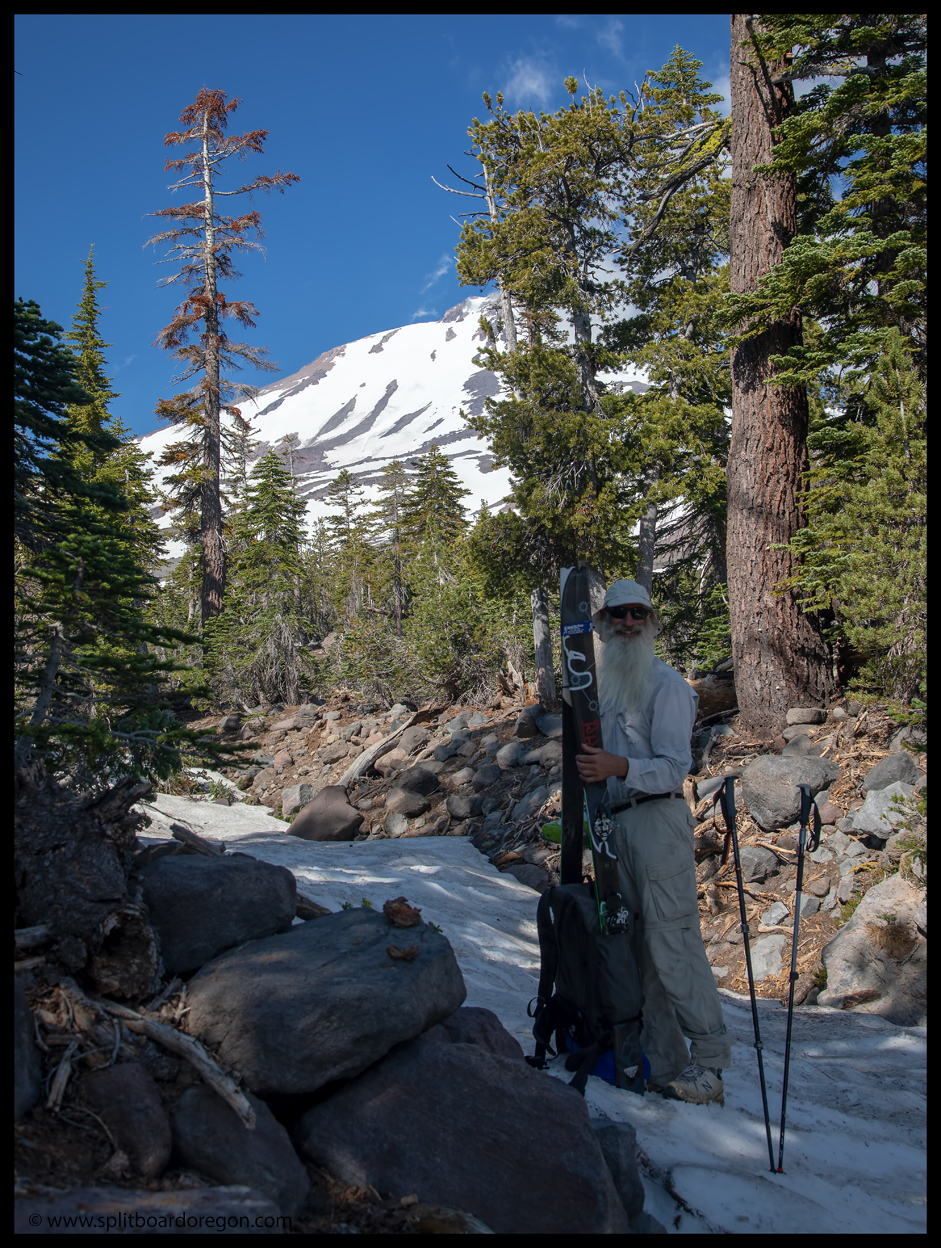
A couple of hours later, after winding around on gravel roads on the east side of the mountain, we made it to the Brewer Creek trailhead. We were a bit surprised to only see one other rig at the trailhead, and quickly set about unloading gear from the car. A half hour or so later, our packs were stuffed to the brim with overnight gear, and skis and boots added the finishing touch, and it was time to hit the trail…
At the trailheadThe Hotlun side of Mt Shasta
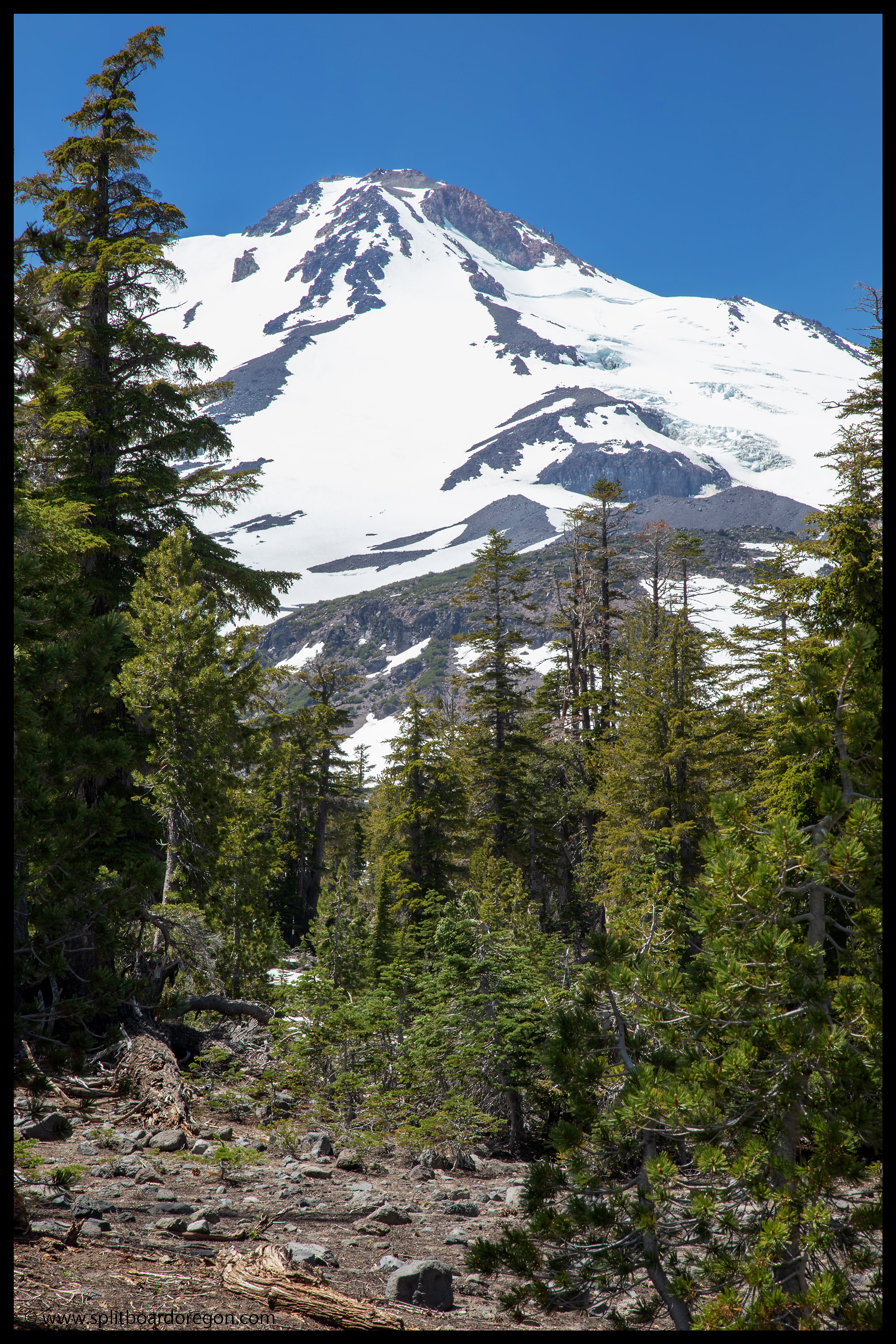
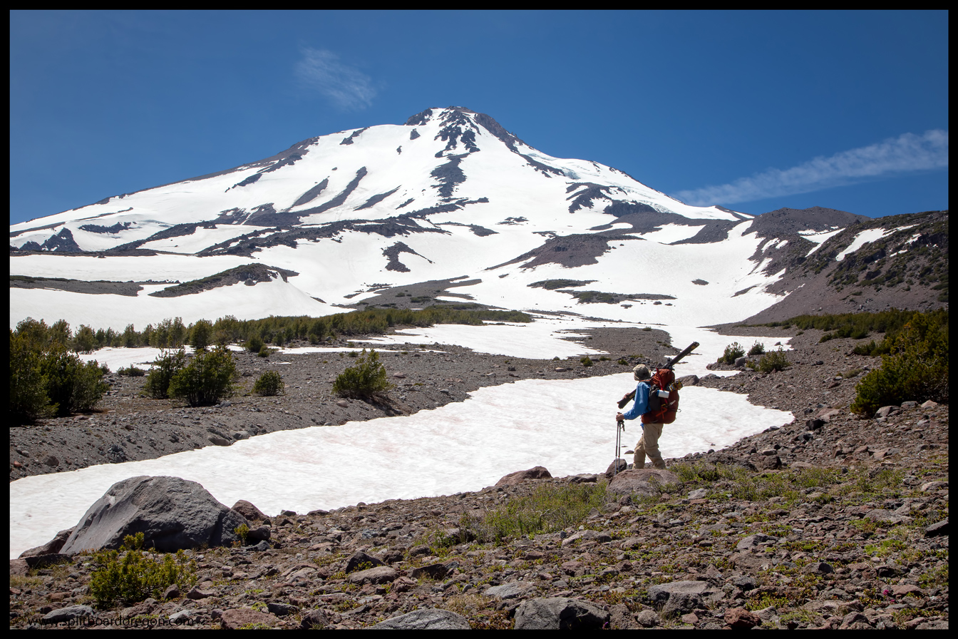
We followed the trail for a mile or so, until it became difficult to follow due to snow patches on the lower mountain. Working our way south, we traversed across the lower reaches of the mountain looking for a spot to camp. About halfway across our traverse, I noticed a glimmer under a rock. Investigating a bit further, it turned out to be the find of the trip — 5 cans of Old Chub, 4 of which were still in pristine condition. The dates of brewing were from July of 2015, but they were preserved perfectly…
Hiking to campThe find of the trip
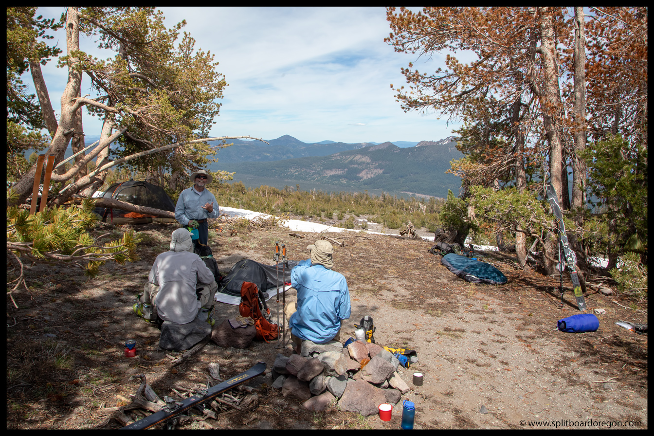
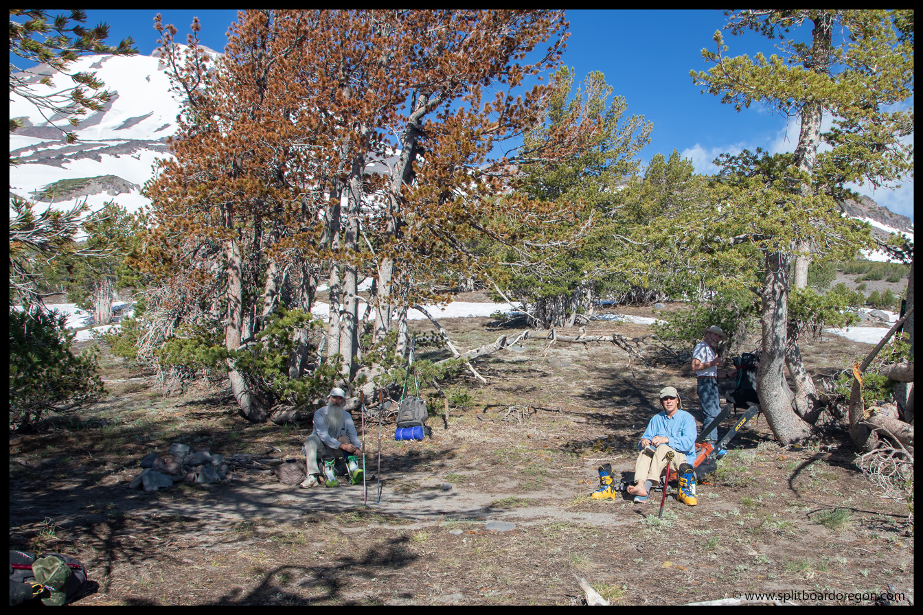
After stowing the brews safely in our packs, we headed on a bit further, and ended up finding an awesome campsite in the trees at the edge of what looked to be a continuous snow patch with the larger snowfields up higher. Ski in/ski out from camp looked promising. It didn’t take too long to get the packs unpacked, camp set up, and the urge for some evening turns to take over…
Hanging at camp before skiingDan enjoying turns above camp
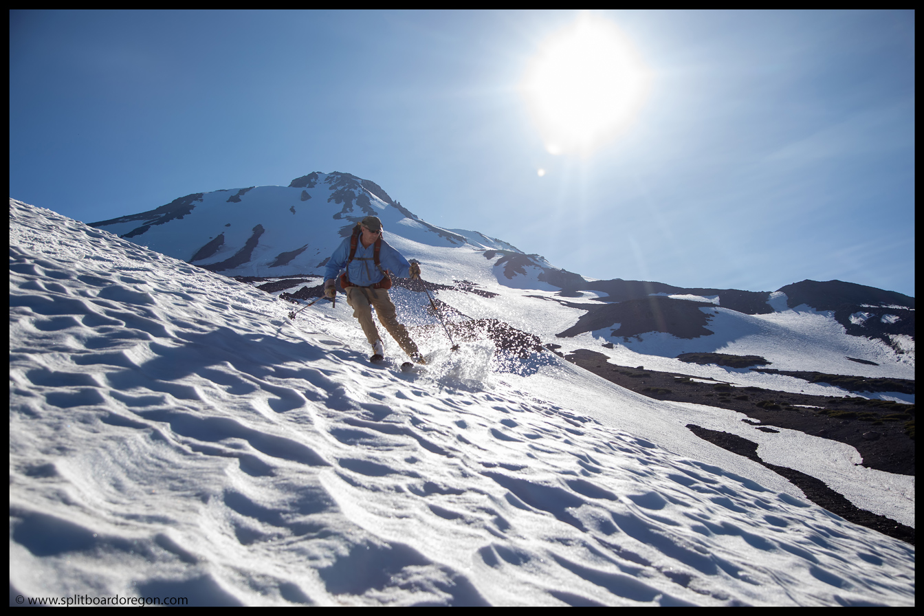
We set out on skins a few feet from the sleeping bags, and were interested to see if our snowfield next to camp would connect to the snow higher on the mountain. As luck would have it, it did, and we’d only have to ski over a few rocks in a spot or two. We put a couple thousand feet between us and camp, before calling it for the day to enjoy a great corn run back to camp.
John skinning above campEvening turns on Mt Shasta
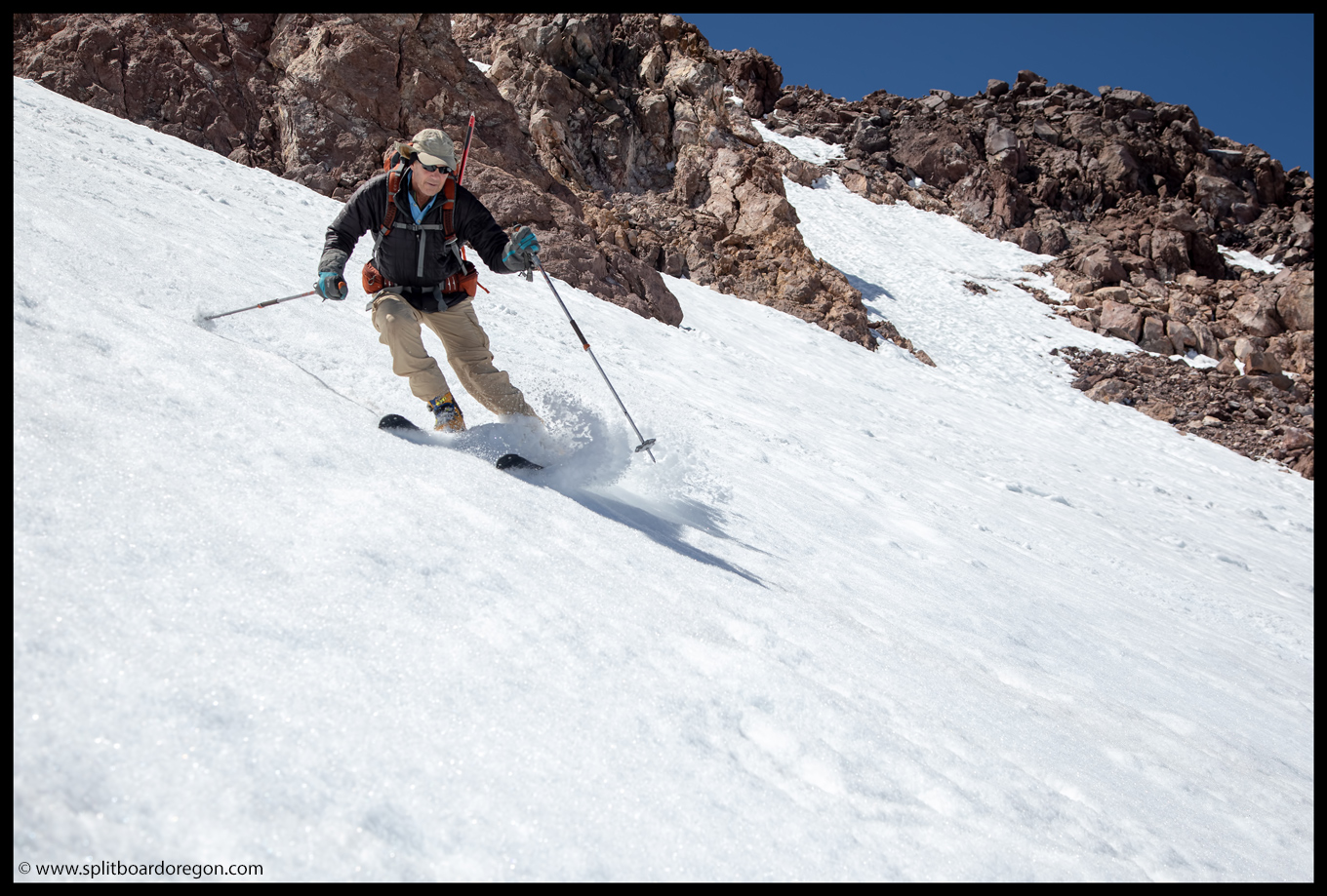
The turns were nice, and the snow was in good shape for the most part, with a few spots that skied better then others. We explored skiers left on the way down, eventually working our way onto the broad ridge that was to the south of our campsite.
Taking a brief break during the evening skiJoe above the final pitch
On the ridge, we dropped in one by one down the short, steep face. Joe and John headed down first, and then I followed, snapping a few pics of Dan as he skied down.
Dan skiing the pitch above campLooking back on Mt Shasta
At the bottom of the slope, the sun was low in the sky next to the mountain, so I switched lenses to see if we could capture a sunburst, and snapped a photo of Dan (above) and he snapped a shot of me. Then, it was a short hike across the rocks, and a few more turns down to camp.
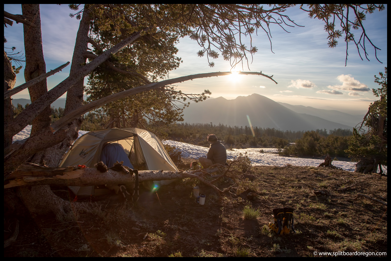
Matt after the evening skiThe view from camp
After airing out the skins and changing out of ski boots, it was time to enjoy a evening margarita along with dinner. My drink was made up with the usual ingredients — crystal light lemonade, an airplane shot of Cuervo, and corn snow. Dinner was pad thai from Good-To-Go foods, and it hit the spot. We hit the sack early, in anticipation of an early morning the next day with conditions that would hopefully be favorable for a summit bid.
Early morning on the mountain
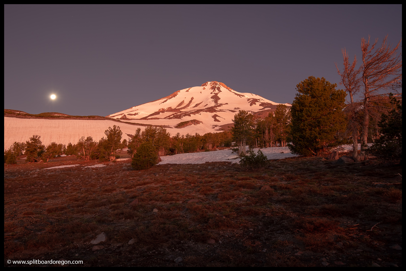
I got a good night’s sleep in my bivy sack, and woke early in the morning in time to get a few shots of the mountain before the sun rose. The rest of the crew woke up a little bit later, and by 6:00 am we were eating breakfast and getting gear ready for the day.
Looking east from camp
It was around 6:30 am or so when we headed out. Given our recon the night before and the firm snow, we elected to leave skins behind but carried ice axes and crampons in the packs. The morning booting went smoothly, and after a couple of hours of hiking we noticed a cloud bank from the south moving in. It seemed to be hanging to the south and east, and was at an elevation lower than us, but would be worth watching as the day wore on…
The crew working their way upJoe and John on the bootpack
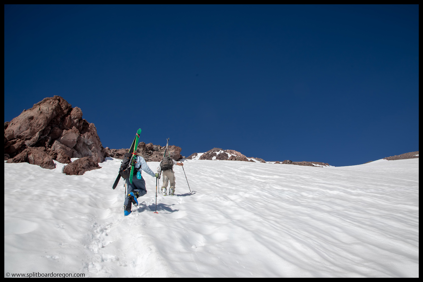
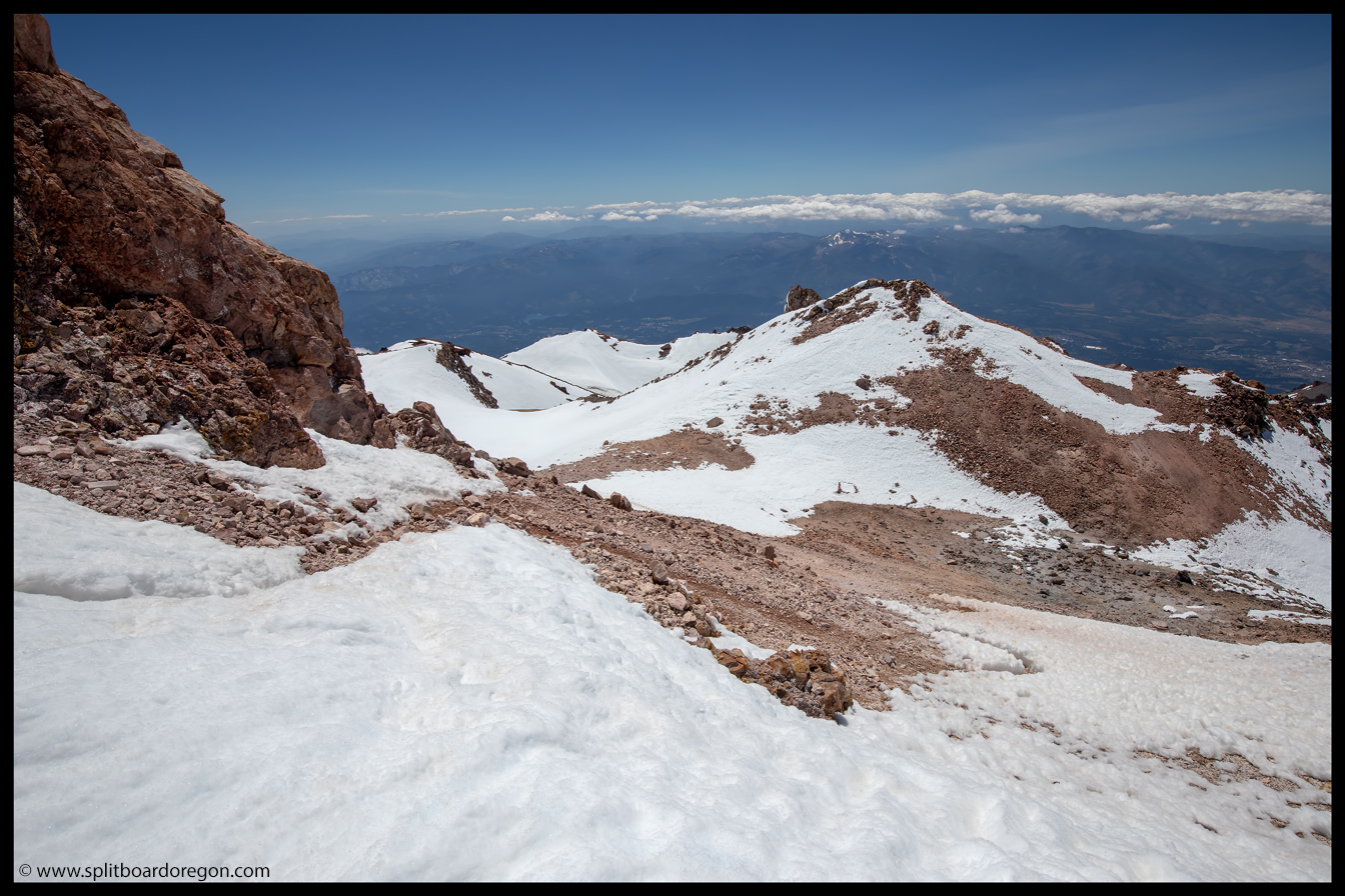
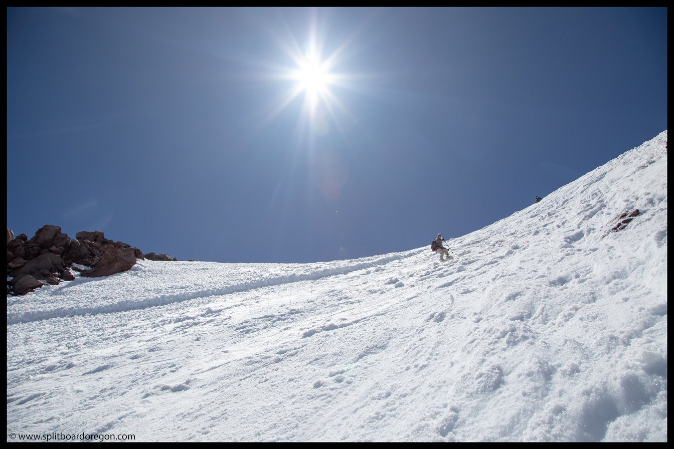
The climbing seemed to go on an on forever, and we took turns setting the bootpack. Around 11,000 feet, we traversed over from the Hotlun side to the Wintun side. Although tiring, at this point I was getting stoked because it looked like the summit would be in striking distance as long as the weather held off.
Dan working up the mountainGaining ground on the summit
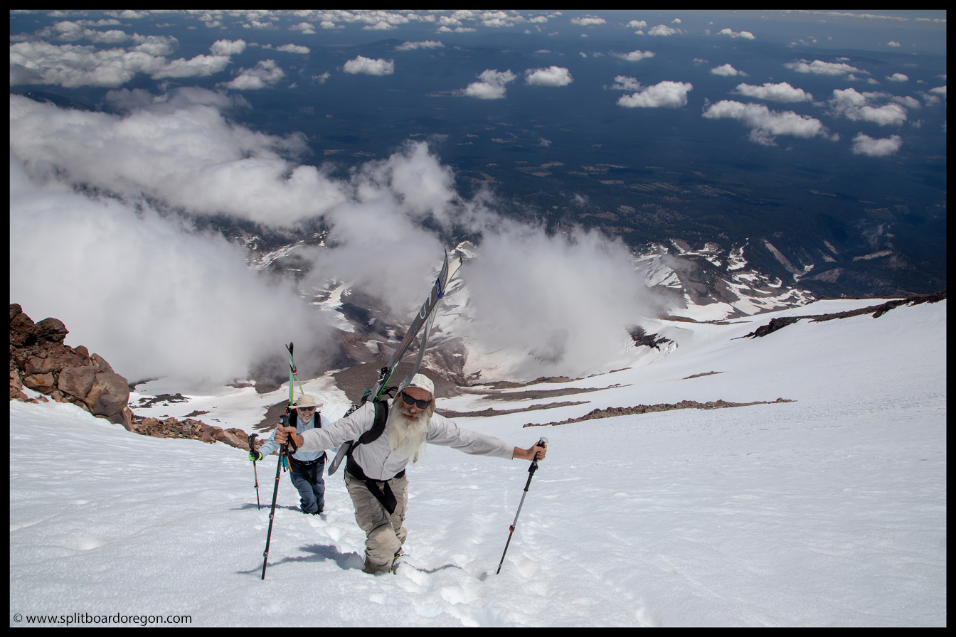
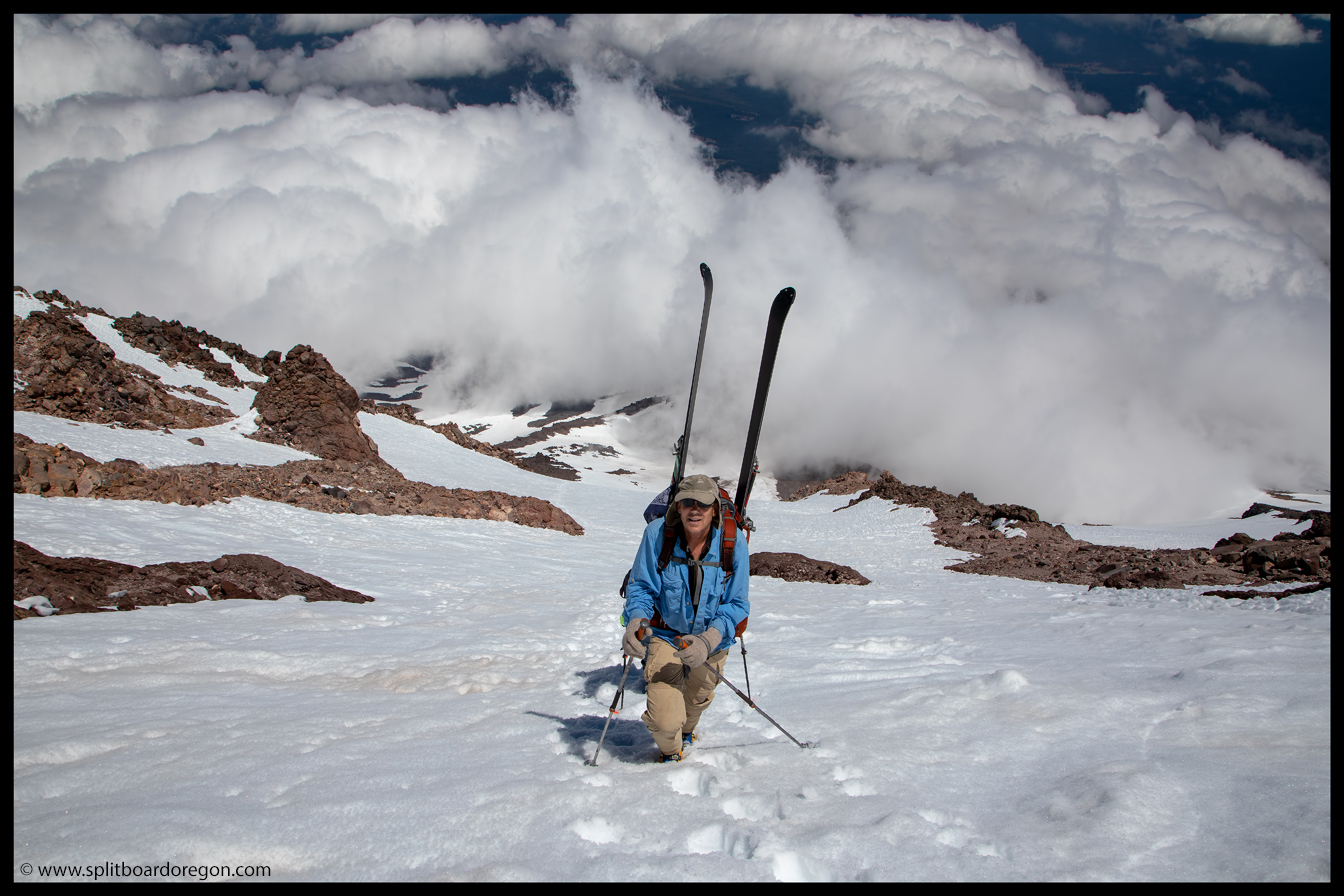
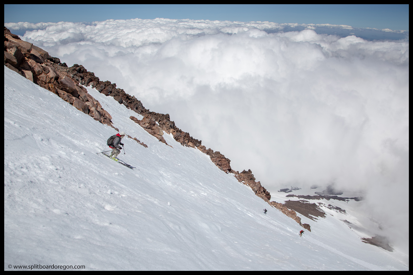
Between 12,000 and 14,000 feet, the going was pretty slow due to unconsolidated snow conditions, but we pressed on. Near the top, we only put in 50-75 steps apiece before gladly falling to the back of the line on the bootpack. The hard work eventually paid off though, and we made it to the summit…
Dan above the cloudsThe view towards Shastina from just below the true summit
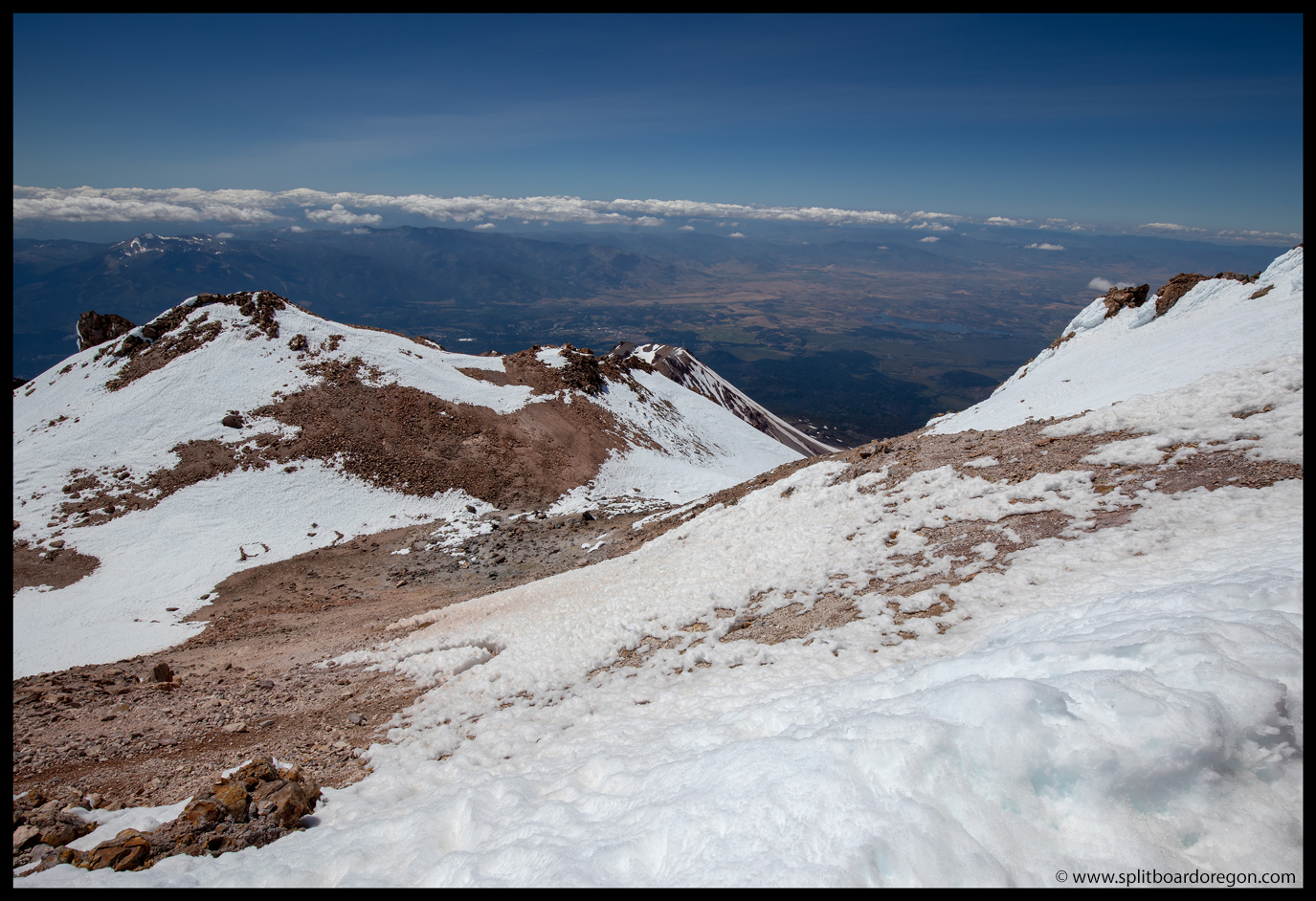
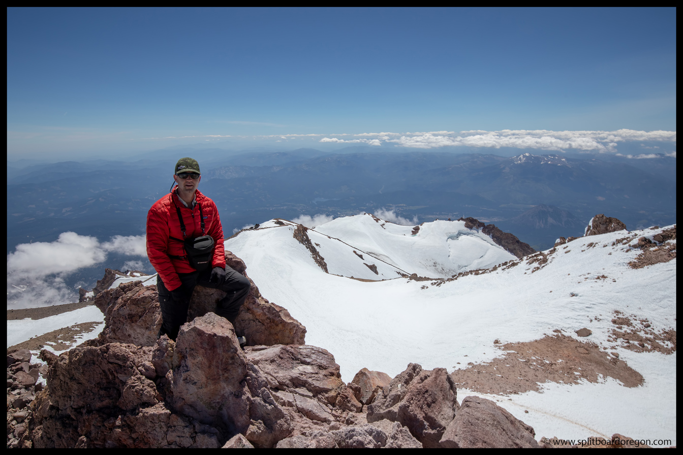
I was stoked to get on the summit, and to see the views south and east, having looked at the mountain from I-5 on multiple trips south with the family on the way to southern California. Looking to the west, the massive crevasses of the Whitney Glacier stood between us and Shastina, and to the south was the route up Avalanche Gulch and Misery Ridge. The winds were howling on the ridge, so we donned down puffies and made the short hike to the true summit a few hundred feet away…
Shasta summit ridge viewOn the summit
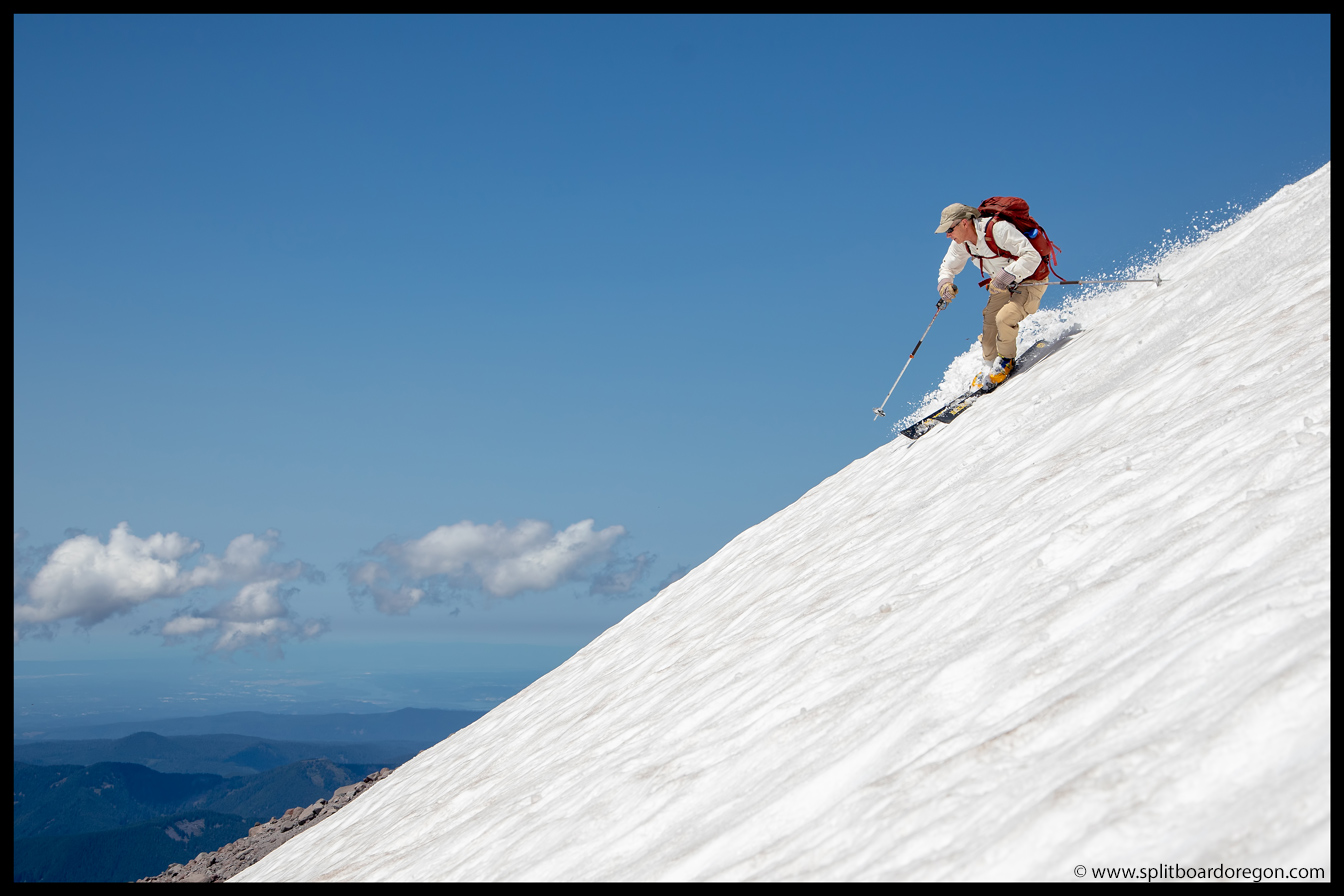
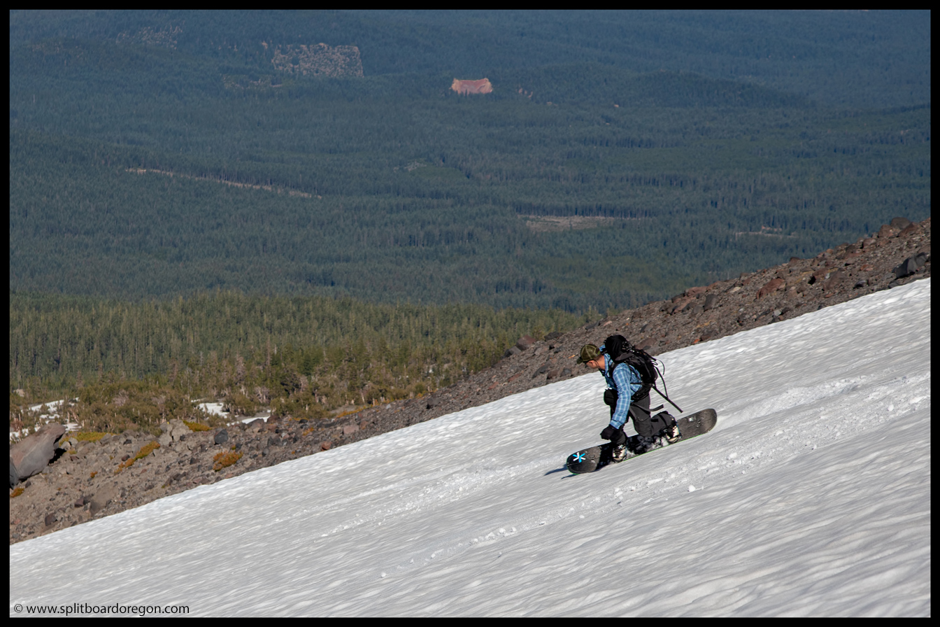
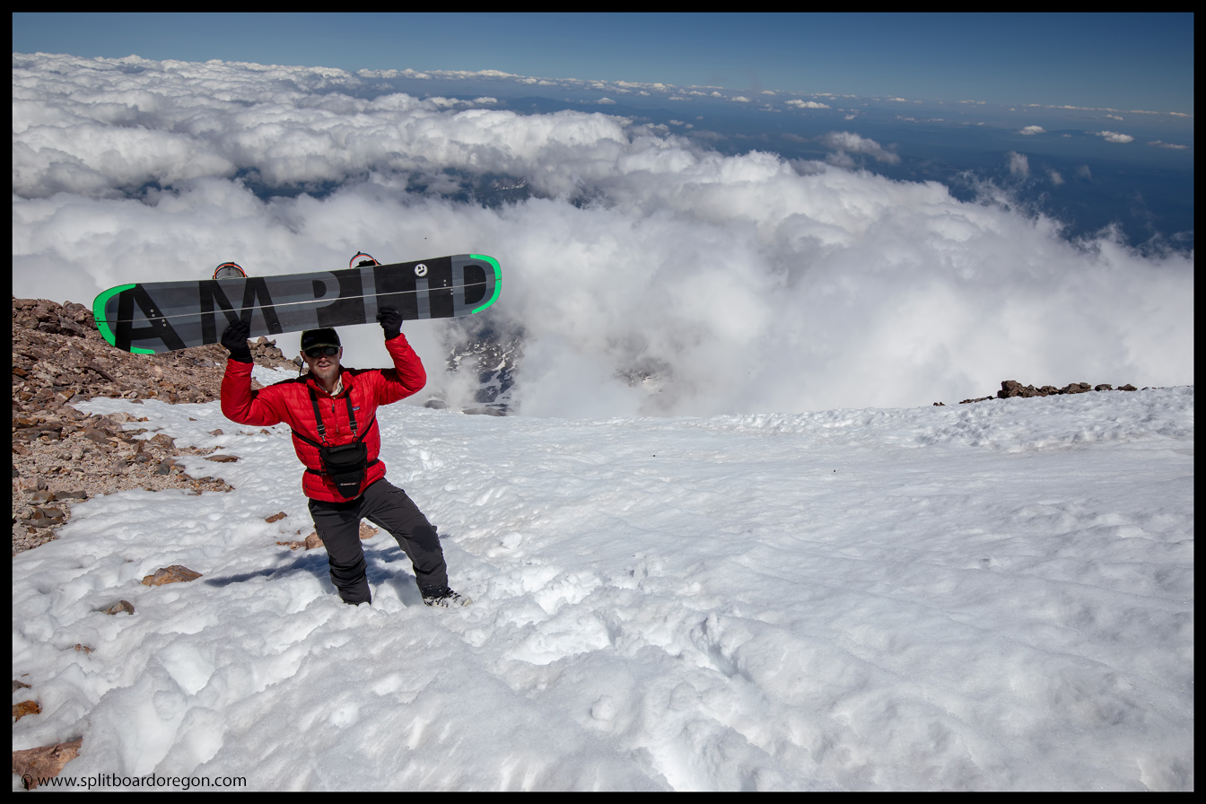
We spent a few minutes on the summit, soaking in the views and stoking on the fact that nobody was around. Surprisingly, the entire time we were on the summit and summit ridge (about 45 minutes to an hour), we didn’t see anyone, even on the approach routes. Back down at our gear, we snapped a few more photos, and readied to start the descent. I strapped in, and made the first turns off the summit ridge, and set up to shoot some photos of the skiers coming down…
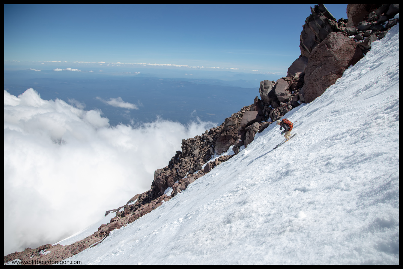
A quick shot before dropping inDan skiing the upper pitches of Shasta
The views off the top were incredible, and made for some good pics on the descent. Dan skied down first, followed by John and Joe. I fired off a few shots of the guys coming down, as well as some shots as we worked our way out onto the Wintun proper.
John skiing down from the summitJoe ripping the upper slopes on the Wintun Glacier
The snow on the upper thousand feet was in decent shape, albeit a bit bumpy. We worked our way down, and Dan grabbed the camera and snapped a few shots of me riding…
July turns off the topDan enjoying a well earned turn high on Mt Shasta
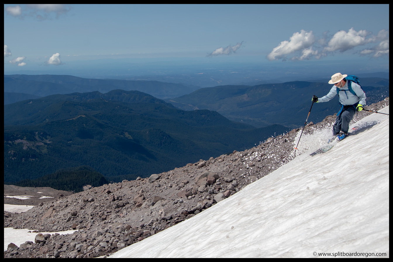
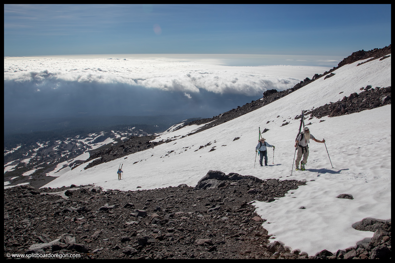
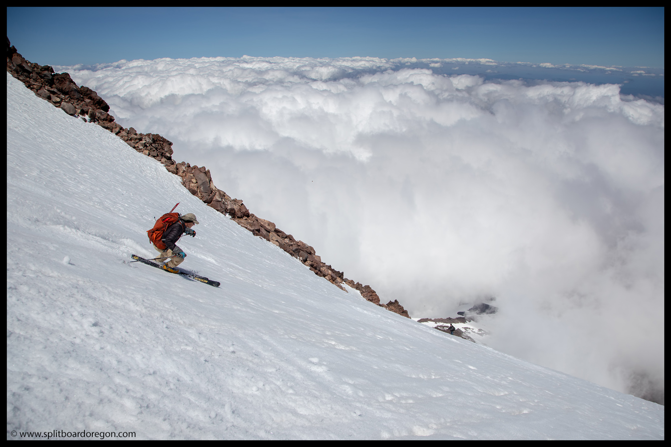
The Wintun Glacier has a decent amount of vertical, and the descent went on and on and on. Somewhere around 1,500 vertical off the top, the snow became more unconsolidated, and the turns began getting pretty manky…
Dan skiing above the cloudsThe skiers heading down
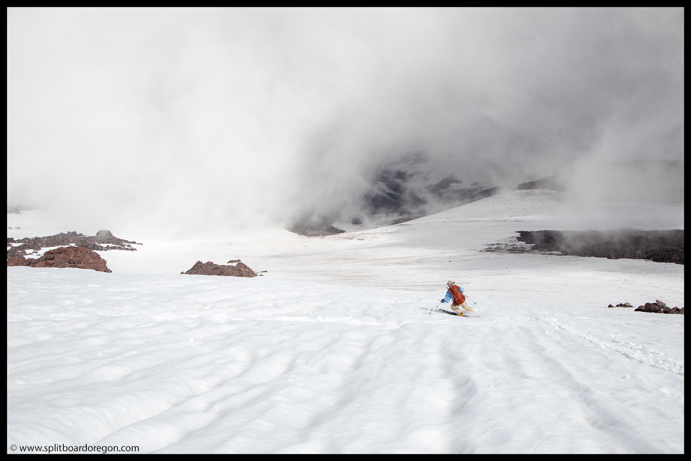
At an elevation of around 12,500, we did a ski of the slope and got a significant wet hisser going. The snow was traveling fairly slowly, but ended up running down the remaining length of the glacier. Although it wasn’t exactly what we were looking for, it provided a safer descent route down and we took advantage…
Looking down the slide pathCruising down the Wintun
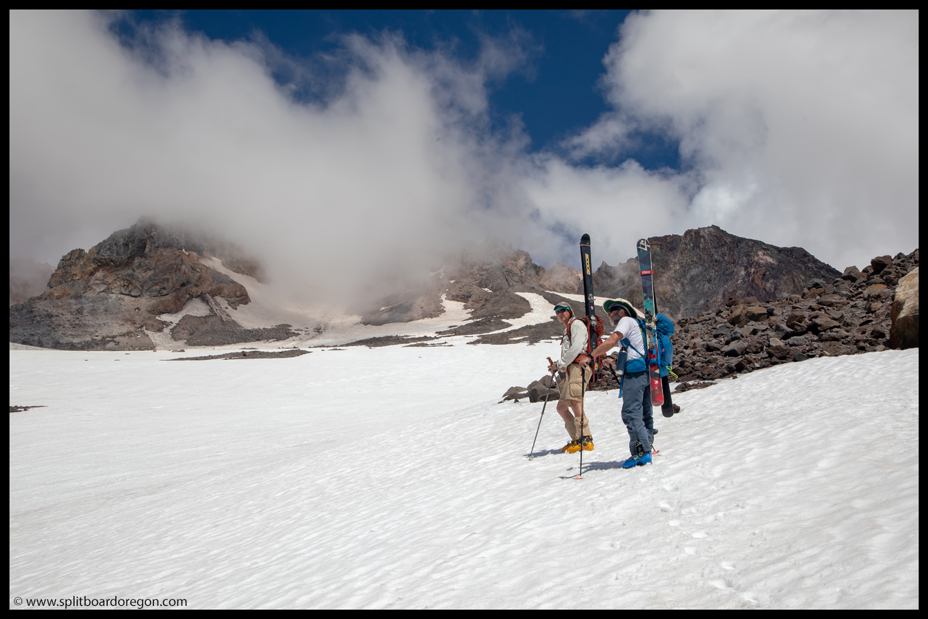
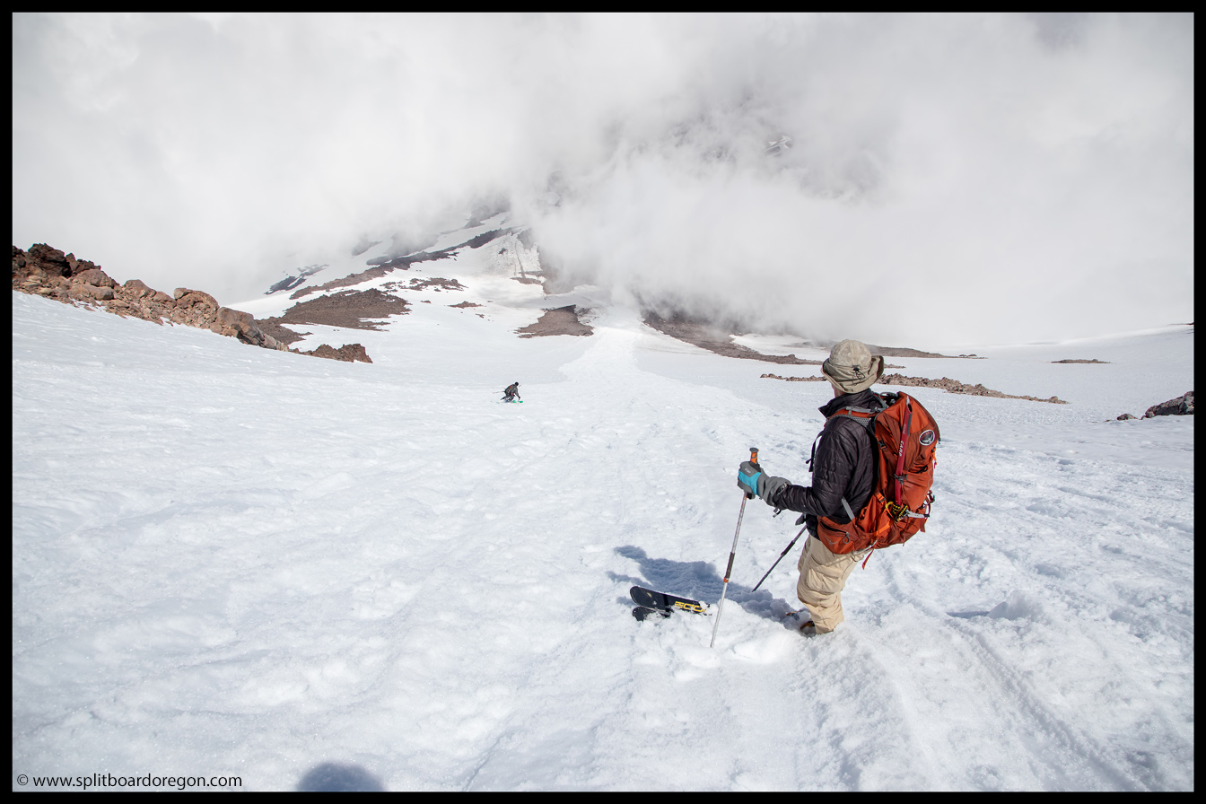
Once we had descended the majority of the Wintun, it was time to cross over the ridge and traverse out onto the Hotlun side of the mountain. We were able to find one spot where we could keep skis on and make the transition, and frankly, were hoping for some better snow on that side of the ridge….
Endless turns on the Wintun GlacierJoe skiing across the slide path
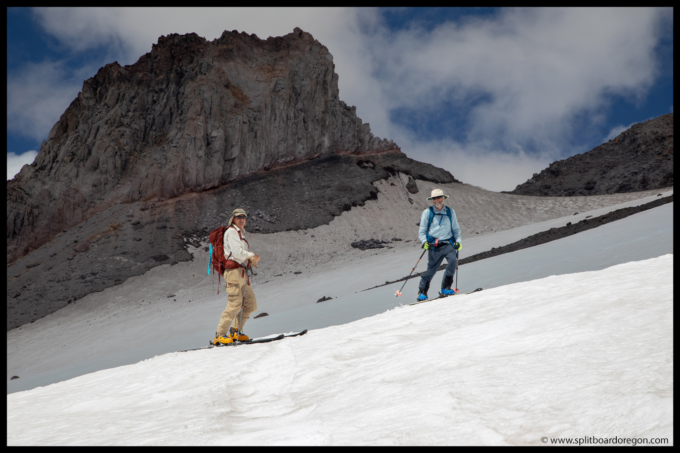
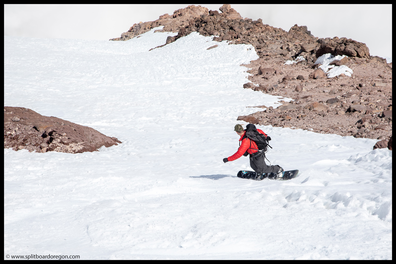
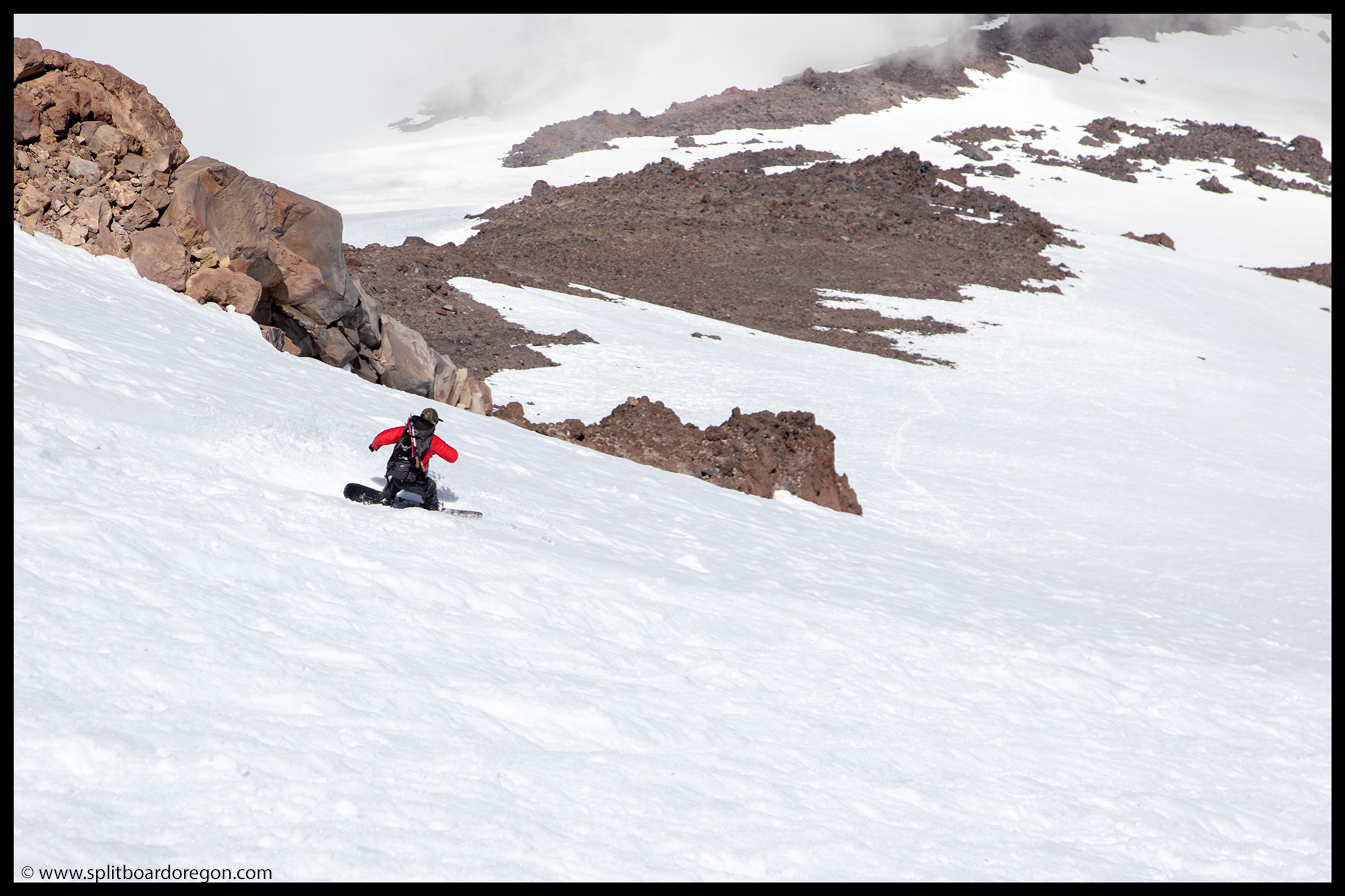
Indeed, the snow on the Hotlun side was in better shape, and we continued making turns back down towards camp. Around 9,500 feet, we rolled into a thick cloud bank that obscured our vision for a few minutes, but were able to continue on without incident.
Dropping into the clouds
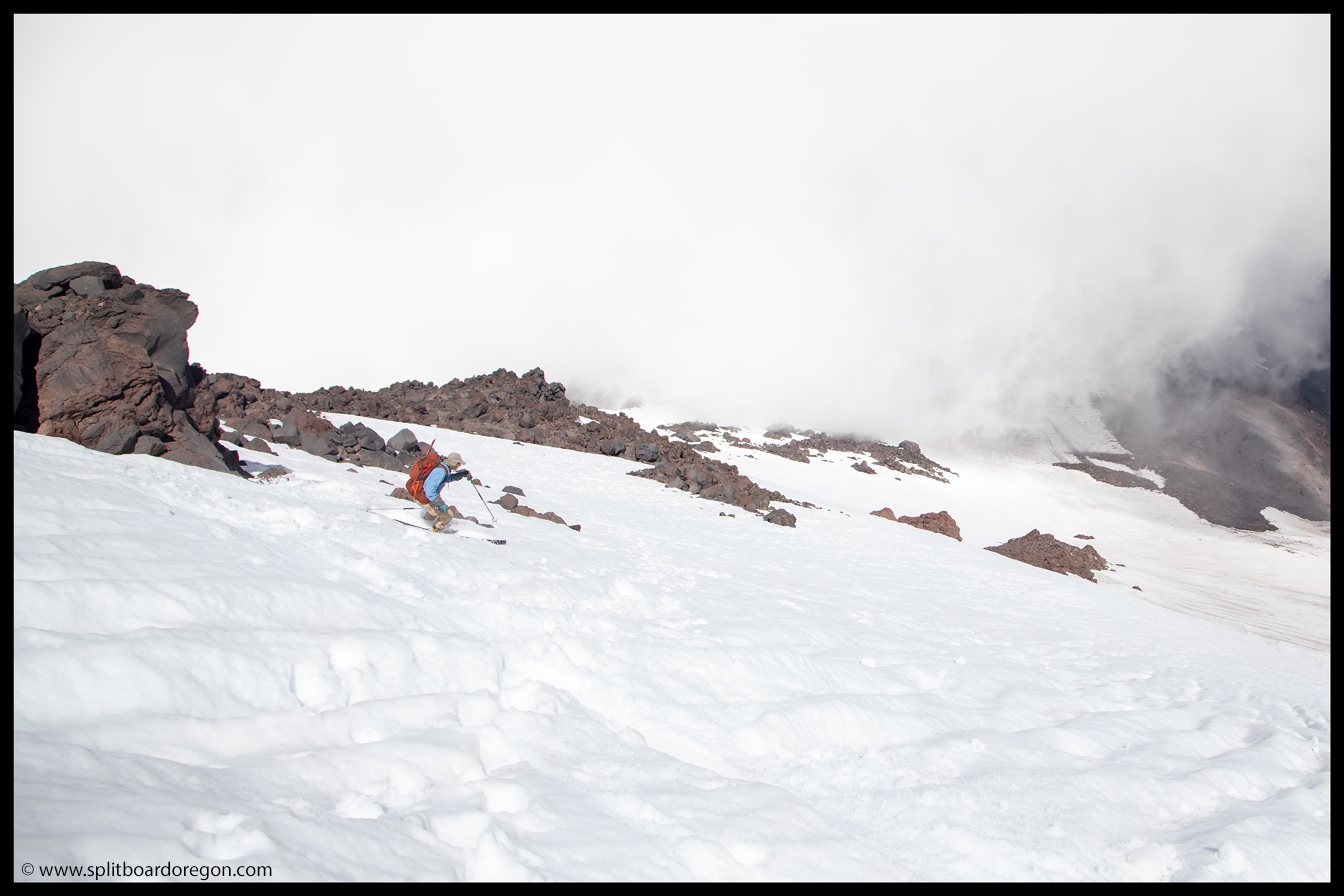
Like the day before, we enjoyed some excellent turns above camp, and worked our way skiers right to ski a similar line to what we skied the previous evening. I caught a few pictures of Dan skiing with Ash Creek Butte in the background…
Dan skiing above camp
We made it back to camp by early evening, it time to enjoy a cold beverage as well as a well earned dinner — I think had a beef stew freeze dried:) We were pretty taxed after a day of strenuous climbing, somewhat from elevation but mostly from the unconsolidated snow conditions. We discussed possible plans for the next day, along with the usual bs, and then hit the sack early to get some well deserved rest. I slept well, and we woke to mostly clear skies the next morning…
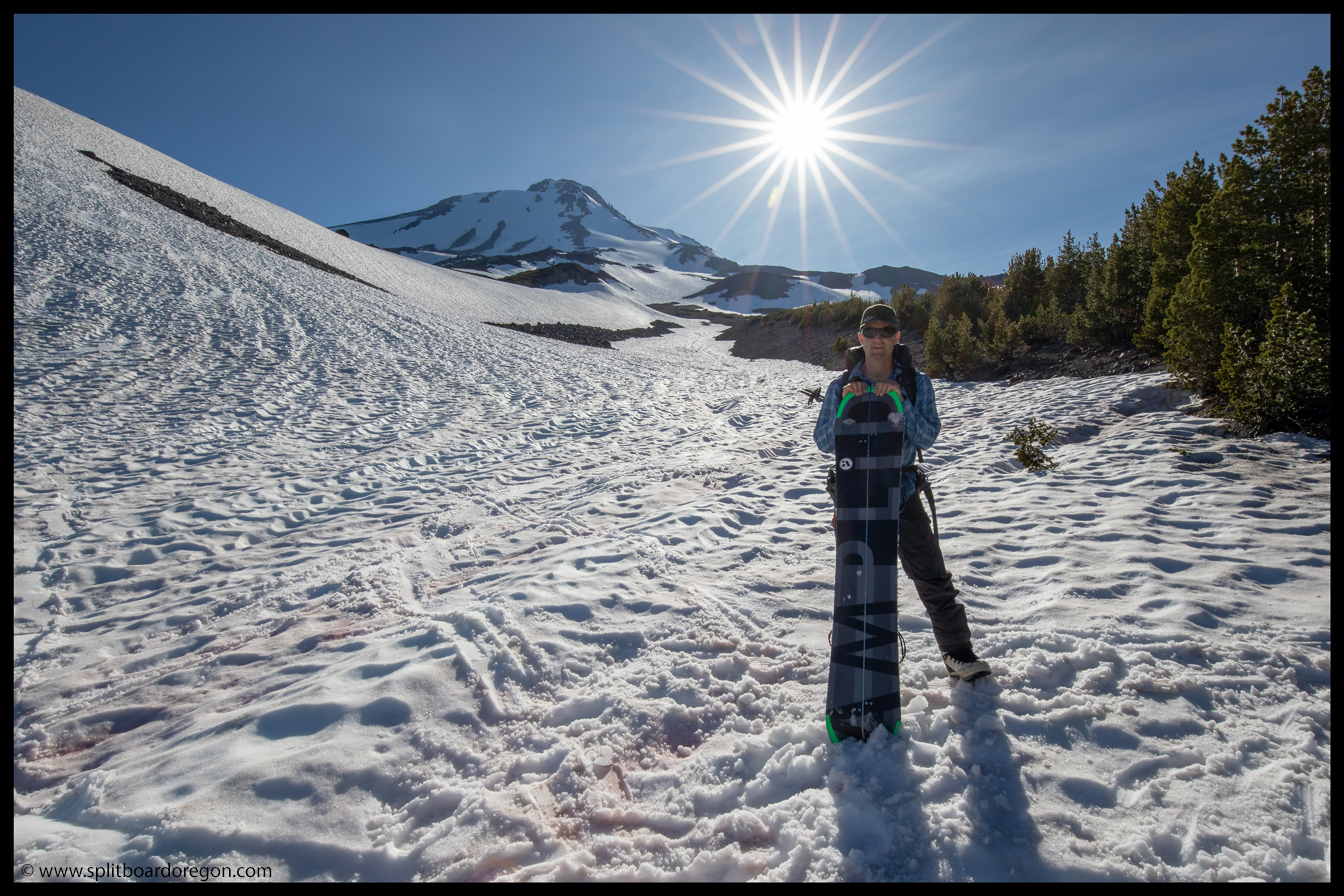
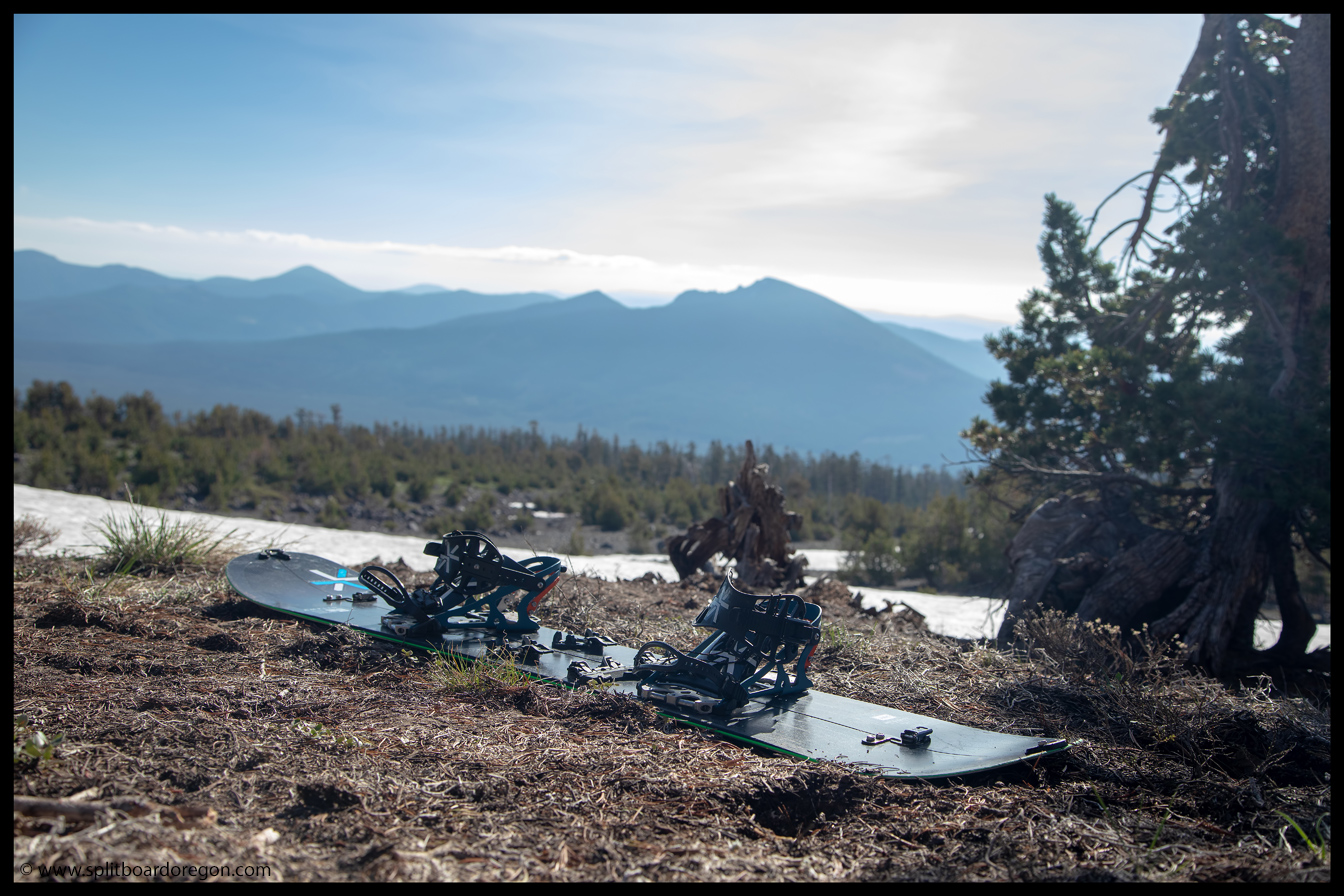
My board a few feet from my sleeping bag
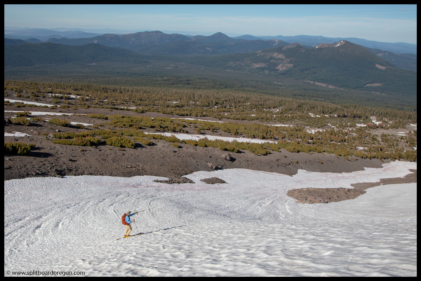
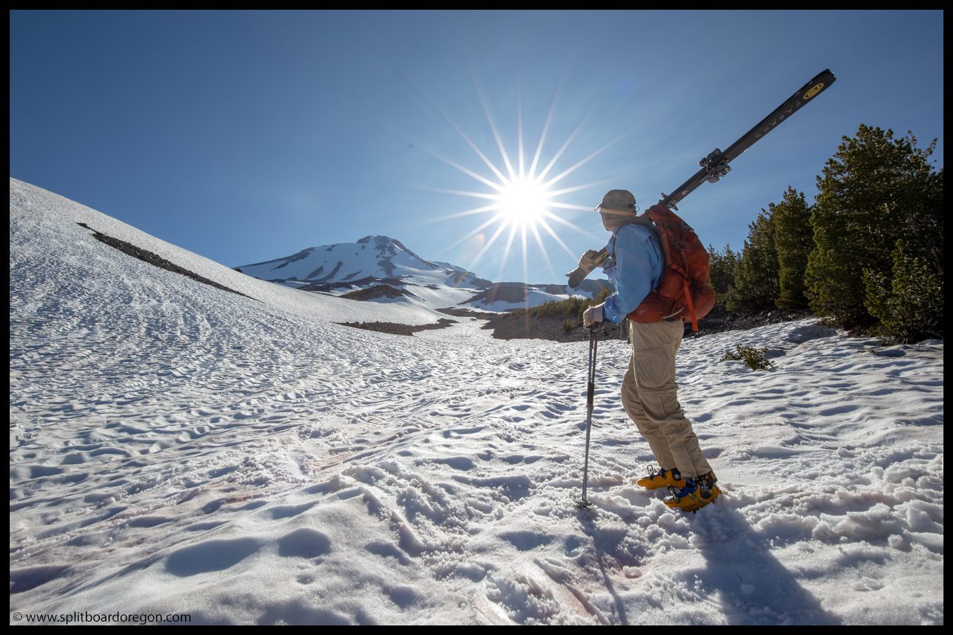
During breakfast, we discussed plans for the day, and ultimately decided to pack it up and leave Shasta, but make a pit stop at Crater Lake for a few turns on the way home. We broke camp, and hoisted heavy packs onto our shoulders for a ski down the snow fingers towards the trail below.
Packing up campLooking back on the mountain
Somewhat surprisingly, we were able to link turns and snow patches below camp for several hundred feet. Combined with our run from the summit the day before back to camp, the total vertical for the “one” run split over two days totaled nearly 7,000 feet! We skied down to treeline, following the snow in the gully to where it finally ran out. From there, it was a short half hour or less hike back out to the trailhead…
John and Dan skiing the fingerJohn at the end of the snow
At the trailhead, I was stoked on the trip. We unloaded heavy packs, found the beer in the cooler, and stacked gear in the car, readying for the drive out (which proved to be interesting in it’s own right). Given it was my first experience on Shasta, I’d have to count it as a success, and I can’t wait to get back! Below is a parting shot from the trip…