June 16, 2006 – Tumalo Mountain

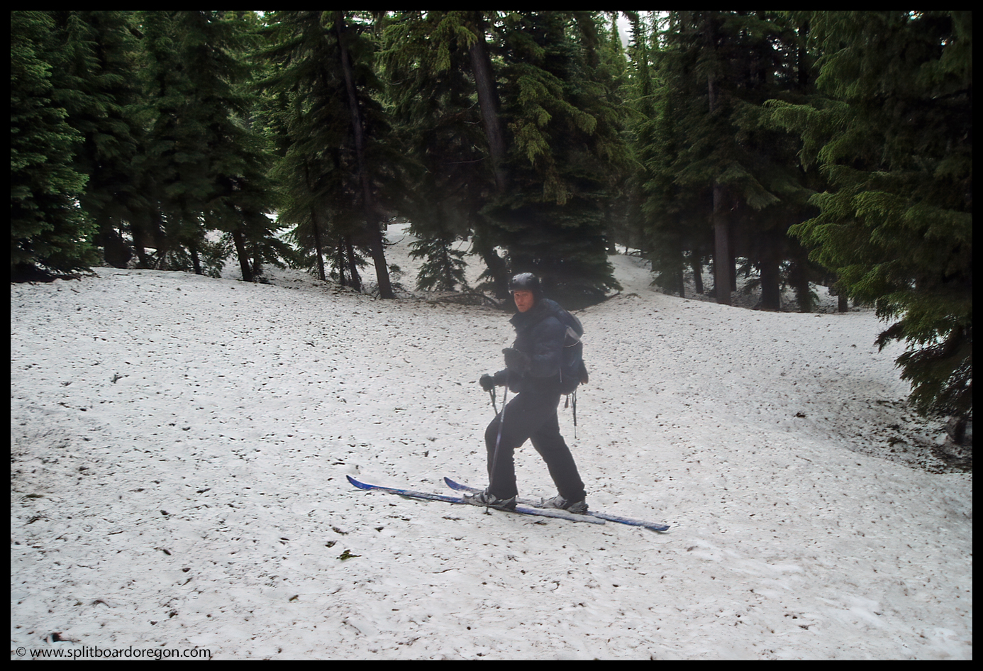
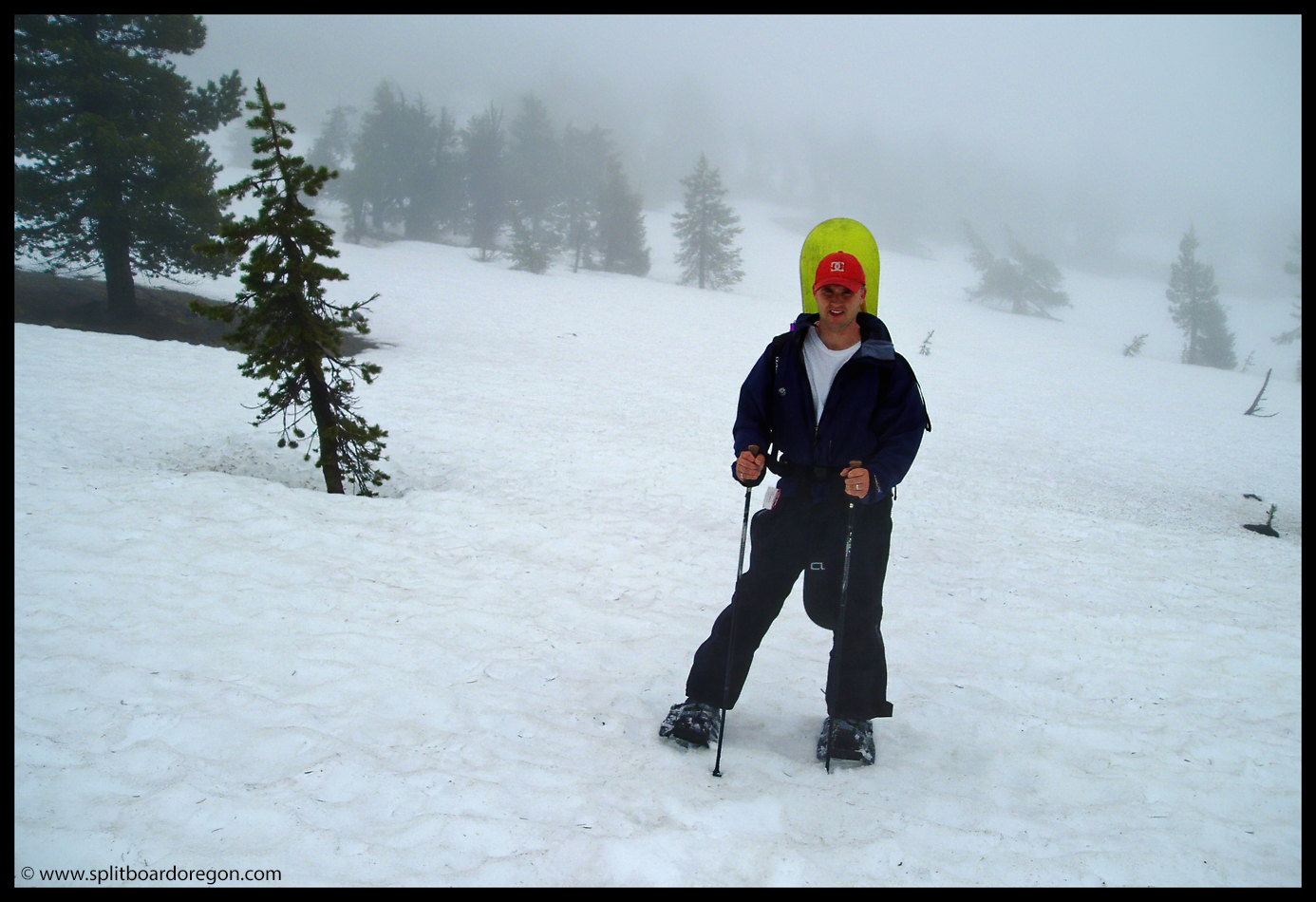
Even though rain was in the forecast, I took Friday off of work and headed east to meet up with Todd in hopes of riding the South Sister. By the time I reached Elk Lake, my hopes for riding the South were fading given the rain, fog and generally poor weather to the north. I met Todd at Devils Lake, and neither of us were excited about hiking and camping in the rain, especially with limited visibility, so we elected to drive back to Hosmer Lake and set up camp. We took a few nice pictures of the lake and Mt. Bachelor to the northeast, but unfortunately only a few of my pictures survived a computer crash shortly after the trip. The next morning we awoke at 5:00 am, still with slight hopes for riding the South Sister. The weather at the trailhead had not improved, and visibility was still near zero. So, we drove to Mt. Bachelor hoping the weather to the east would be a little more cooperative. The snowpack at the base of Bachelor was still in good shape. Not wanting to hike under the lifts, and not having explored Tumalo Mountain before, we decided exploring the 7800 foot peak north of Bachelor was in order. With our packs shouldered , we set out in the rain. Visibility was limited, and rained on us most of the way up.

Todd heading out
Matt on Tumalo’s south side

Even though the weather wasn’t cooperating, it was really nice to get out on the snow, and especially nice since not a soul was around. Halfway up the mountain, we stopped for a quick break to refuel with some food and water.

A quick break partway up
Nearing the top

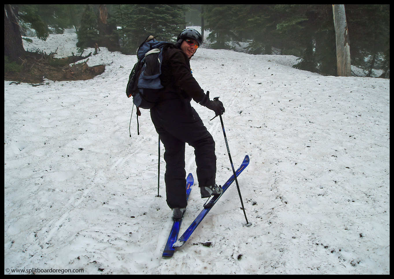
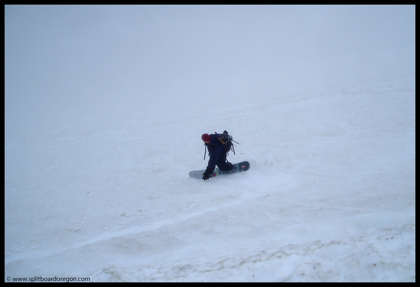
The dense tree canopy lower down eventually gave way to a sparser thinner alpine environment near the top. We reached the top in a pretty thick fog, and found some shelter out of the wind behind some large rocks, where we enjoyed some snacks and fresh brewed coffee made with the Jetboil. Shortly thereafter, it was time to drop into the bowl. We dropped in kind of blind, but weren’t concerned about wet slides even though it was raining. The first run we kept to a lower angle pitch riders left in the bowl. The snow was surprisingly fast and smooth, even with the steady rain.

Todd dropping in
Dropping into the bowl

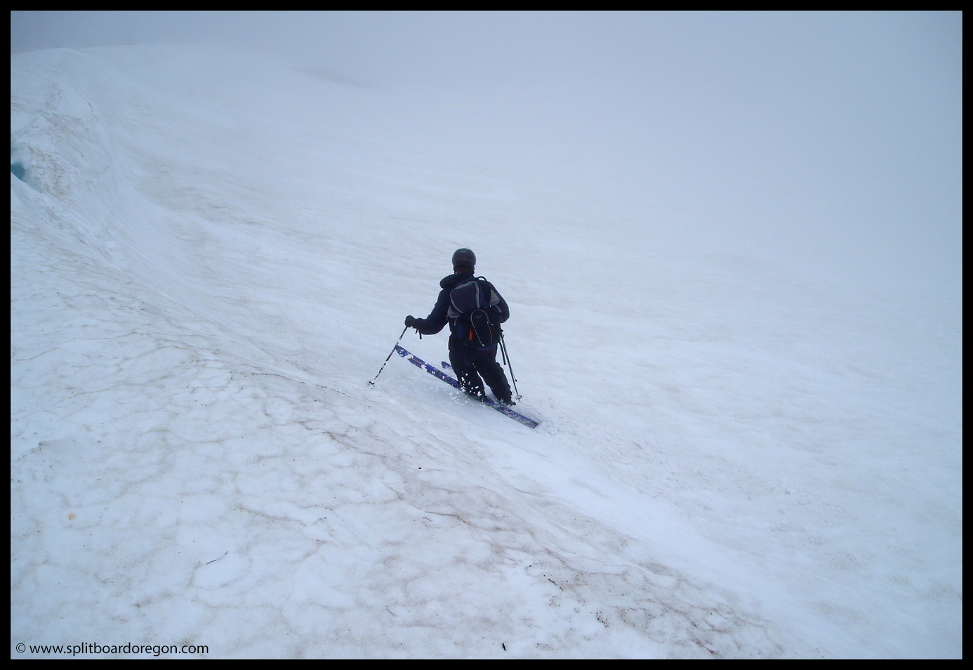
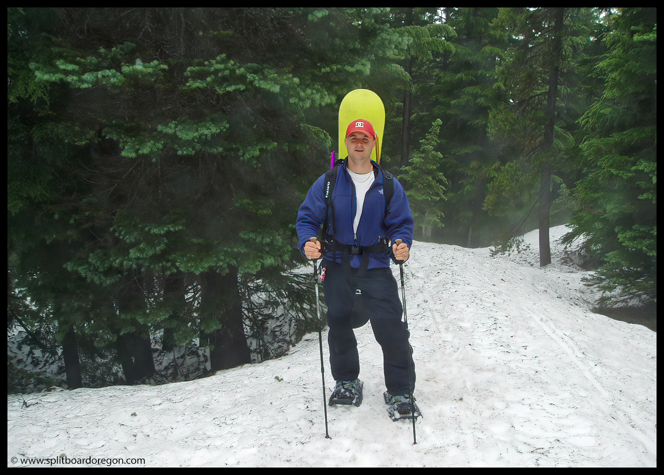
We skinned back up the northwest ridge which provided the easiest access to the top. After more coffee at the top, we dropped in for another run – this time in the middle of the bowl. The pitch was steeper and the snow was excellent. We ended up making two more runs on the north side, before skinning out and riding the south side back to Dutchman Flats. Though both of us were thoroughly soaked by the end of the day, we had an excellent time and really wouldn’t have had it any other way. Sometimes when expectations are low, some of the best memories are made. Here’s a parting shot of Todd on the south side on the ski out….

Todd on the ski out

April 2000 – Mary’s Peak

Mary’s Peak is a special place to me. Growing up in Philomath, I could see it from near my house and visited it several times during my childhood. It seems fitting that this is the area where I became interested in backcountry snowboarding and started exploring once the lifts closed in the spring.

While in college at Oregon State University during the late 90’s and early 2000’s, I made several trips up to Mary’s Peak during the spring months of April and May with my pal Andrew to ride the last remaining patches of snow on the 4,097 foot peak. Usually, we’d build a kicker and session it over and over again before hiking or riding back down to the parking area. Most of the pictures we shot at the Peak were taken on point and shoot film cameras, as digital cameras had yet to become mainstream. Typically, we’d find a good patch of snow on the northwest facing slope a few hundred feet above the parking lot, near the gravel access road that led to the top of the peak.

From Corvallis, Mary’s Peak made a nice outing because the drive was less than 40 minutes, while driving to snow in the Cascades required over an hour at a minimum. The view from the top of the Peak is excellent, stretching across the Willamette Valley nearly 3800 feet below to the Cascades. On a clear day, it’s possible to see from Mt. Rainier in Washington to the north to Diamond Peak to the south. The Pacific Ocean can also be seen to the west.

I’ve been up to Mary’s Peak several times since, most recently with my family for a summer hike. I plan to return this winter to continue exploring, as the winter snowpack can sometimes exceed 8 feet and riding through steep noble firs on the north side sounds really appealing.

Mary’s Peak, May 2000

November 3, 2003 – Willamette Pass Dawn Patrol

It had been snowing for a few days in the mountains and Andrew and I were getting ancy for the season to begin. Soon the weather broke, and the forecast was for clear and sunny skies. We couldn’t wait any longer and headed up to Willamette Pass for a dawn patrol to check things out. Upon arriving in the parking lot, we found about 16-20 inches of snow on the hill, so we quickly loaded our packs, shovels and gear, and headed up By George.

Andrew heading up By George

We worked our way up the mountain, and I had no doubt the riding on the way down would be great given the lightness of the snow. After about 45 minutes or so, we traversed left and worked our way up High Lead, stopping a few hundred feet from the top, as the upper pitches didn’t have quite enough snow for good turns. We ate our lunch, then rode down to a suitable spot to build a small jump to fool around on near the left hand side of the run. It didn’t take too long to make and we were sessioning it in no time. The amount of snow dictated that the jump couldn’t be too big, especially since the landing zone wasn’t flush with excess deep snow.

First air of the season

We hit the jump several times and just enjoyed being out in winter again after a long hot summer. Andrew busted out with several 360’s sans poles…..

Andrew busts out an early season 360

Once afternoon rolled around, we packed up our gear, and traversed back to By George. The ride down George was really good given the early season conditions. Riders left yielded enough snow for some decent powder turns but I didn’t open it up fully for fear of bottoming out. Back at the truck after an excellent day, we reflected on how nice and refreshing it was to get out and enjoy winter again!

July 3, 2003 – South Sister

Depending upon the snow year, good turns can be found on the South Sister well into July. Regardless of the snow pack however, good views can always be found on the mountain. Below is one such view while hiking along the Lewis Glacier in July while an Oregon wildfire blazes in the background……….

Near 10,000 feet on South Sister

My good pal Andrew was in town visiting from Idaho. Both of us had an itch to make turns, so we decided to head out to the South Sister and make the most of it, not really knowing what kind of conditions to expect. The drive over was a bit of a debacle, as we missed the Highways 58 exit off I-5 while jabbering and passing a semi truck. We had to turn around in Creswell and backtrack to the Goshen exit. Then, after turning onto the Crescent Lake Cutoff, we found the Cascades Lakes Highway closed due to a forest fire that was just flaring up, and this forced us to head into La Pine and then Sunriver. After driving by Mt. Bachelor, we finally arrived at the Devils Lake trailhead around 10:00, having hoped to be there by 7:30. Not to be deterred, we loaded our packs and started up the trail along Hell Creek. The mosquitoes in the trees were fierce, especially around the lingering patches of snow higher up in the drainage. Finally, we reached the large flat above Moraine Lake, where we met a fellow named Jeff who hiked up to about 8000 feet with us.

South Sister – July 2003

The weather started warming as we trudged across the flat, but the snow conditions up higher looked promising for some good turns, and the views were really scenic. Broken Top to the east still had a few good lines in the West Bowl, but the snow appeared to be going fast…..

Above Moraine Lake – July 2003

Climbing up the higher snowfields, we reached the base of the Lewis Glacier around 8900 feet. At this point, Jeff, who was in tennis shoes, bid us farewell, and we continued moving up. We did stop for a brief rest part of the way up the Lewis Glacier for some snacks and a few pictures. I snapped this photo of Jeff posing with Broken Top in the background…

Jeff with Broken Top and the Lewis Glacier

We hiked on the ridge trail along the Lewis Glacier and past the large bergschrund. At this point, we decided to ditch our glisse equipment since the snow was petering out. Continuing along the ridge, the views back to Broken Top were excellent…..

Matt w/Broken Top

Once we reached 10,000 feet, only a few hundred vertical feet from the summit, we decided to call it since the hour was getting late, we didn’t want to hike out in the dark, and I was pretty tired. The views of the wildfire from our vantage point were excellent however. Once we had hiked back down to the gear, we strapped in and enjoyed a few thousand vertical feet of mid-summer corn.

Early July turns…

The snow quality was very nice, with only a few spots where the shadows had allowed the snow to re-freeze. The ride back down to the flats above Moraine Lake was smooth. Making nice turns on the corn snow felt really good -so good that we didn’t stop to take many pictures. I did, however manage to snap this photo of Andrew before we got down……

Andrew looking on….

Once down to the end of the snow, we loaded the packs back up and hit the trail down Hell Creek, making it back to the car at Devils Lake around 7:30 pm. It was a pretty long drive back to the Willamette Valley, and when we turned in for the day I was dog tired. It was definitely worth it though for some good July turns!