July 9-11, 2017 – Mt Rainier, Fryingpan Glacier Environs

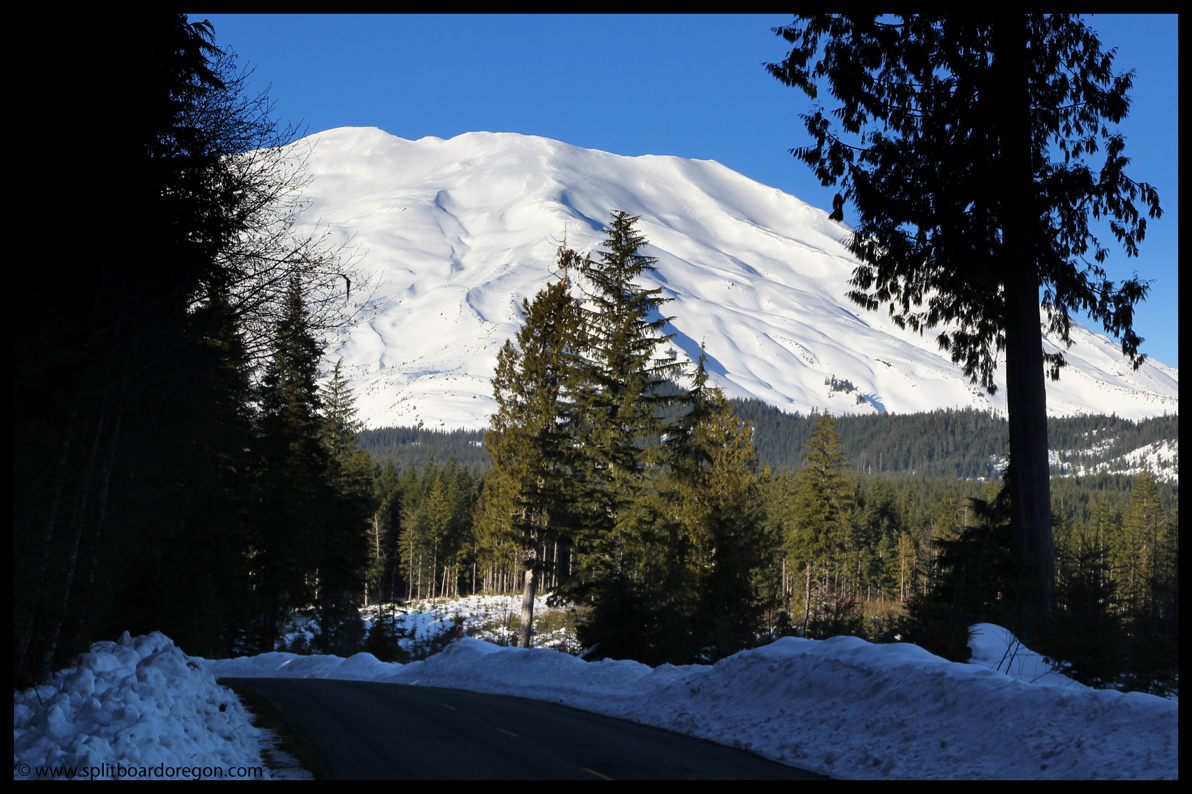
Sitting at my office in early June, I found myself browsing through some of my old trip reports, and realized it had been 8 years since I last visited Mt Rainier.  On a whim, I decided this year would be a good year for a return visit, and started looking into getting a permit.  It took a bit of doing, but I was able to secure a permit, as well as entice Joe, John and Dan to tag along for a trip to the Fryingpan Glacier.

We left the valley early on Sunday morning around 6:00 am.  John and Dan met me at my house, and we picked up Joe at the cop shop in Albany at 6:30.  Somehow we managed to get all of our gear into my Outback, and we headed north on the Interstate.  Four and a half hours later, we arrived at the White River Ranger Station to pick up our permit.  After some haggling with the ranger staffing the station about proper etiquette with respect to how to store our food in bear proof containers and getting the runaround regarding camping in the backcountry zones, we got our permit and headed up to the trailhead.

Dan & Joe at the trailhead

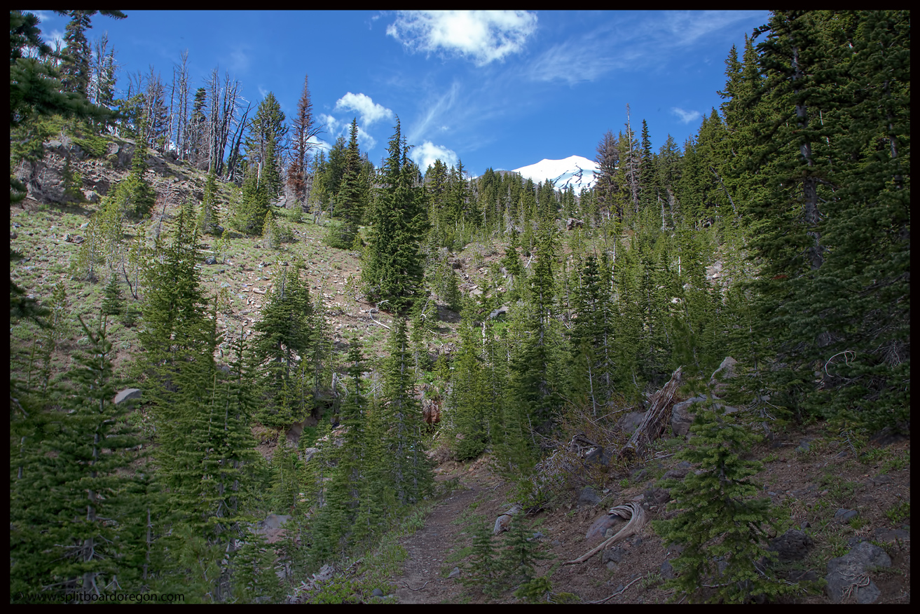
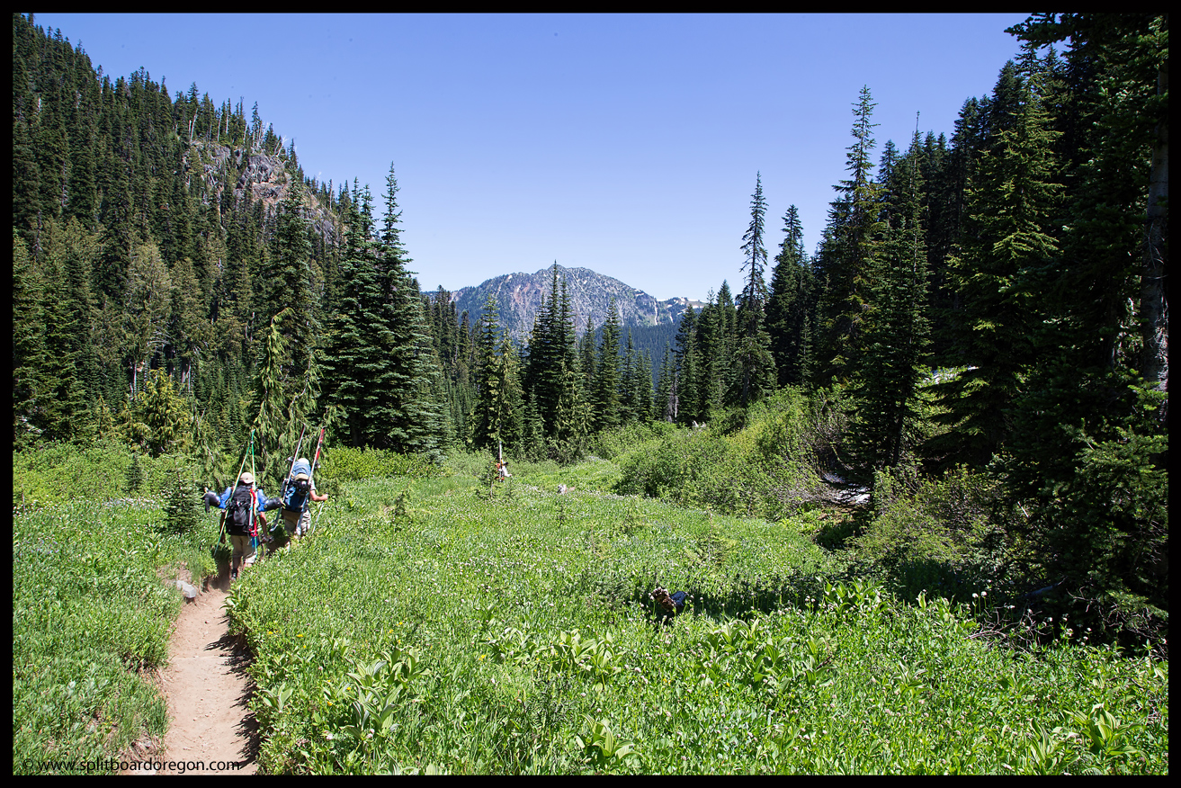
After unloading the gear and eating a quick lunch, we shouldered really heavy packs and started up the trail around noon.  Hiking up Fryingpan Creek in the shade of the forest was just a beautiful as I remember it being 8 years earlier, and soon the forest gave way to the alpine and views of Little Tahoma and the Fryingpan Glacier…

Dan on the hike in

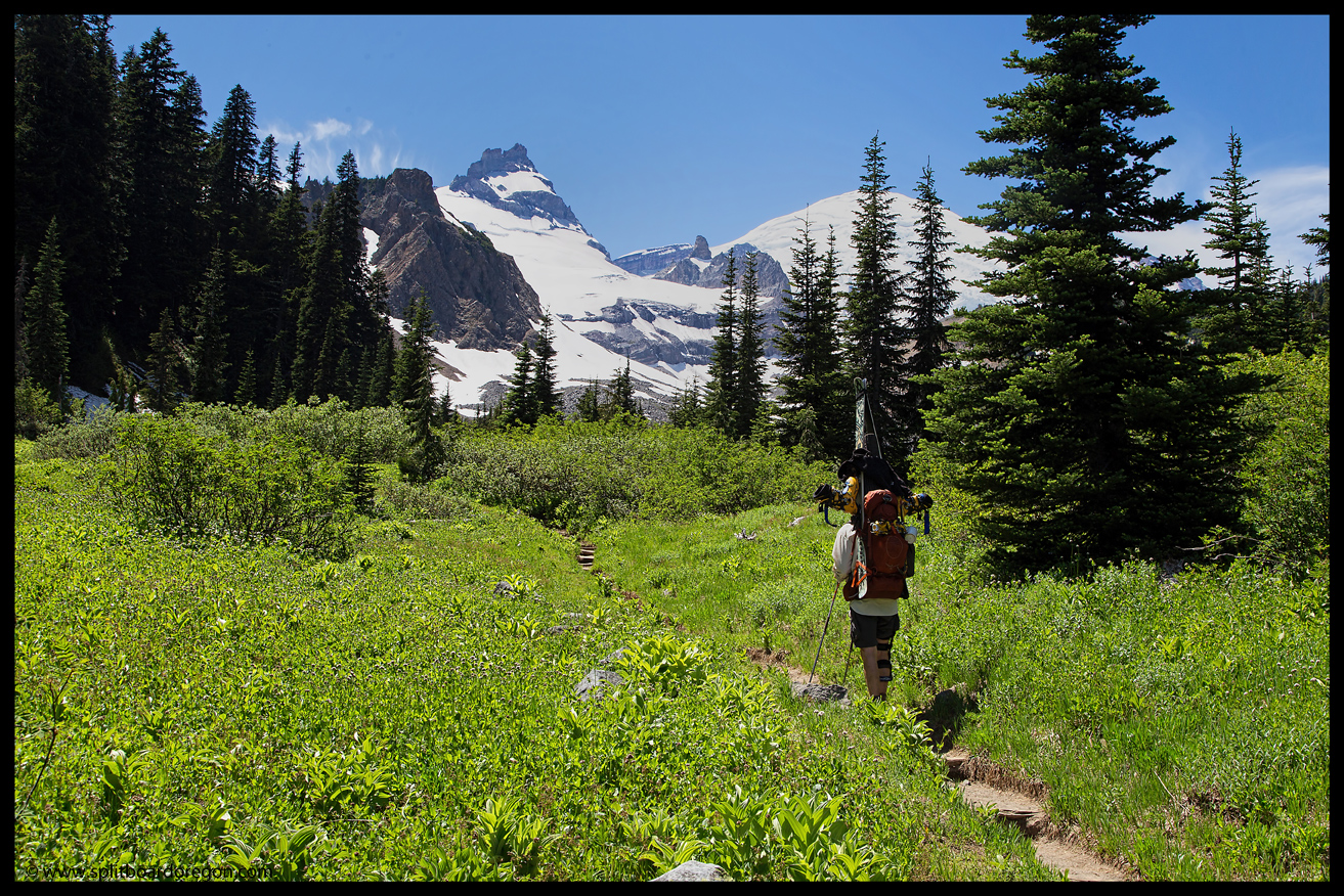
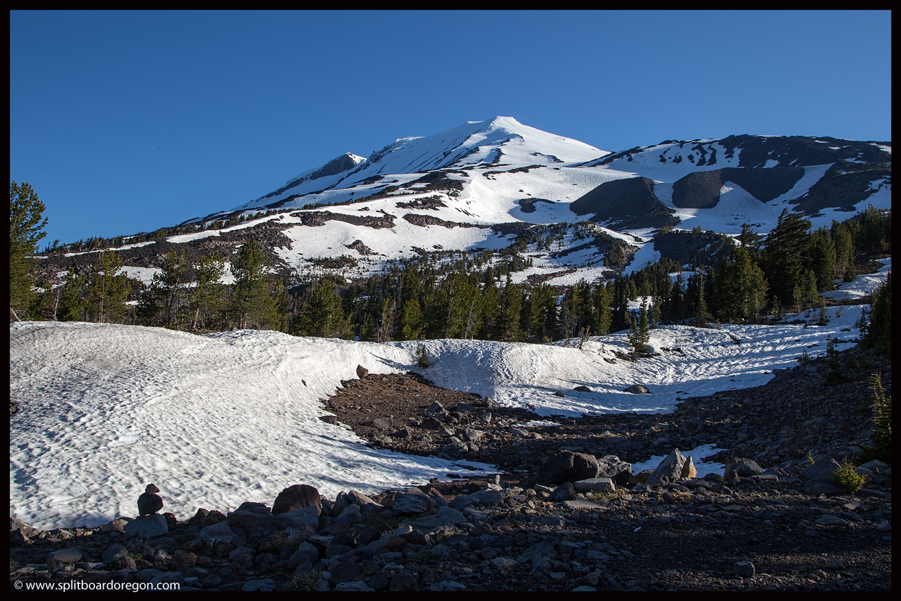
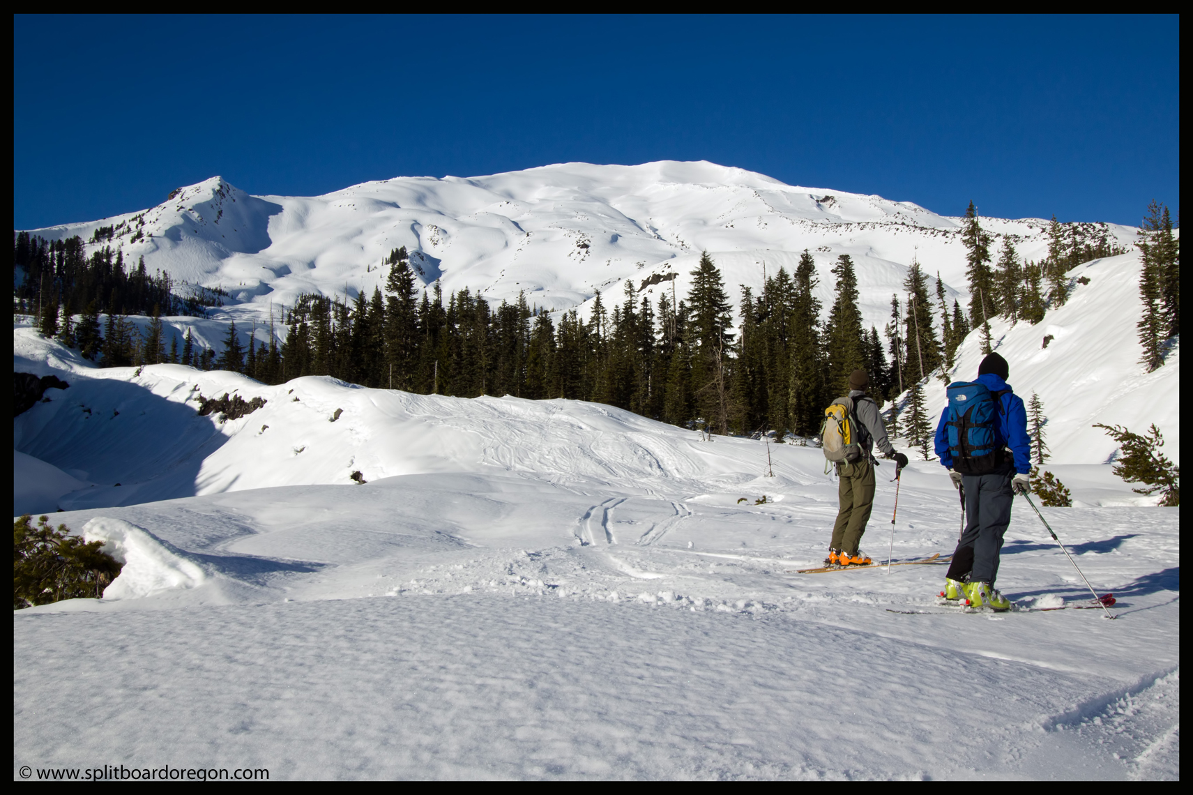
Once we got to the point in the trail where the switchbacks began, the snow patches started.  After briefly losing the trail, we regained it quickly and followed it to Summerland, which always affords awesome views of the mountain…

Dan at Summerland

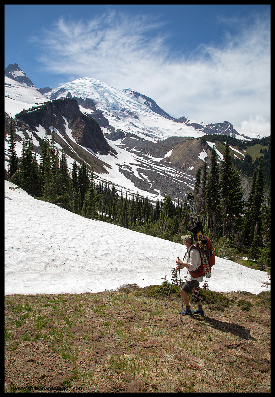
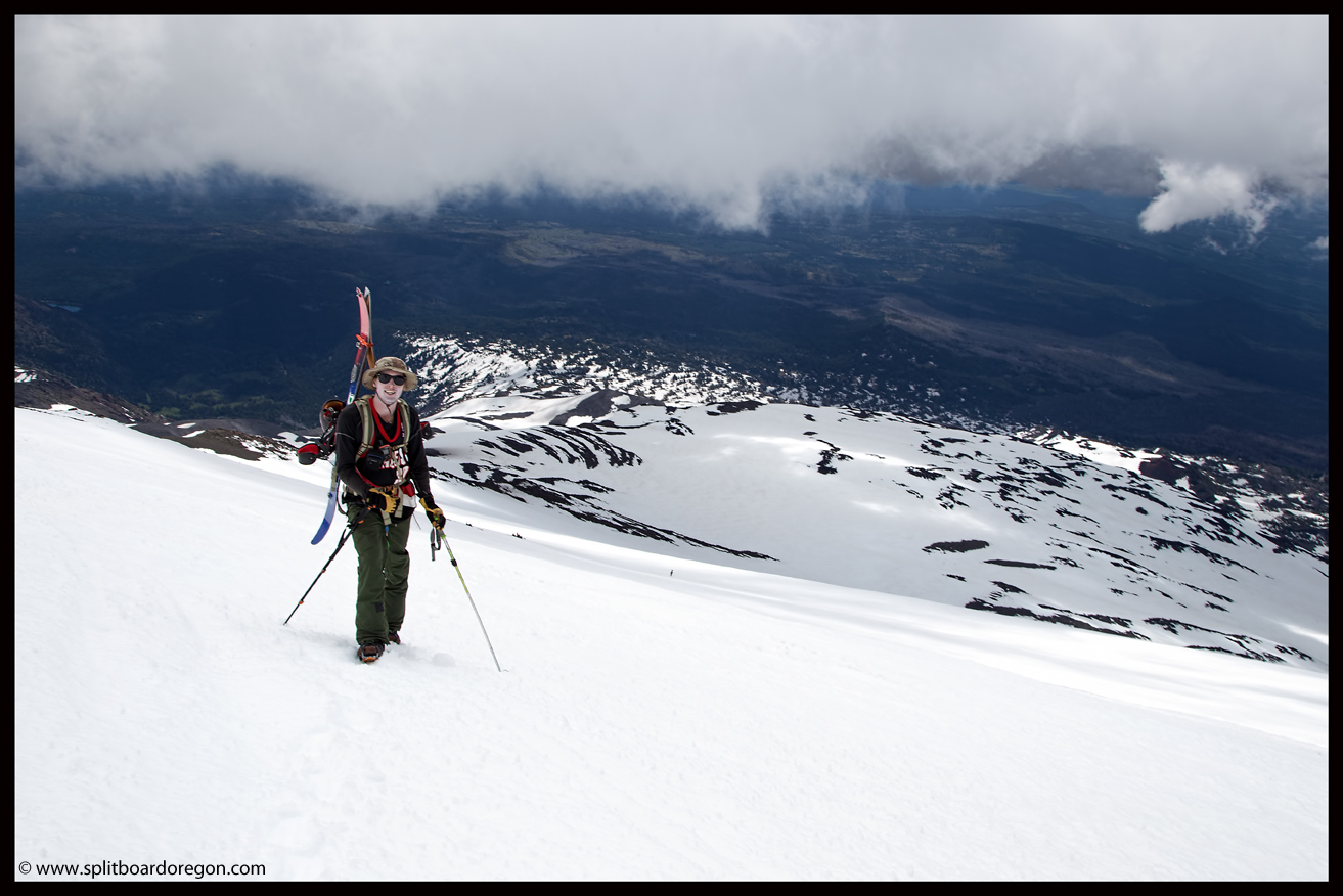
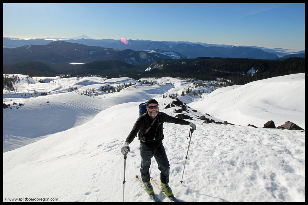
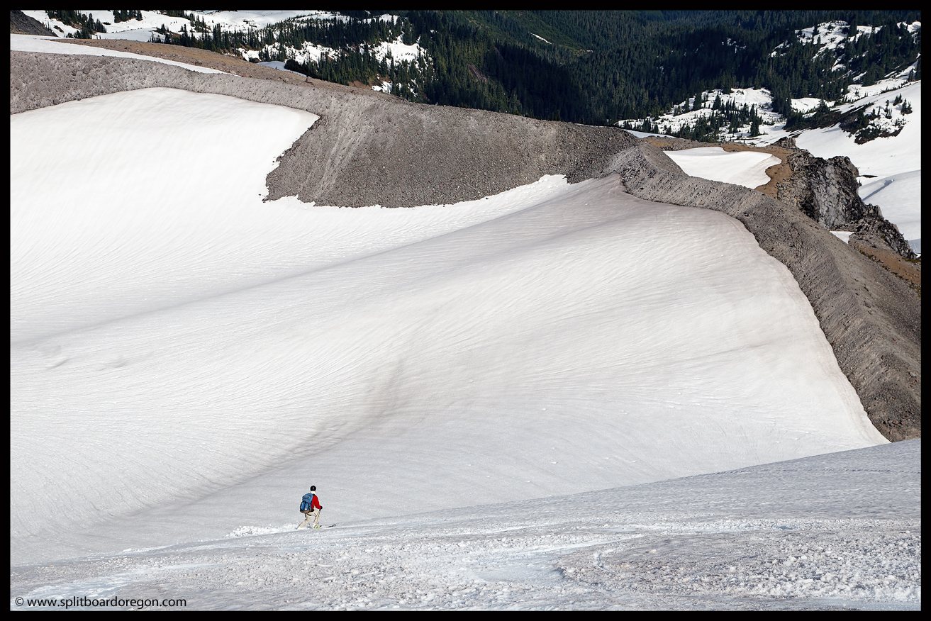
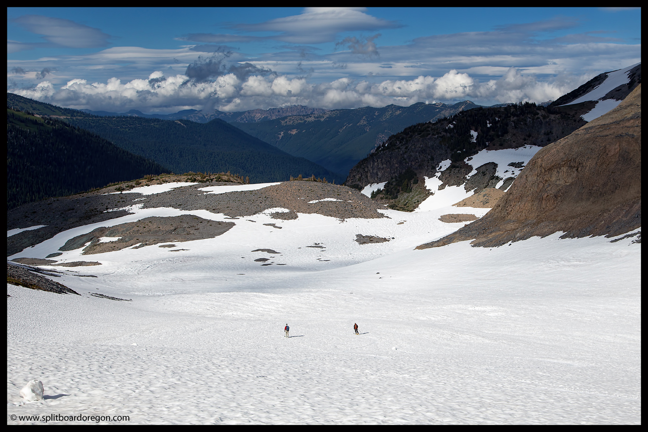
Although we had a permit to camp in a backcountry zone for Sunday night, we dropped our stuff at Summerland, hoping to snag a site there, since we would be there Monday night.  We’d heard that many of the folks who had reserved sites at Summerland recently weren’t showing up due to all the snow on the Wonderland trail at Panhandle Gap.  So, with luck, we could get a site and not have to move camp the following day.  With our gear stashed and out of the way, we headed out for a late afternoon tour.  Our objective was Goat Cirque, and we were able to skin from just outside of the campsites.  30 minutes out, the scenery looked pretty dang nice….

Goat Cirque

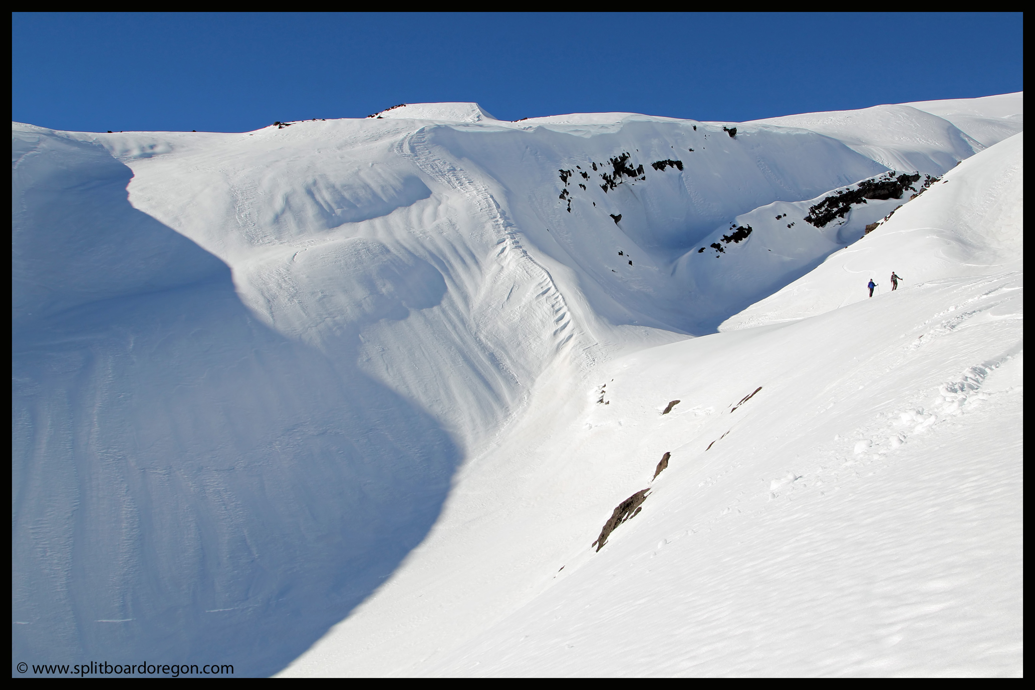
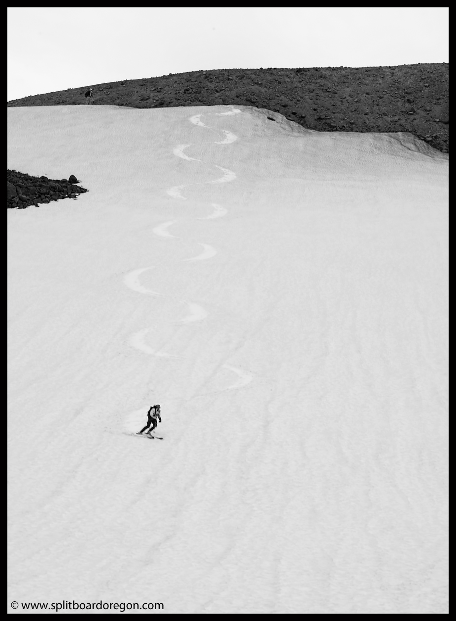
We climbed up a steep ramp to the lookers left in the bowl, eventually making it up to the ridge that separated the bowl from the Ohanapecosh drainage.  The views to the south and east didn’t suck at all…

Looking over the Ohanapecosh

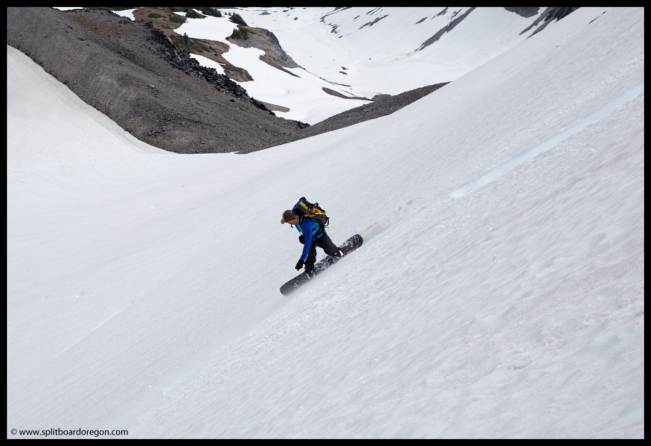
The lighting was really nice, and we lounged around the summit ridge for a few minutes before heading down, taking in the views.  The turns off the top were exceptional corn, and it was a treat to ski the bowl after a long day of driving and hiking.

Joe skiing the upper section

We worked our way down to the bottom, enjoying the soft snow, and made the long traverse back towards Summerland.  As we approached, we saw a helicopter preparing to land.  Watching it, it took off, flew up the mountain a ways, and then came back.  As we got nearer, it was apparent it was some sort of rescue operation related to climbers elsewhere on the mountain.  We heard later that a climber had fallen on the Fryingpan and lacerated both his wrists and broke an ankle.

Dan and the heli at Summerland

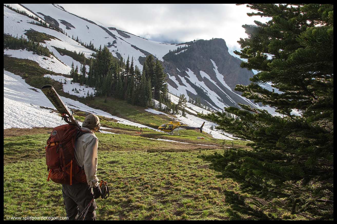
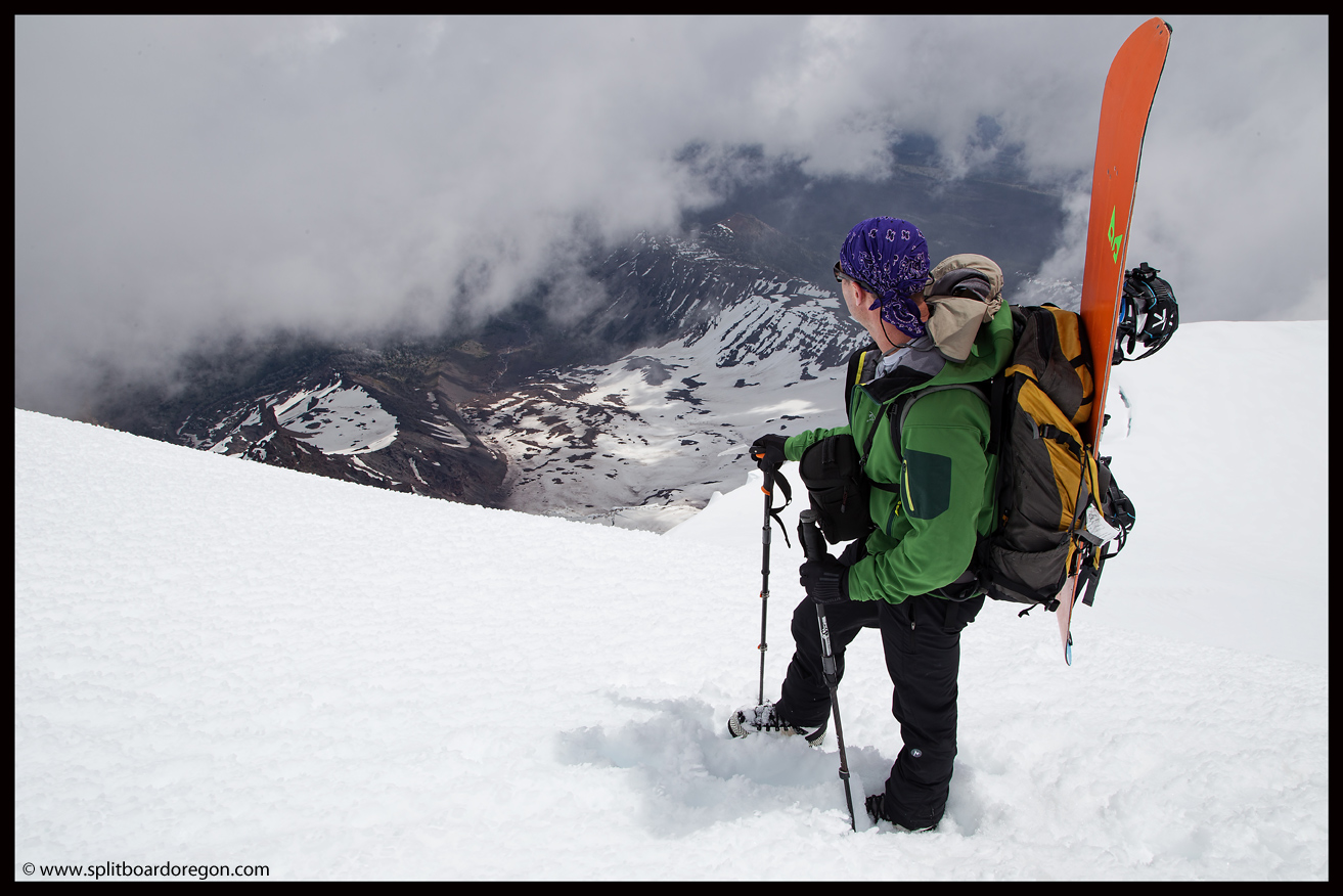
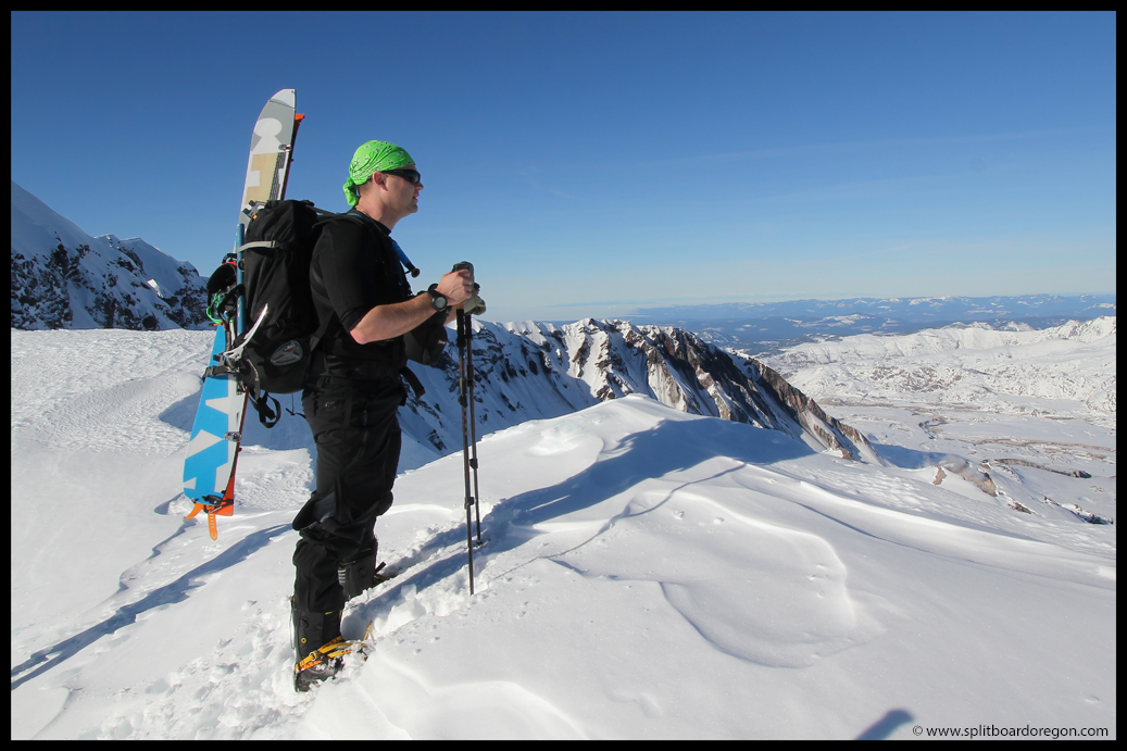
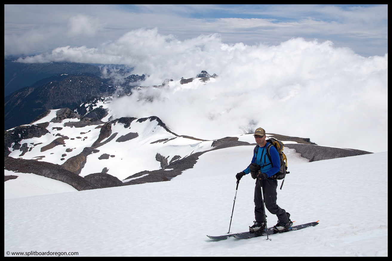
Back at Summerland, we set about making dinner and enjoying the evening.  By 9:00 pm it was apparent that not all five of the sites would be filled, so we snagged a campsite and made ourselves cozy for the evening.  The next morning we headed out after breakfast, with the intention of skiing up to Whitman Crest and possibly Little Tahoma.  The weather was sunny at camp, but clouds started to roll in as we headed up to Goat Cirque.

John climbing below the knife ridge
Joe hiking above Ohanapecosh Park

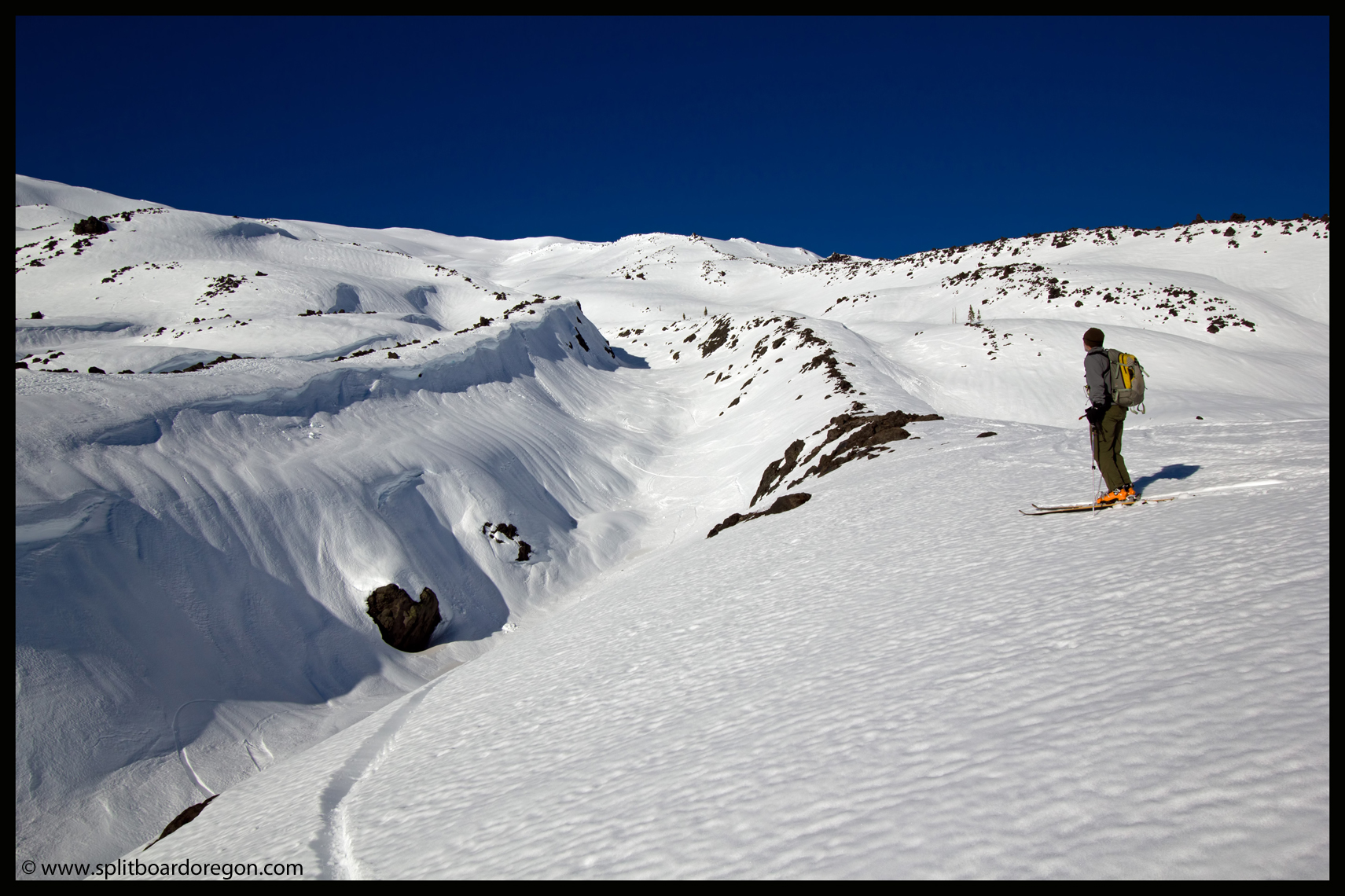
We worked our way above Goat Cirque, and into a good spot for some lunch below the Fryingpan Glacier.  Dan and John decided to climb the small ridge above our position and get in a hundred feet of fun turns on the way down to our lunch spot…

Dan making tracks

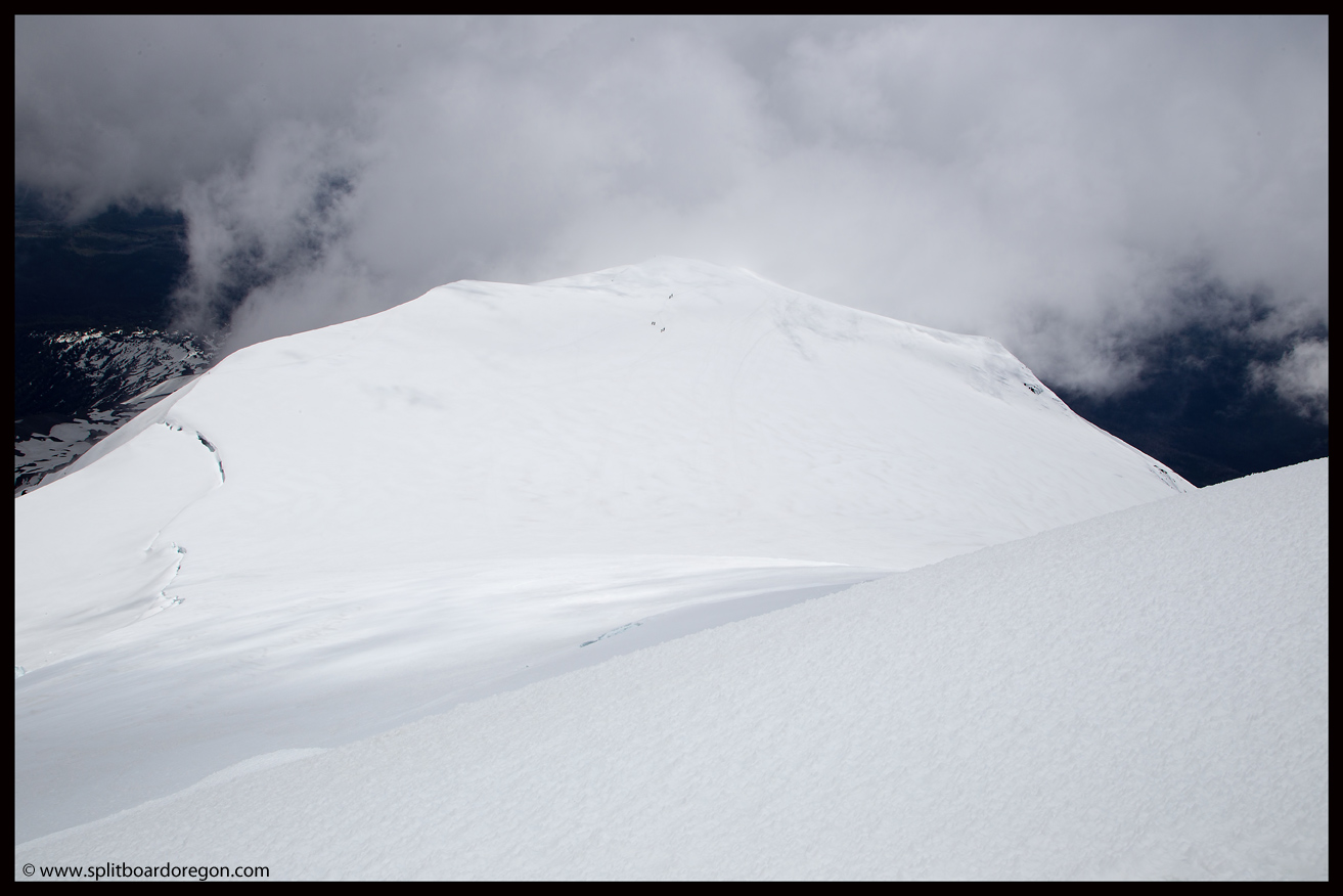
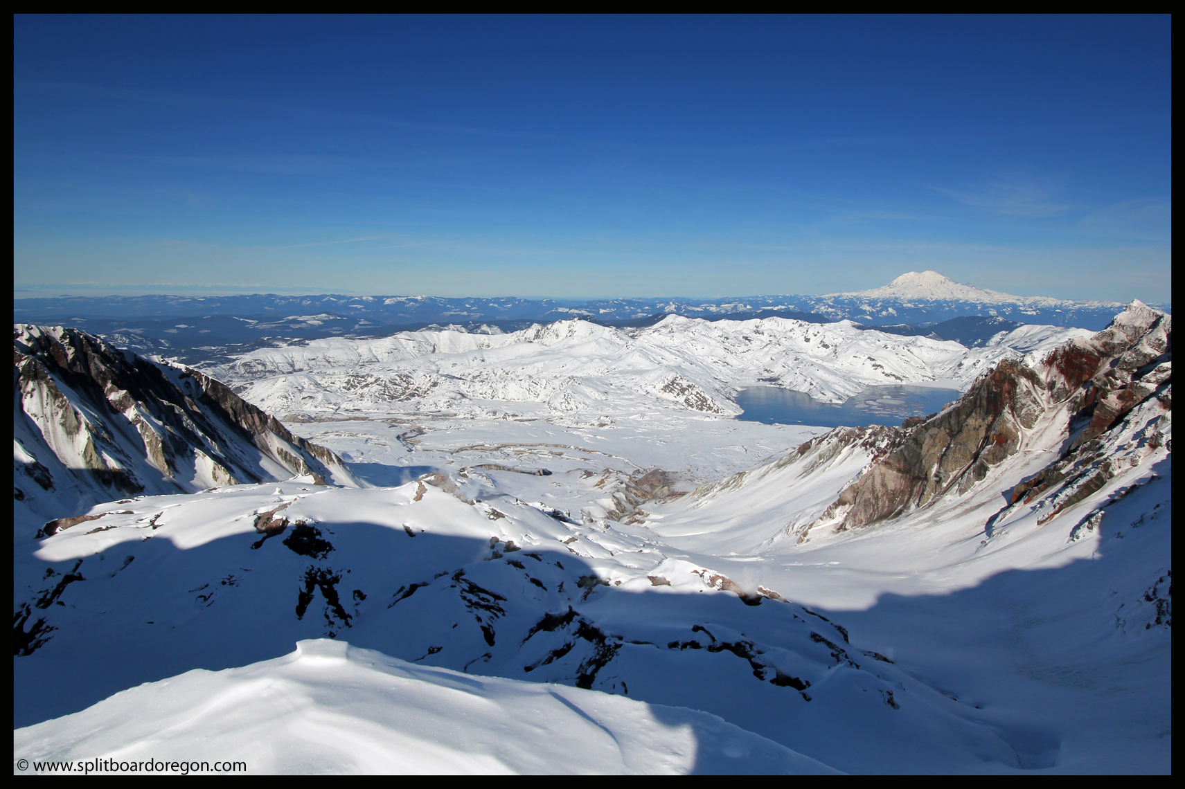
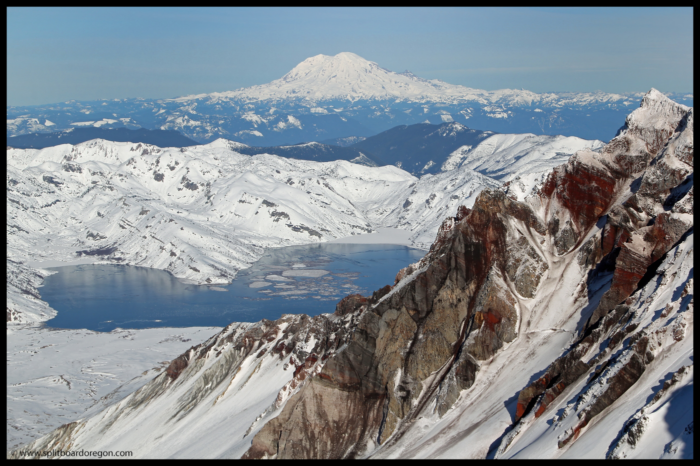
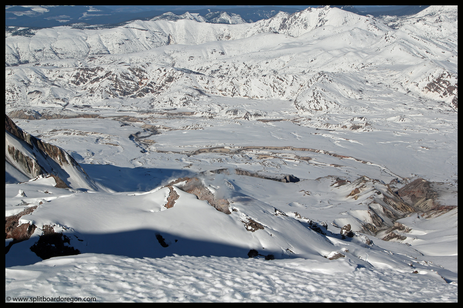
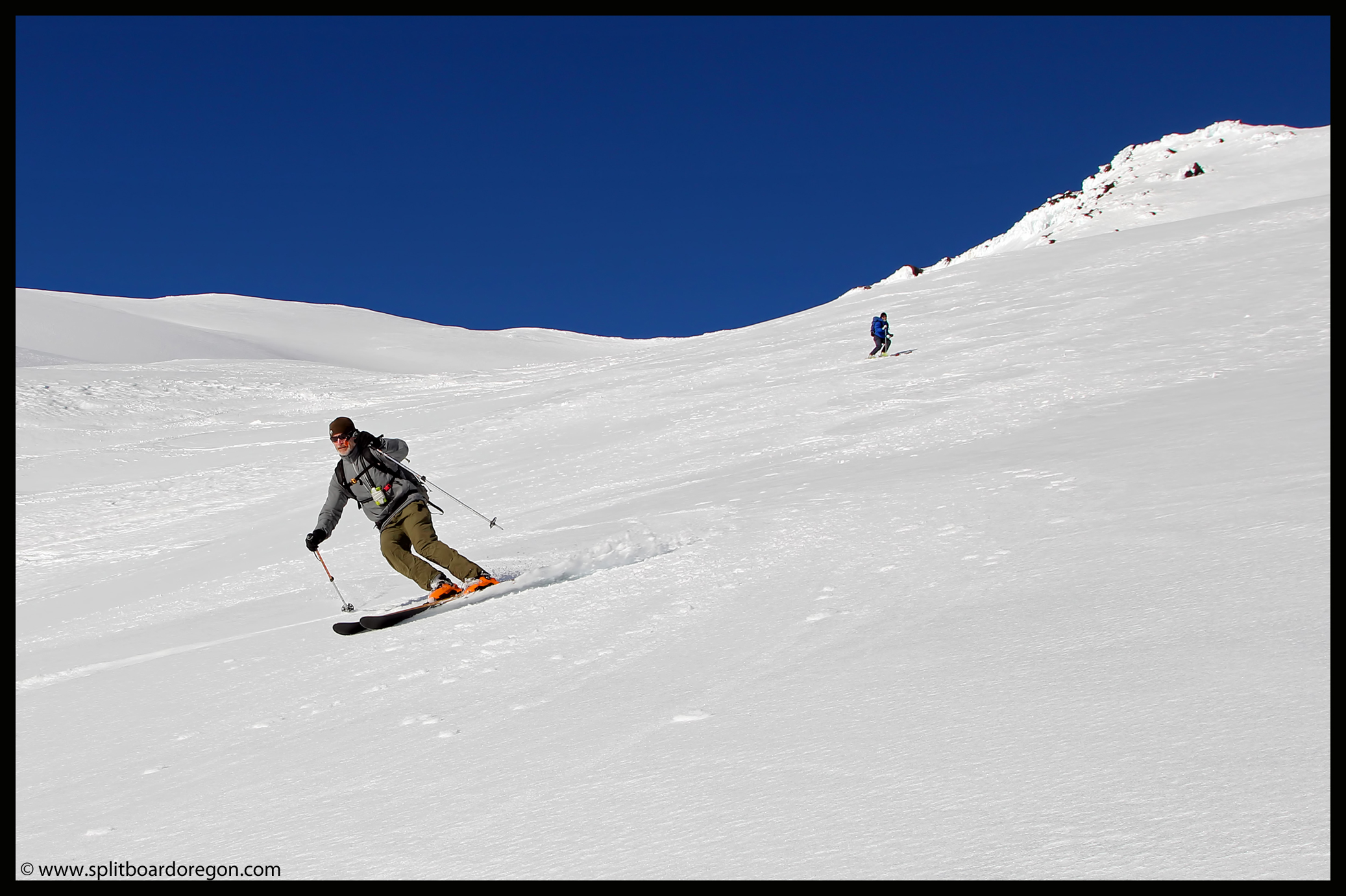
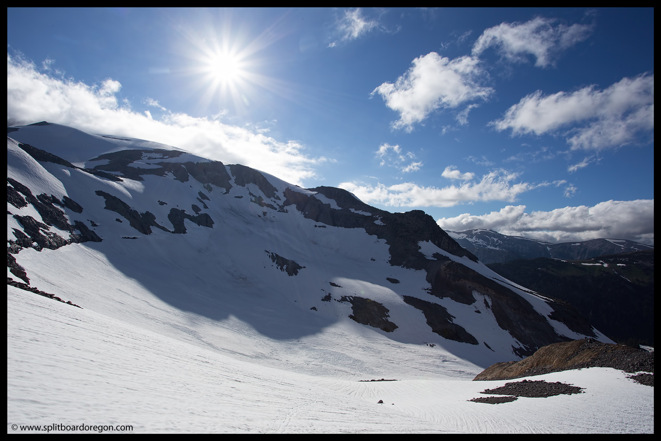
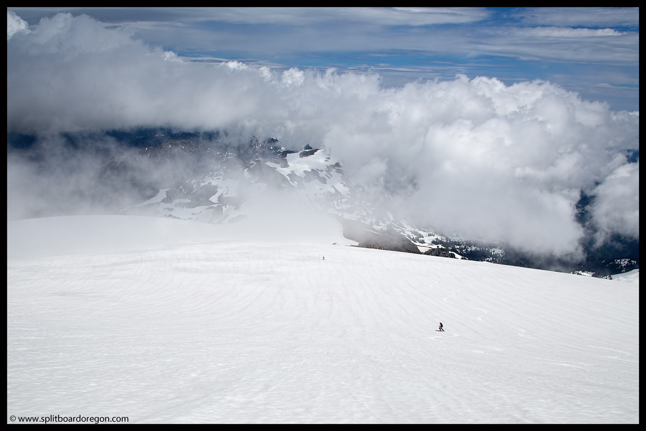
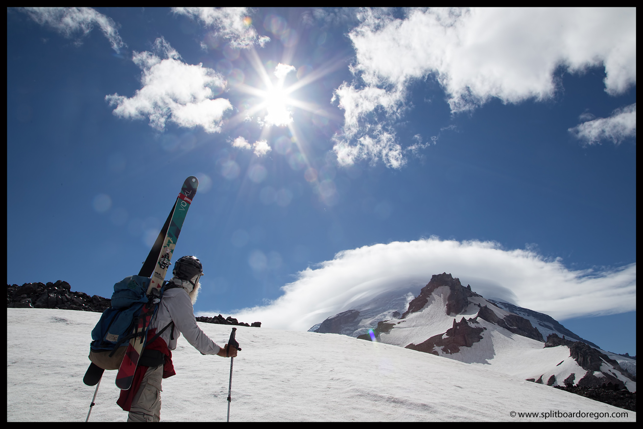
The clouds were rolling in and out all morning, but generally stayed to the south of us.  As we continued to climb up, the views got better and better, so I snapped a few photos along the way…

Hiking below Fryingpan
Skinning above Goat Cirque

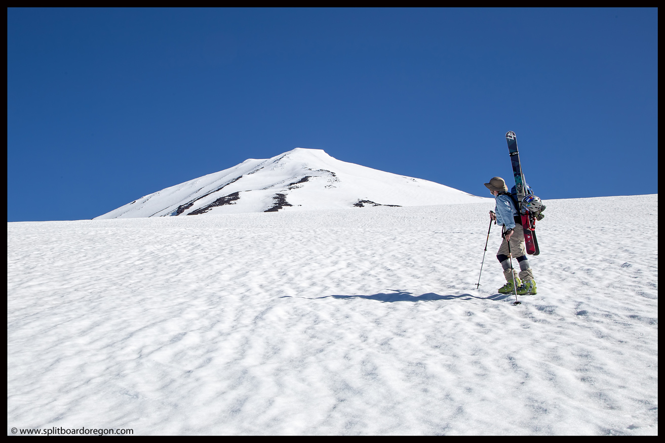
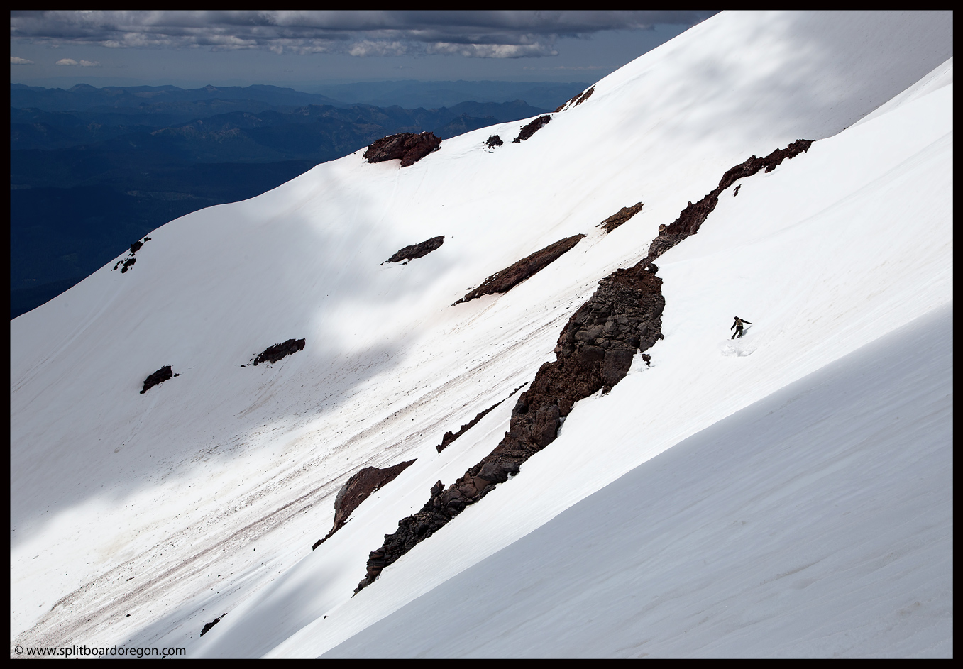
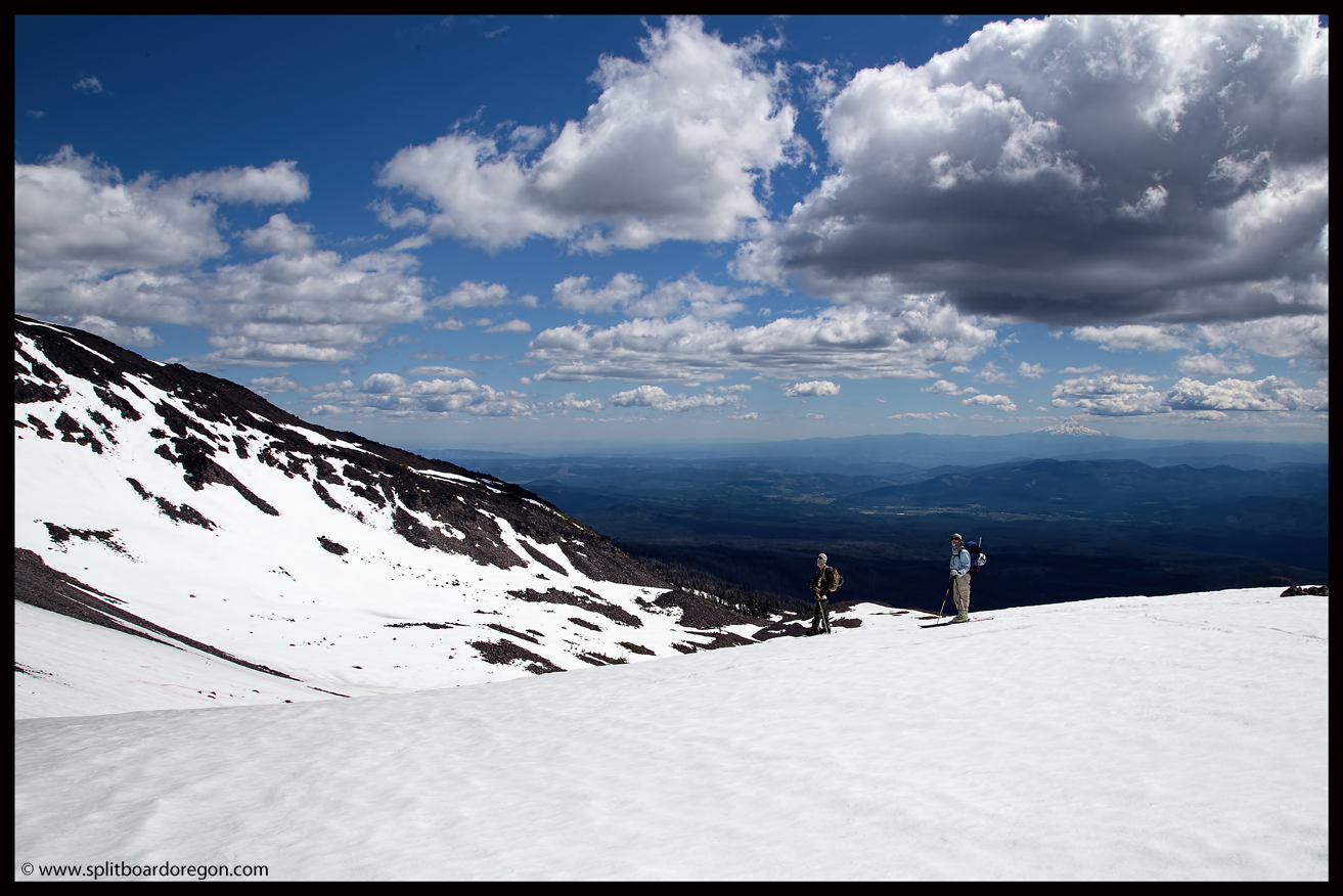
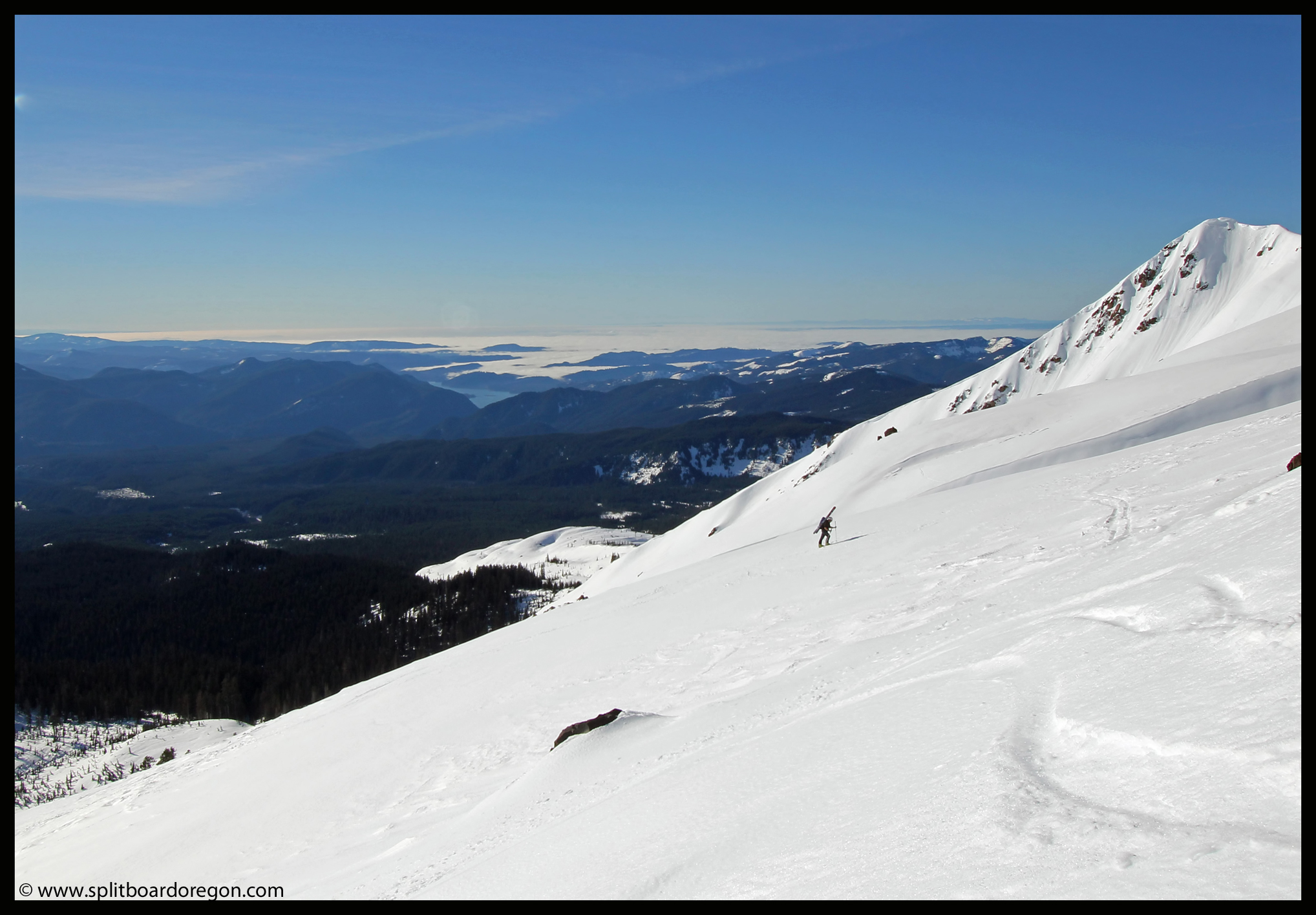
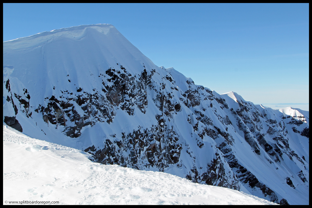
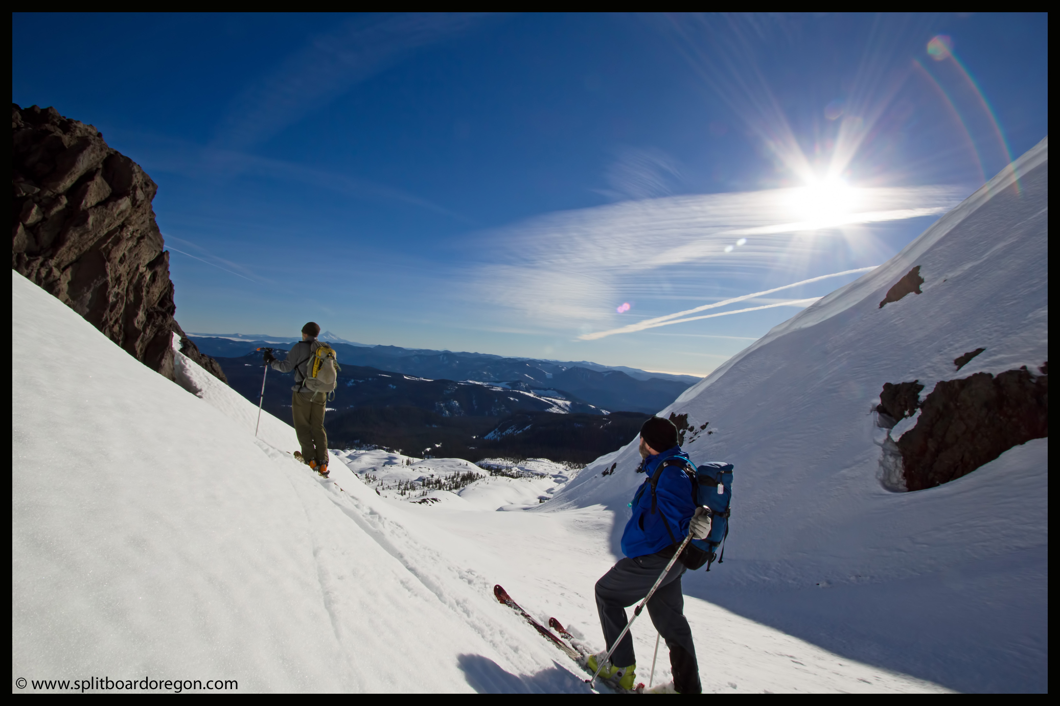
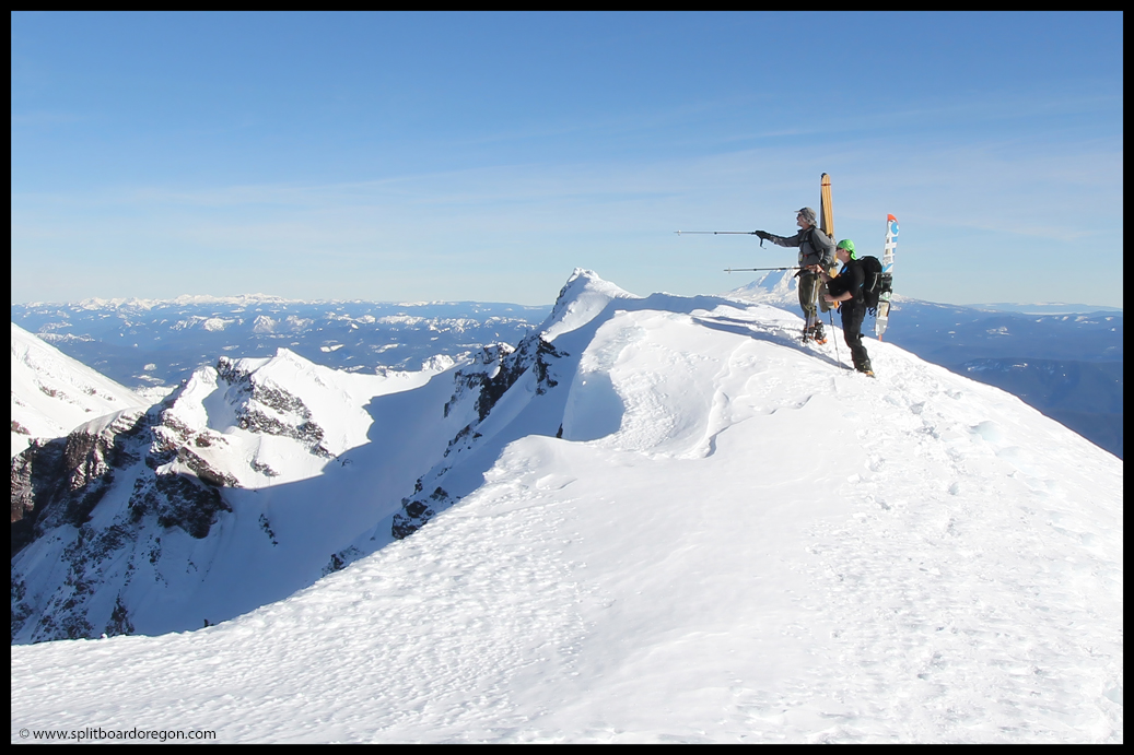
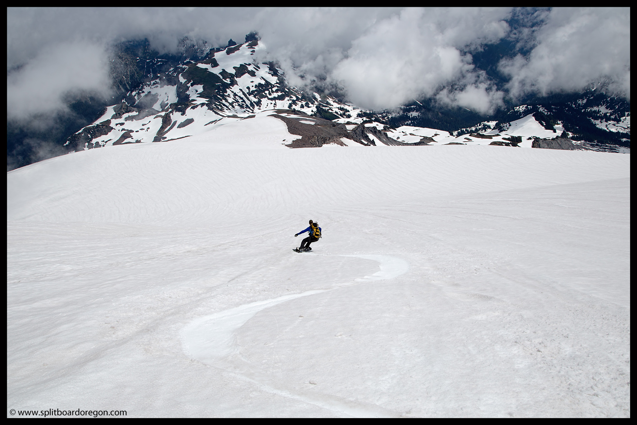
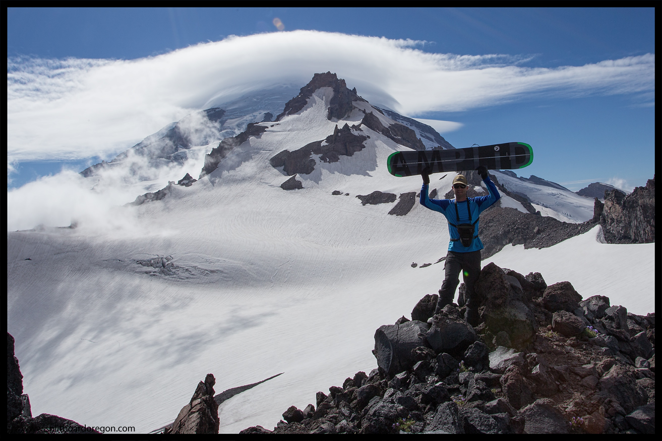
Eventually, we worked our way up onto the Fryingpan Glacier and up to Whitman Crest.  The Fryingpan was in really good shape, and we were able to skirt one crevasse on the headwall to get to a high point somewhere around 9300 feet.  The views were somewhat muted by the clouds, but they added to the overall beauty of the day…

At Whitman Crest
Looking south to Mt Adams

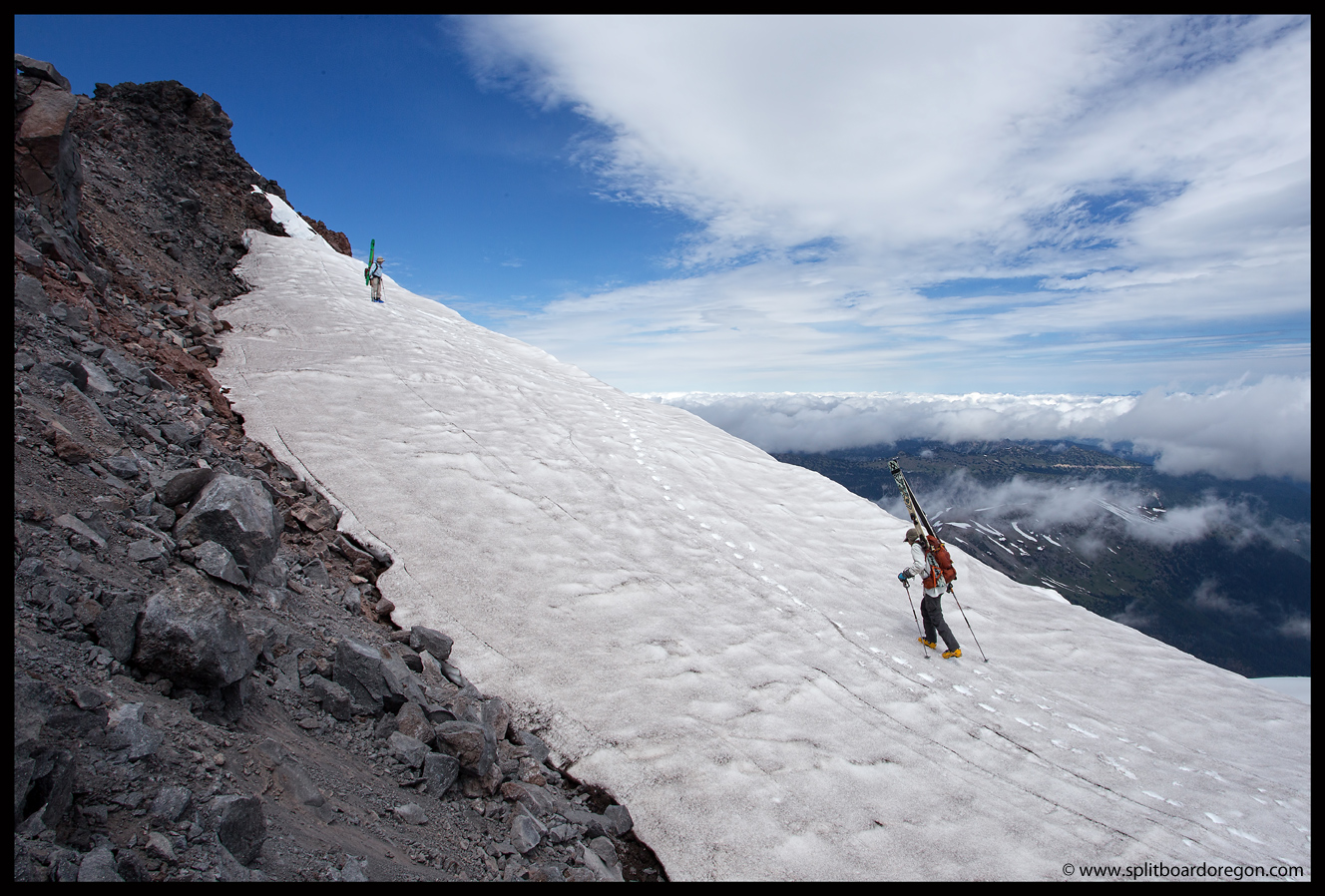
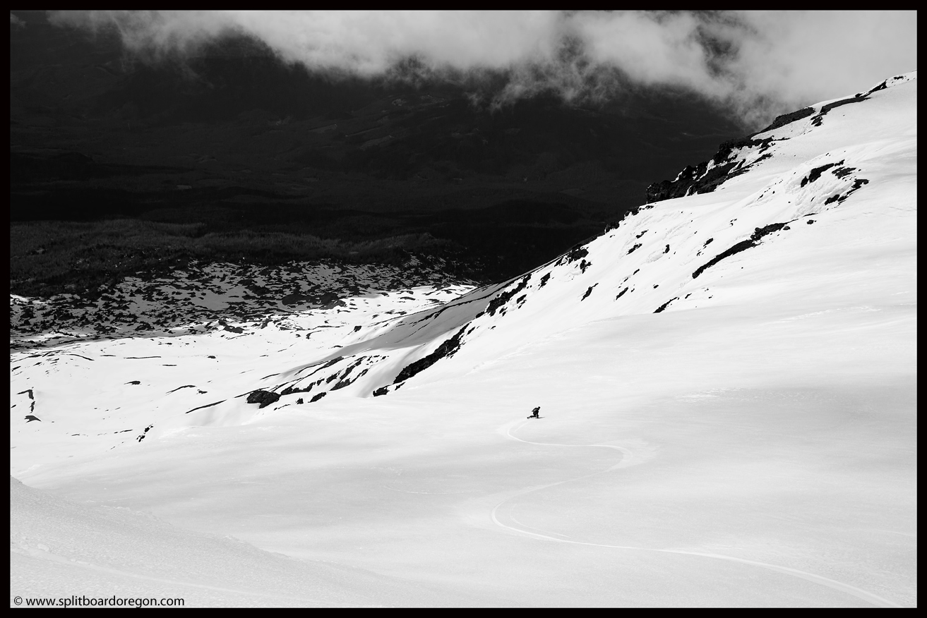
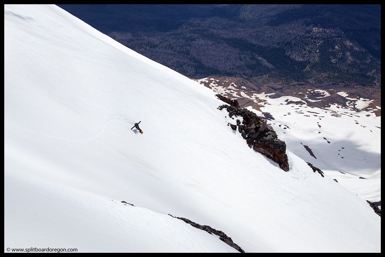
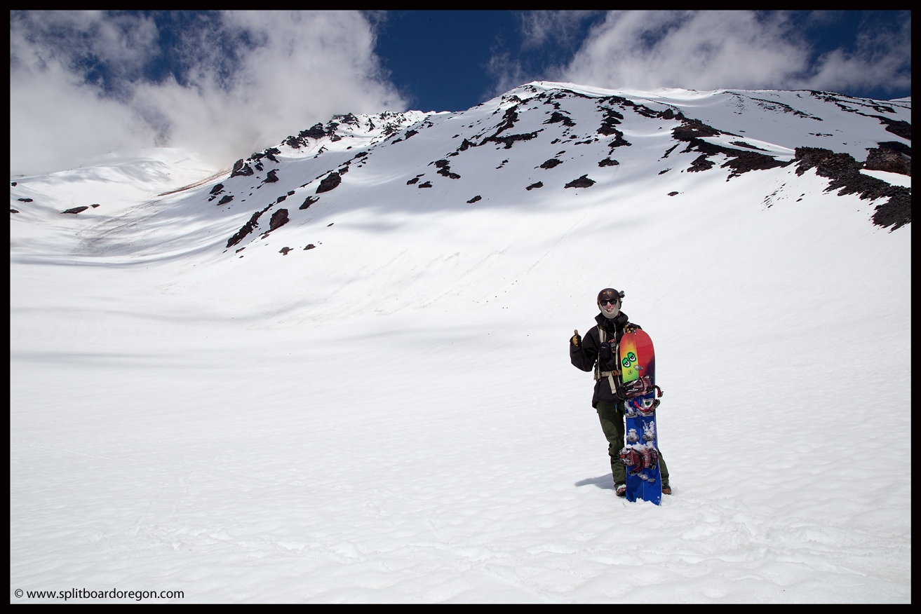
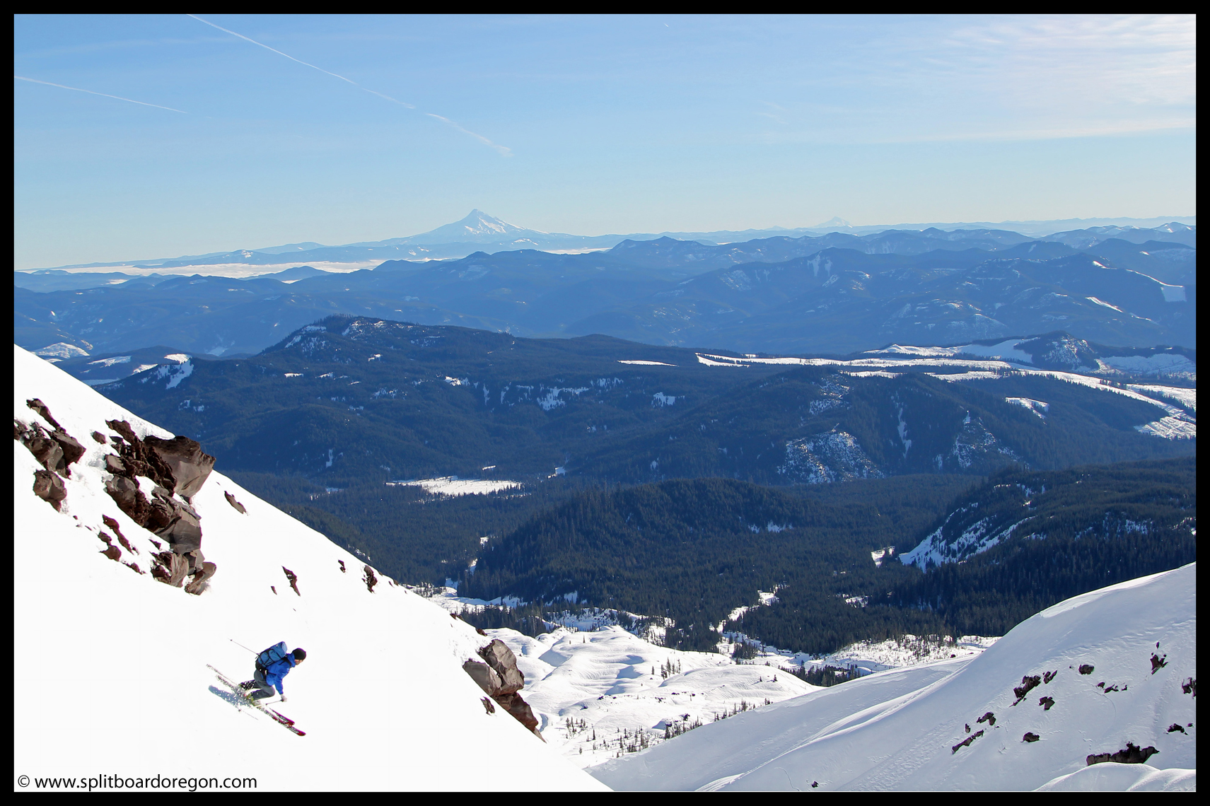
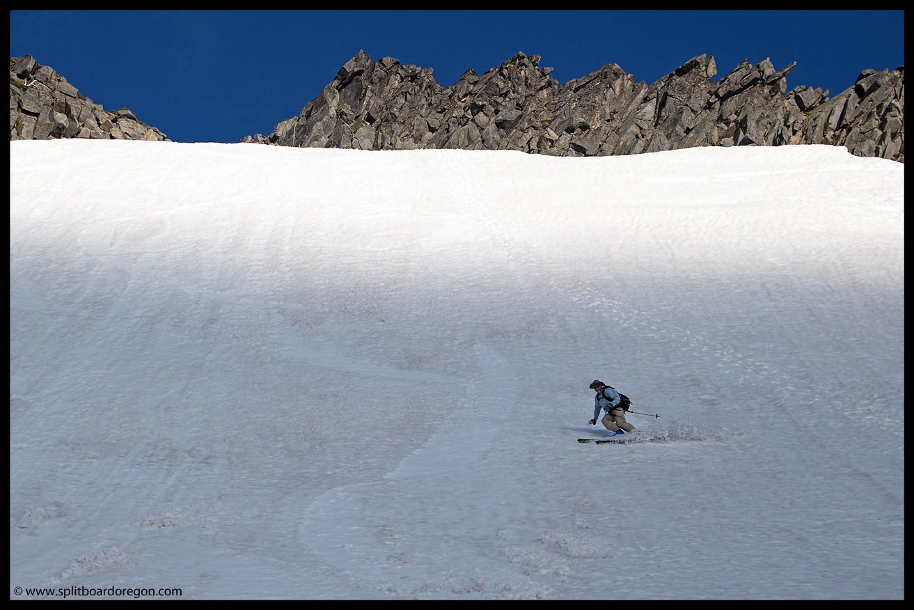
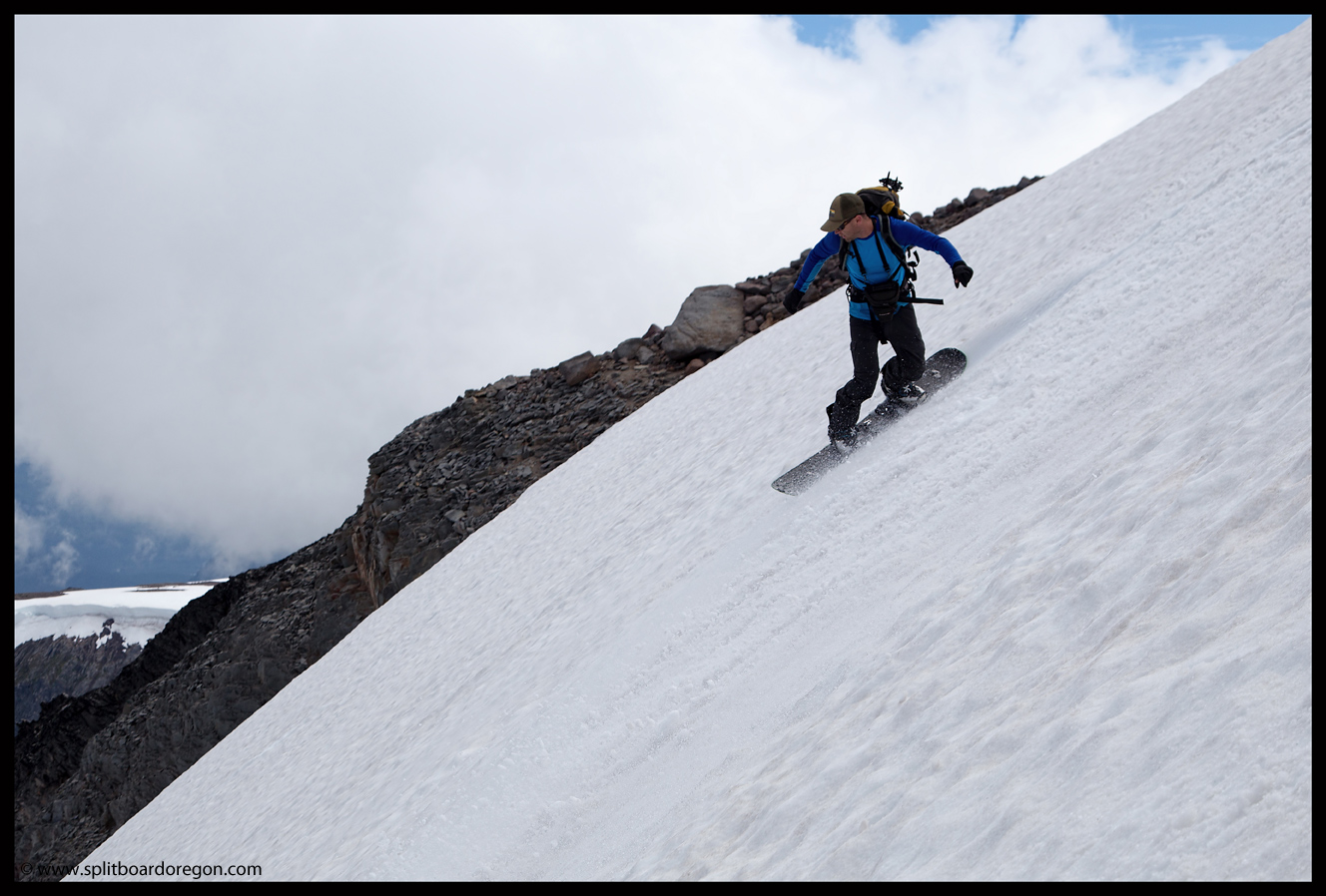
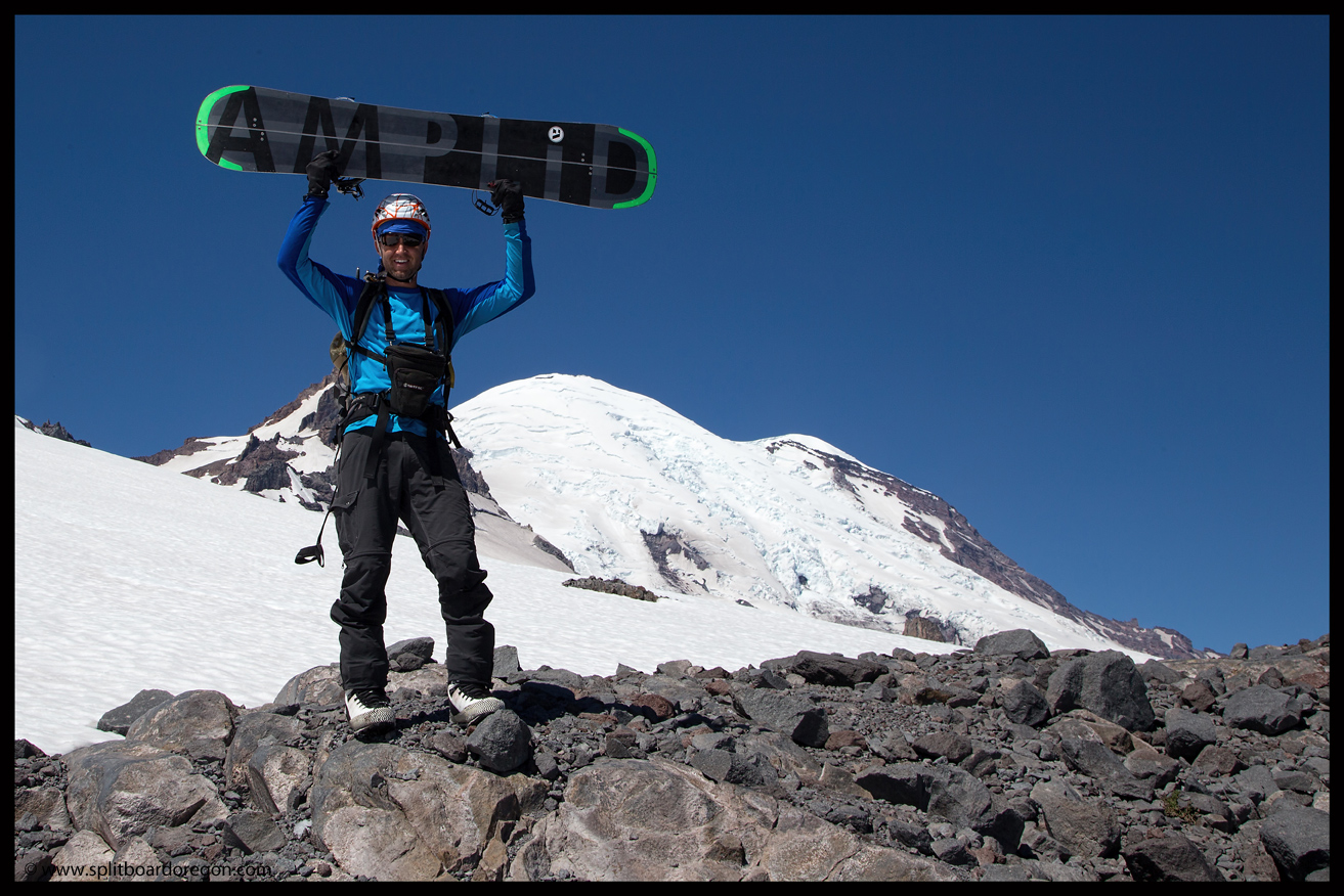
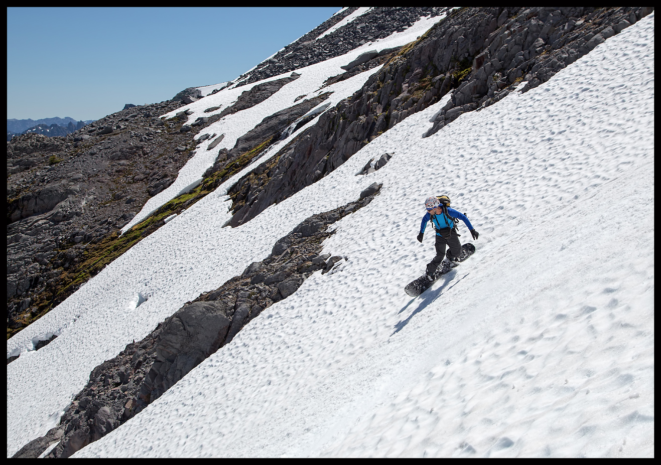
Although I was in favor of continuing on to Little Tahoma, which required dropping down over some rocks to the Whitman Glacier, I was outvoted so we decided to shred the Fryingpan instead — not a bad consolation prize.  I dropped in while Dan snapped a few photos, and the snow was perfect.

Dropping in on the Fryingpan
The skiers feeling small on the Fryingpan

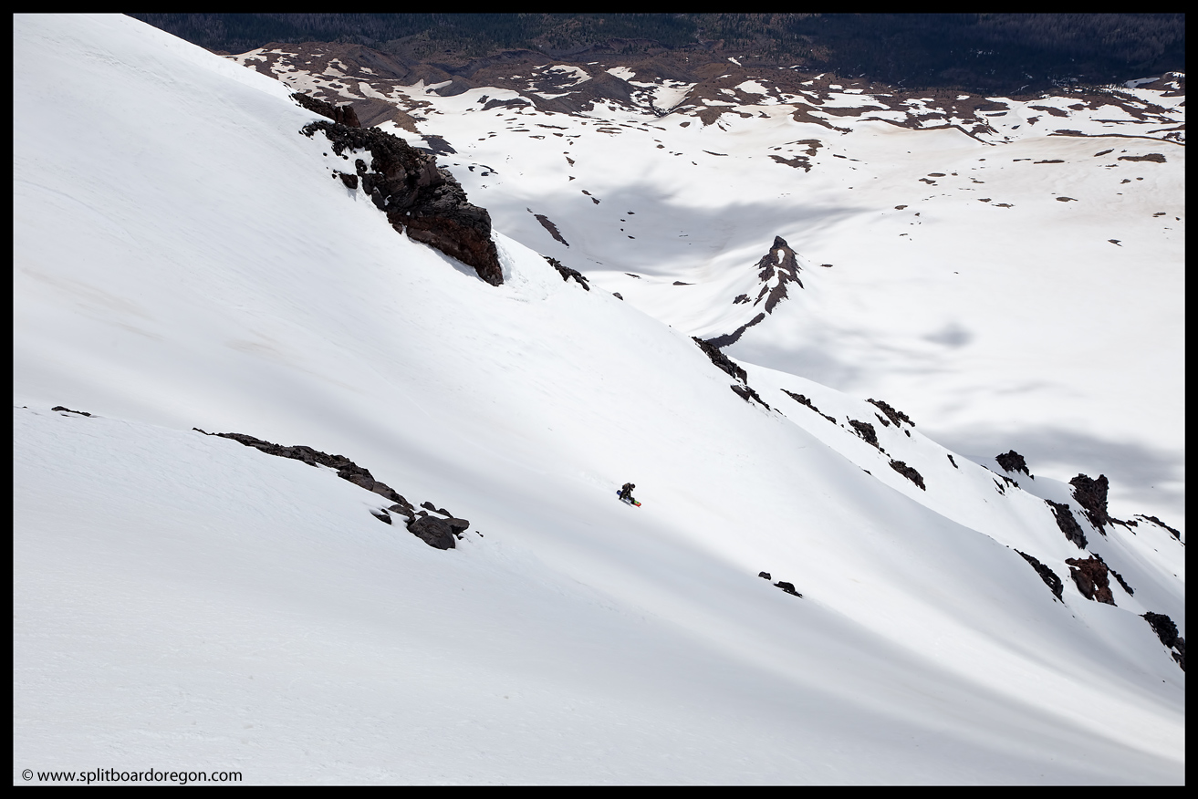
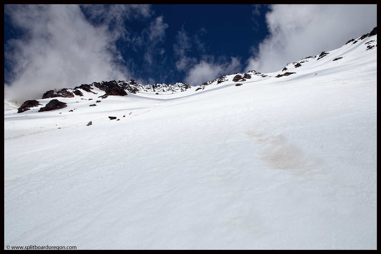
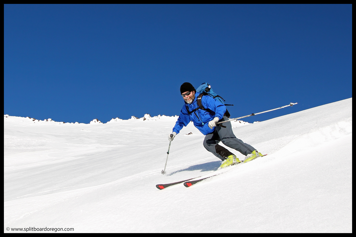
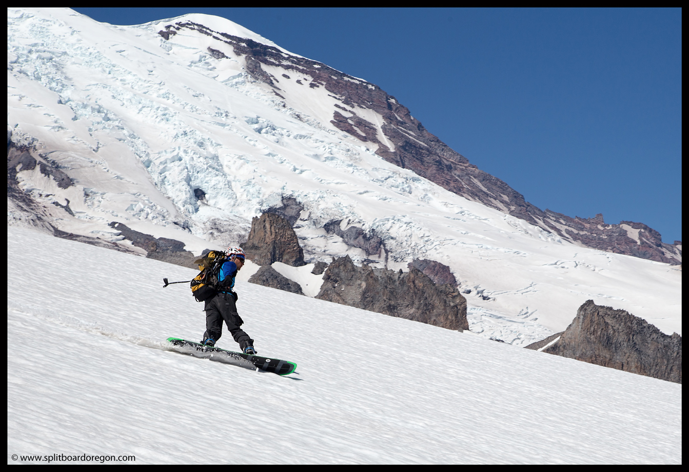
We continued down, working our way back in the general direction of our uptrack.  There was a steep headwall that we wanted to ski adjacent to our uptrack, so we made it a point to do just that.  The sun was perfect as we dropped in, and I snapped pictures of Dan as he skied by…

Kissing the sky on Rainier
Skiing above the Ohanapecosh drainage

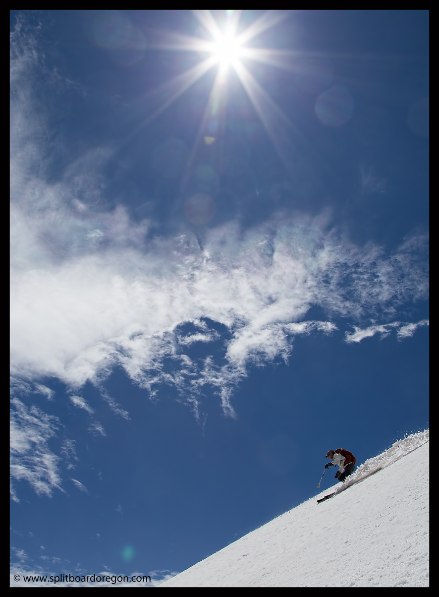
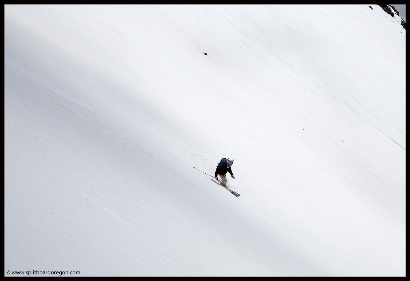
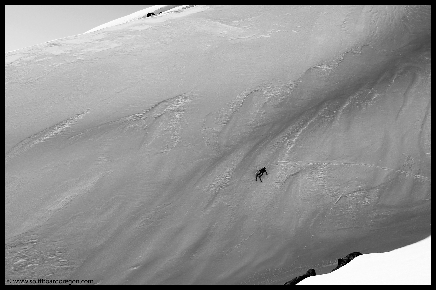
The snow on the headwall was so good that we decided to hike back up and ski it again.  This time, Dan took photos of me as I ripped the steep, perfect snow.

Matt enjoying primo corn

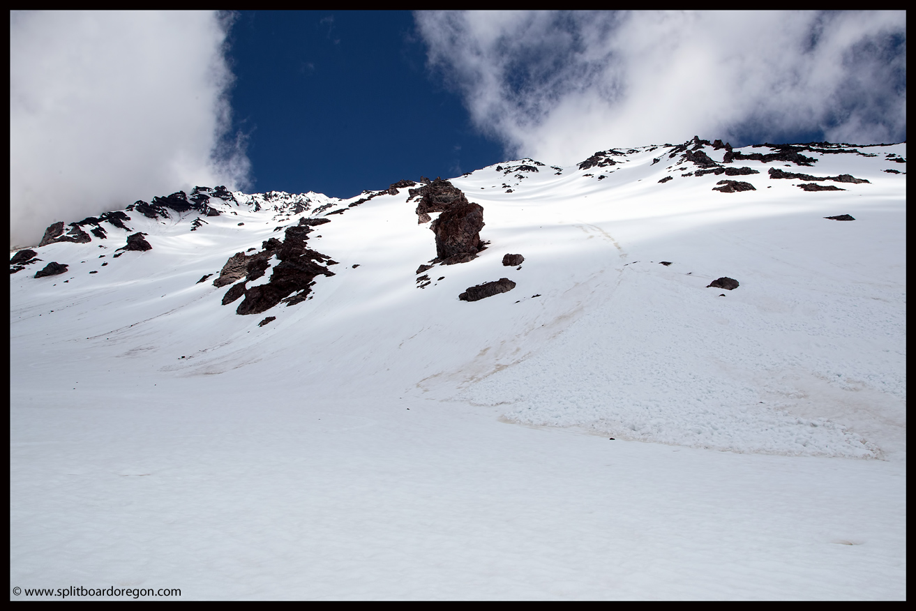
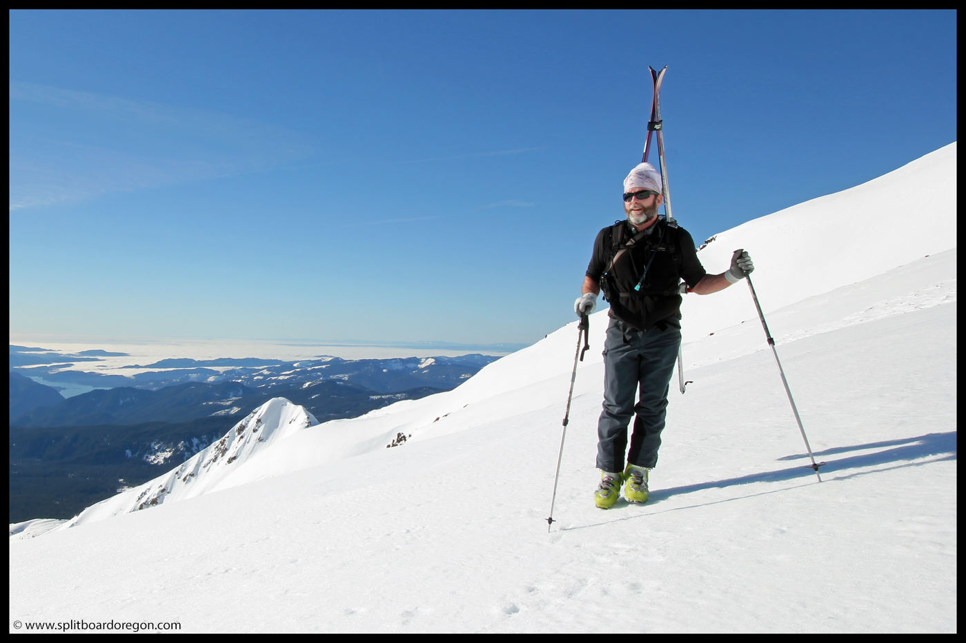
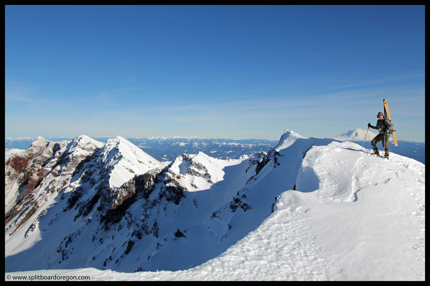
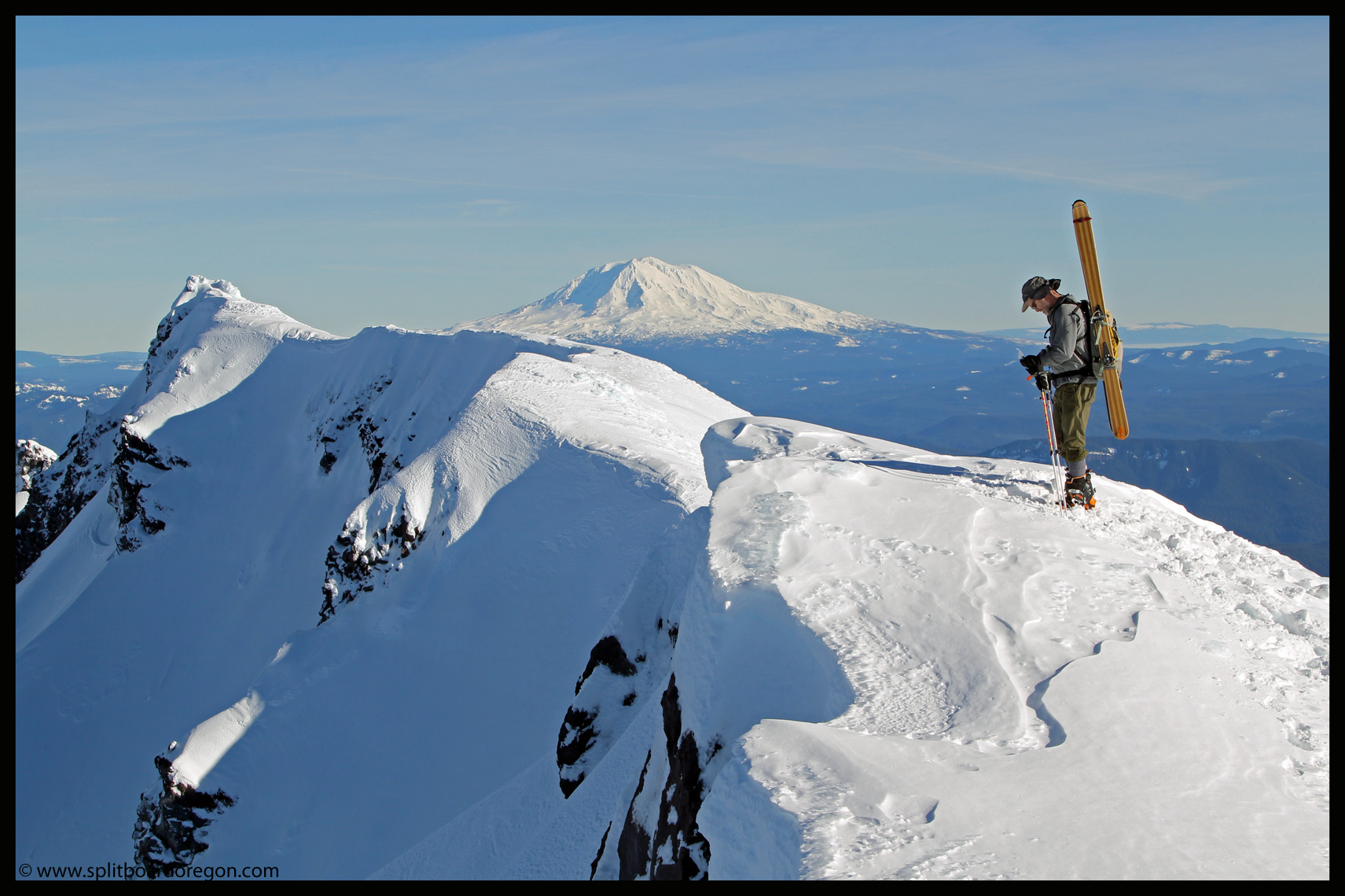
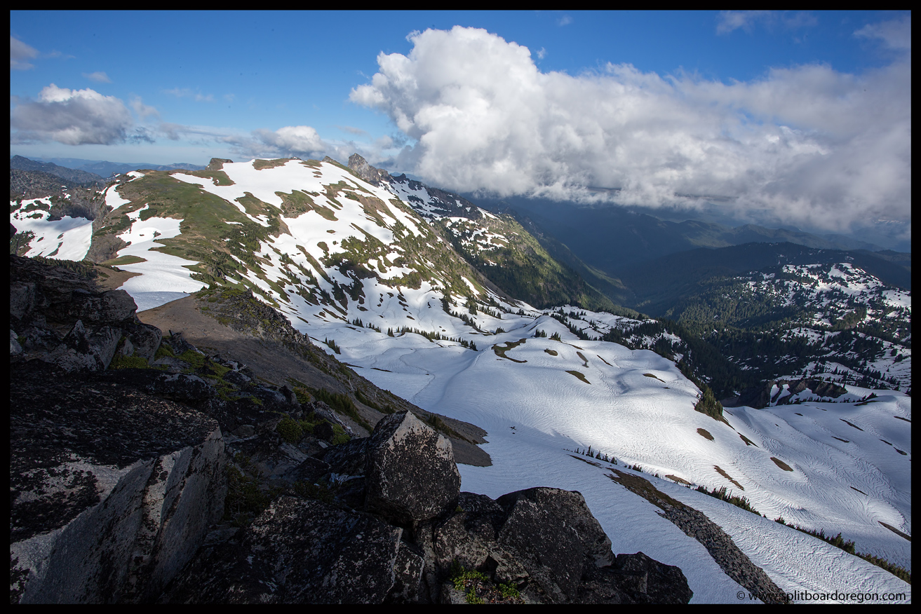
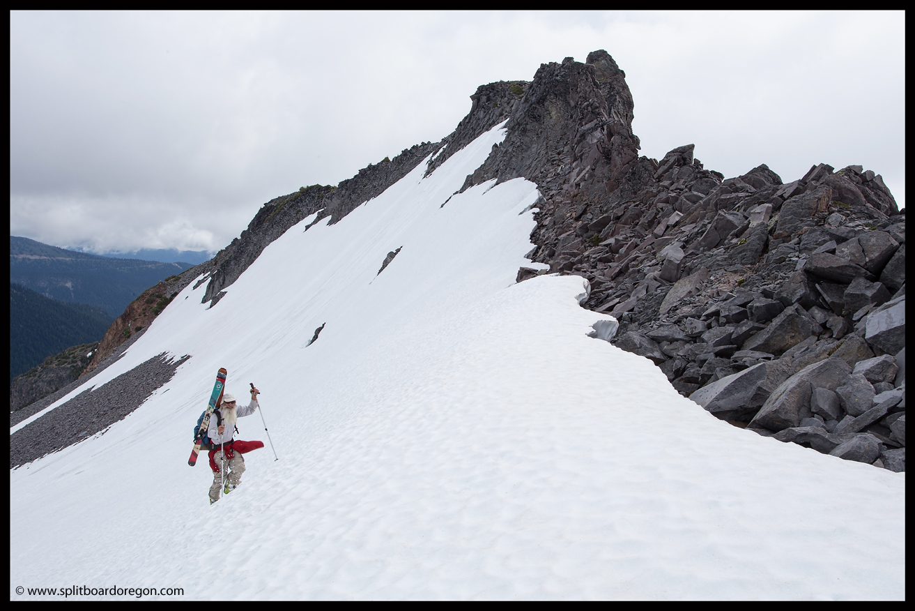
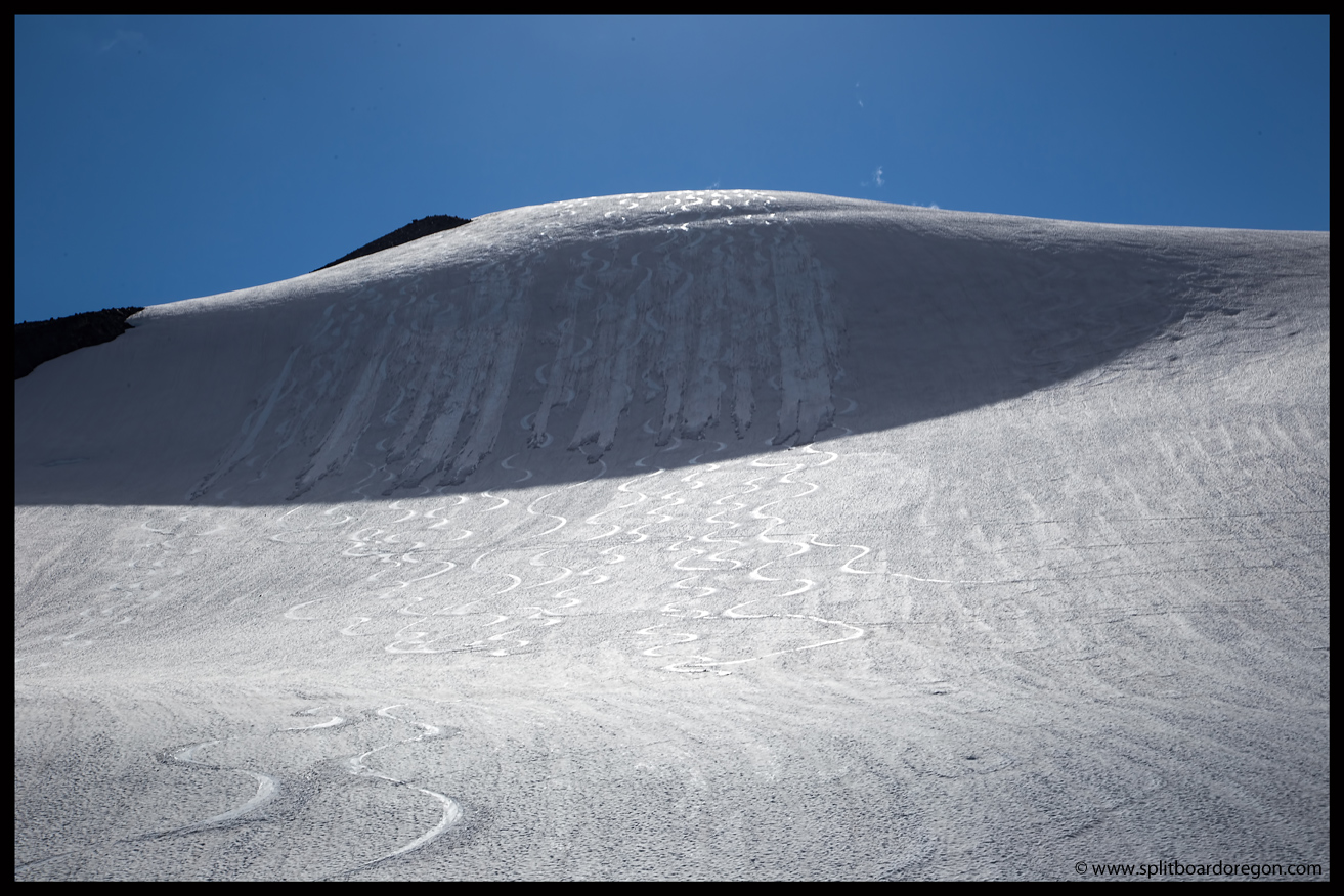
In fact the snow was so good, that we all elected to climb back up and ski it a third time.  This time, at the top of the headwall, John and I decided to go all the way back up to Whitman Crest to ski one more line that we had eyed earlier in the day.  By now it was around 4:00 pm, so by the time we made it back to Whitman it was nearing 5:30 and the lighting was getting pretty nice…

John climbing back to Whitman Crest
Looking out to Little Tahoma

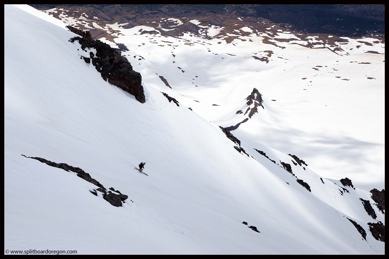
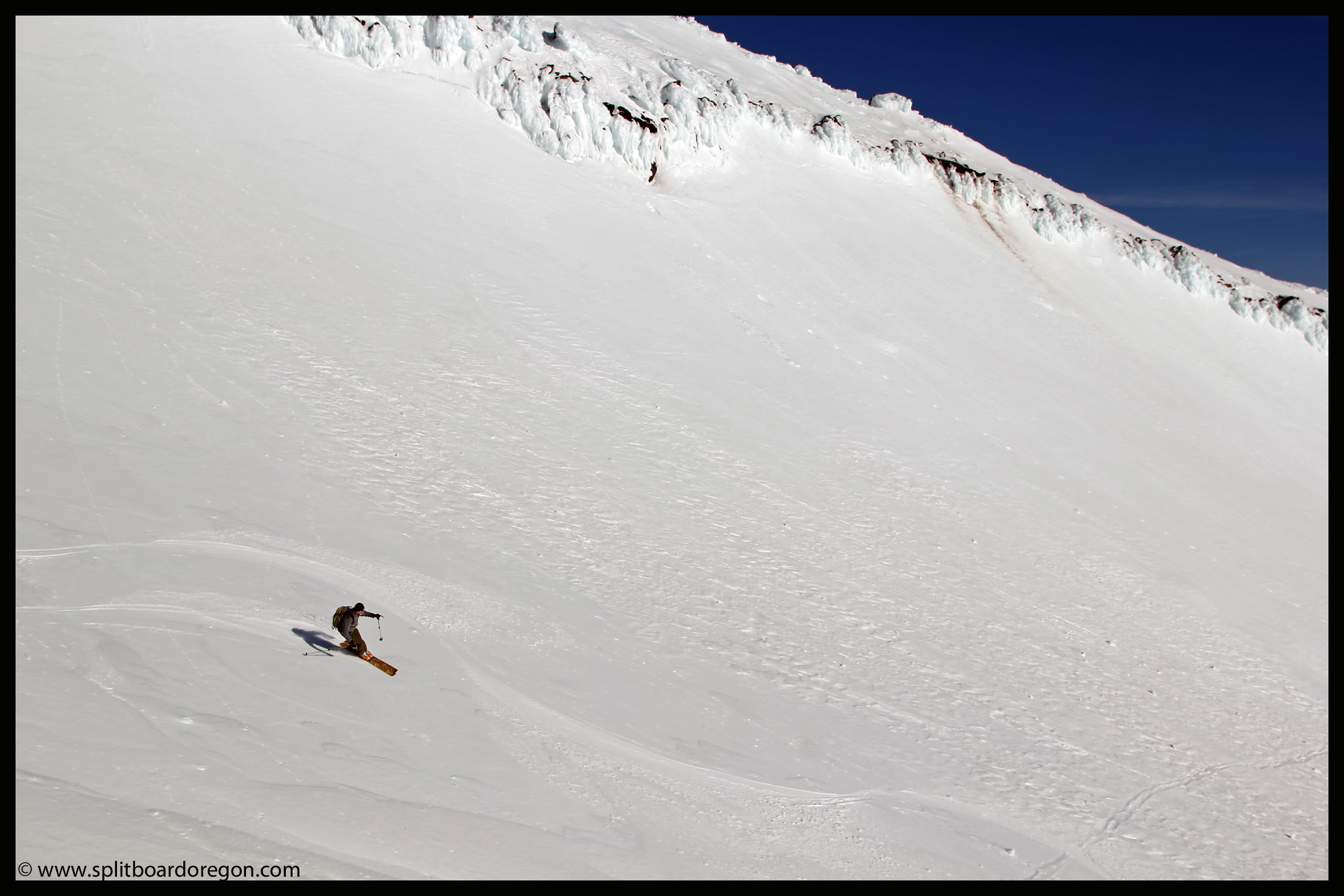
The skiing down from Whitman was equally as good as it was several hours earlier, and we ripped the corn back down the glacier and to the headwall for a great third ski of the steep slope.  Our line this time was a bit to the south from our previous line, and we found snow that was a little bit better and slightly steeper…

2nd run off Whitman Crest

The weather was the best we’d had all day, so naturally I had my camera out trying to snap a few pictures of John.  That is easier said than done, as John rarely stops when he starts skiing….he just goes down the hill!

John harvesting some Rainier Corn
Enjoying more July turns

At the bottom of the headwall, I had to look back and admire our work from three separate runs of excellent fun.  We pretty much tracked up the place, but it didn’t really matter as we were pretty much the only ones around to enjoy it.

Looking back at the headwall

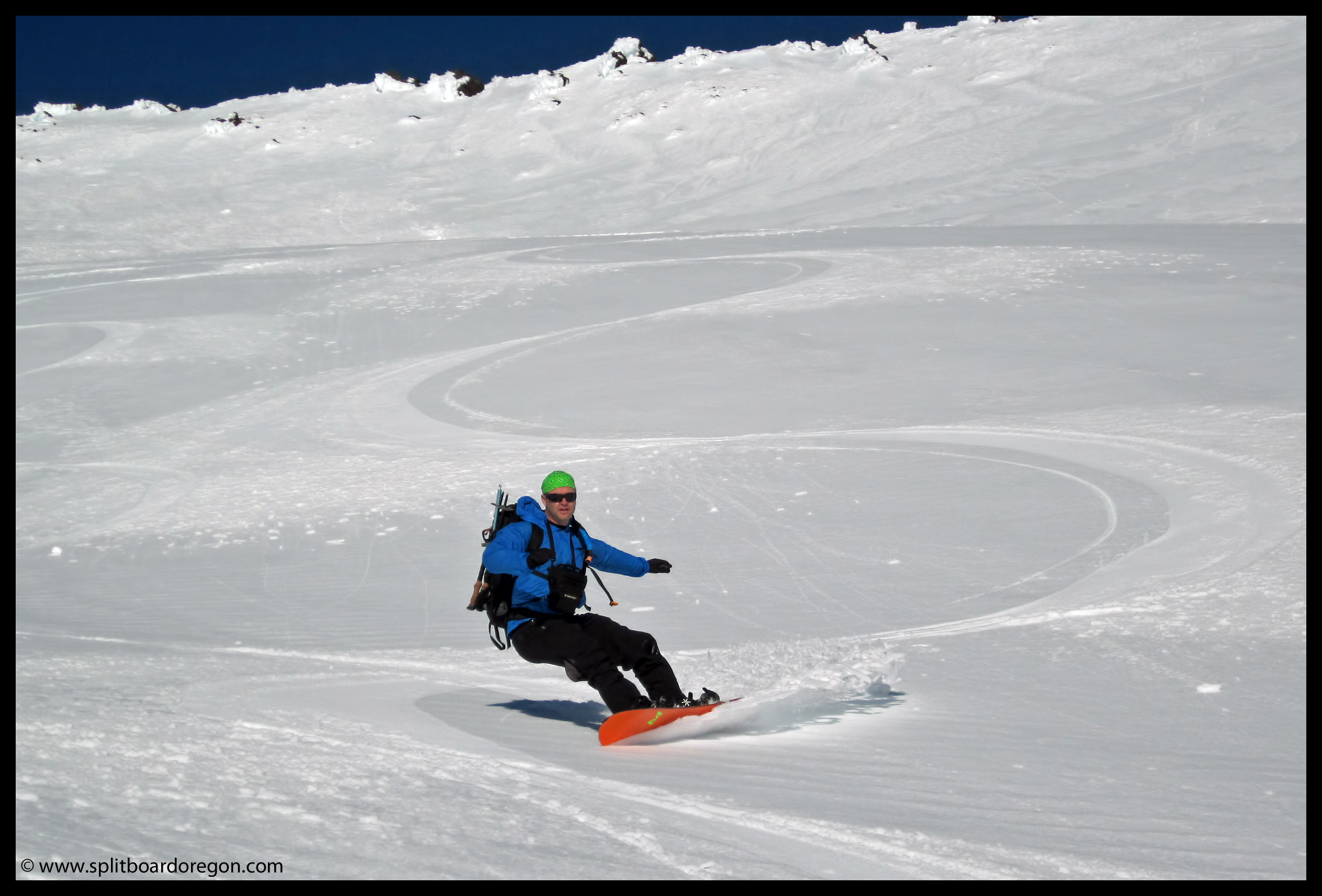
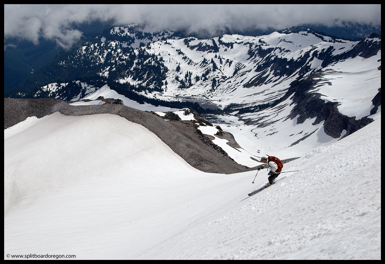
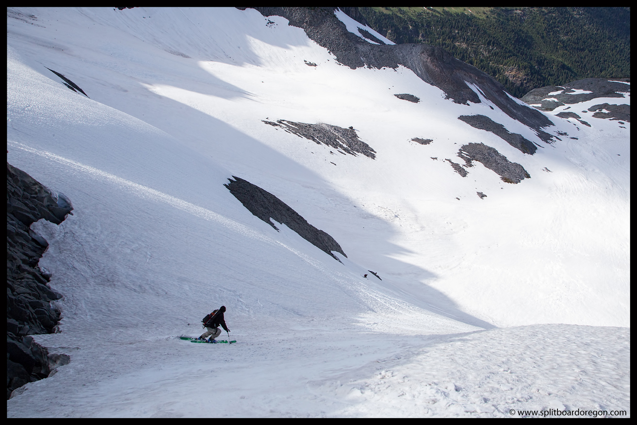
We skied down to the top of the Goat Cirque and met back up with Joe and Dan.  After a bit of discussion, we found the appropriate place to drop in via a steep line of snow above a large crevasse like glide crack.  The snow was perfect, and we dropped in one by one down the steep pitch….

Joe skiing the Goat Cirque gut
Heading back to camp

After the exhilarating turns down the gut, we skied the rest of the bowl out and made the traverse back to our camp at Summerland.  Back at camp, everyone was tired, but satisfied with the day.  We celebrated with backcountry margaritas and a well deserved dinner.  That evening, while at camp, we met and chatted with a park ranger named Bud.  Turns out Bud was also a backcountry skier, and we exchanged stories about various ski trips for nearly an hour.  After Bud left, we hit the sack, in preparation for a final morning of skiing on day three prior to the hike and long drive home.

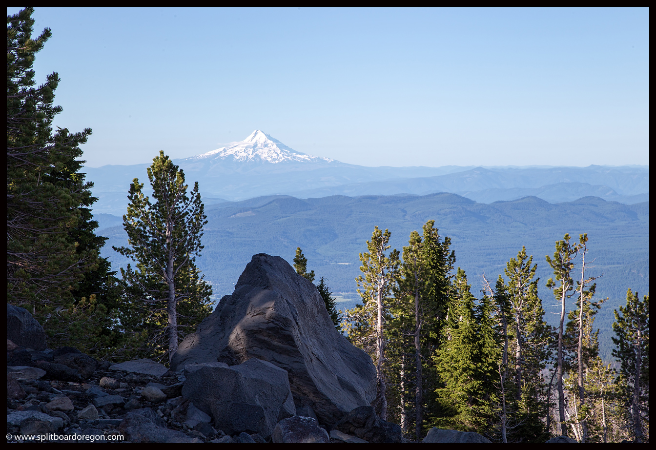
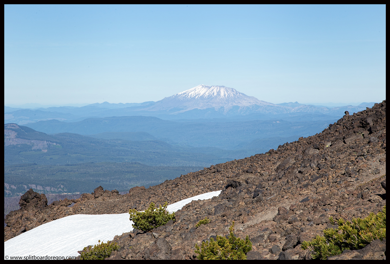
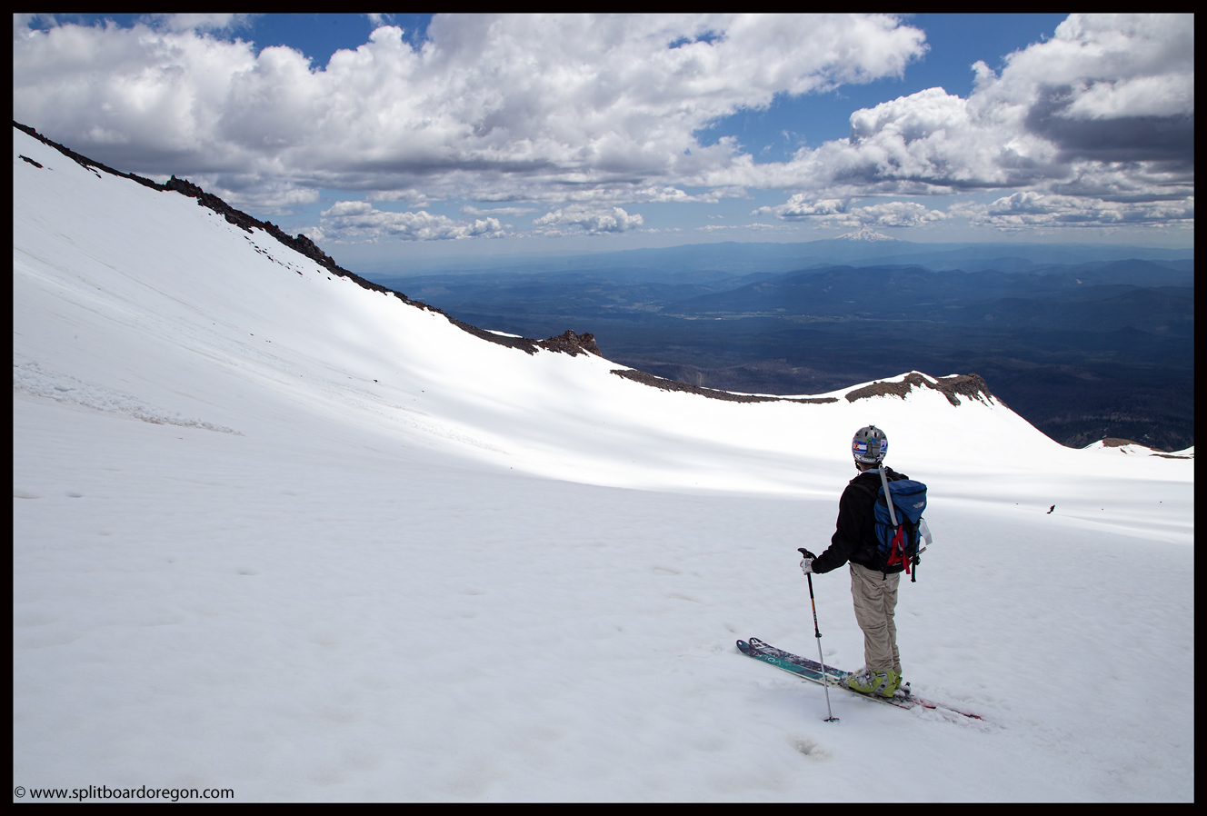
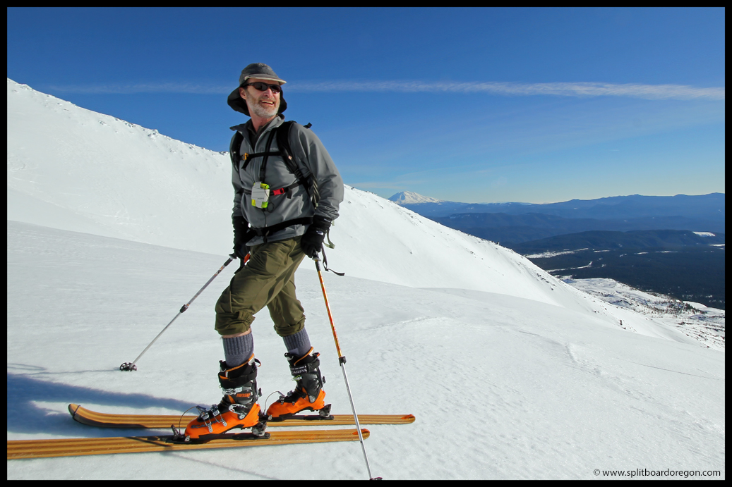
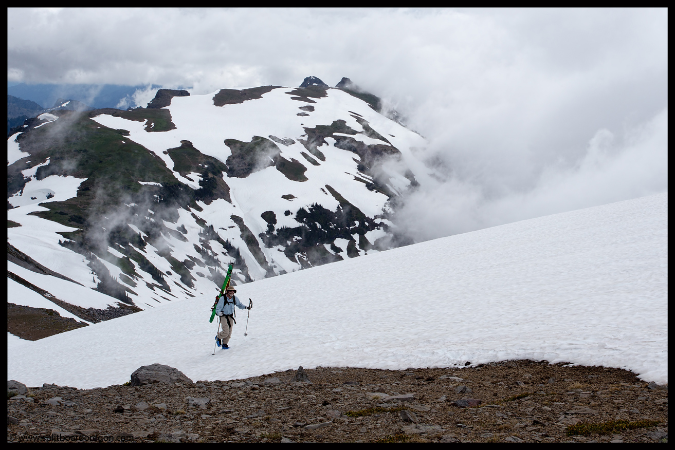
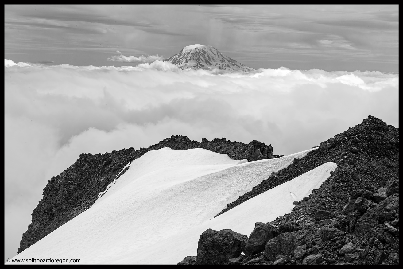
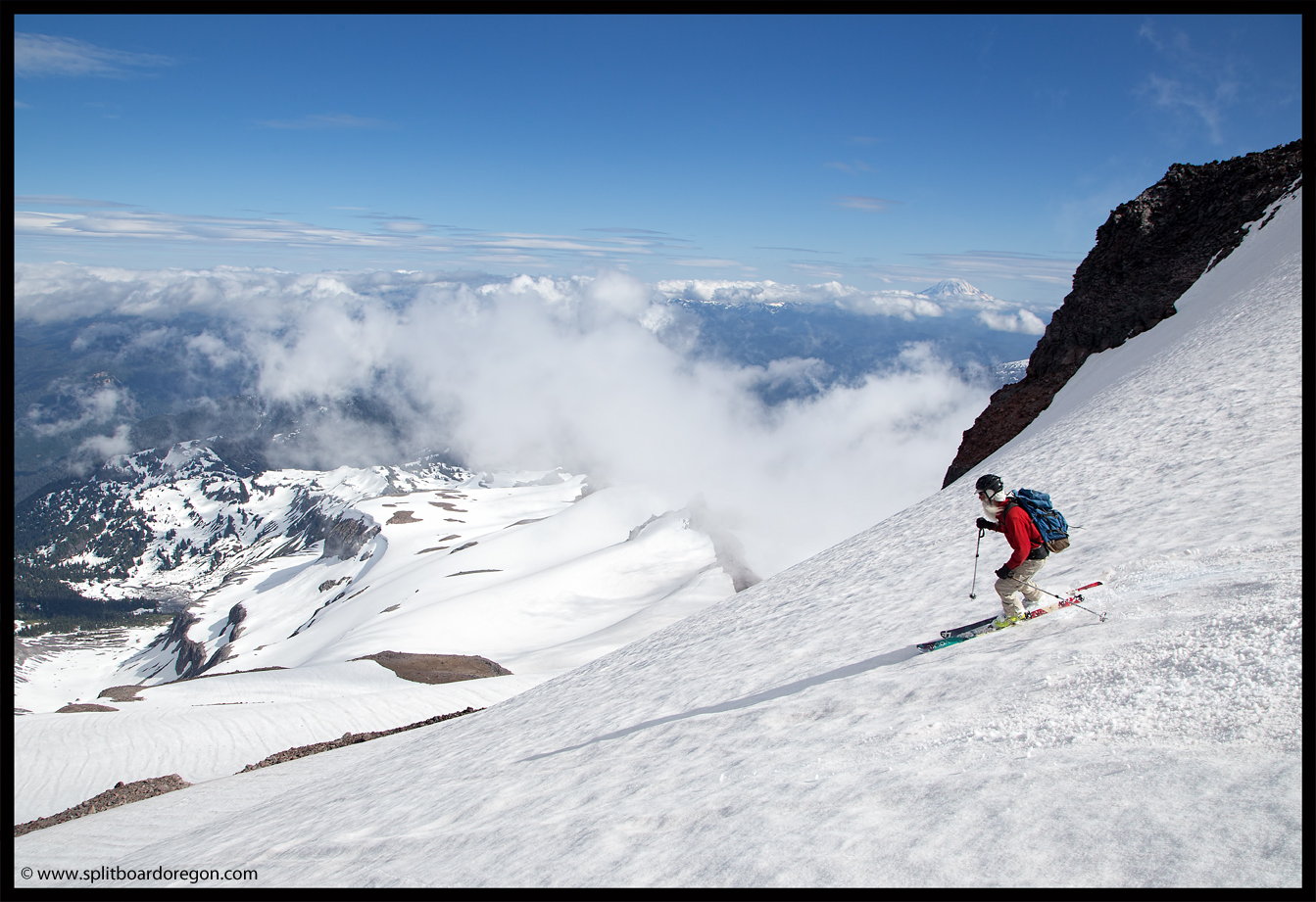
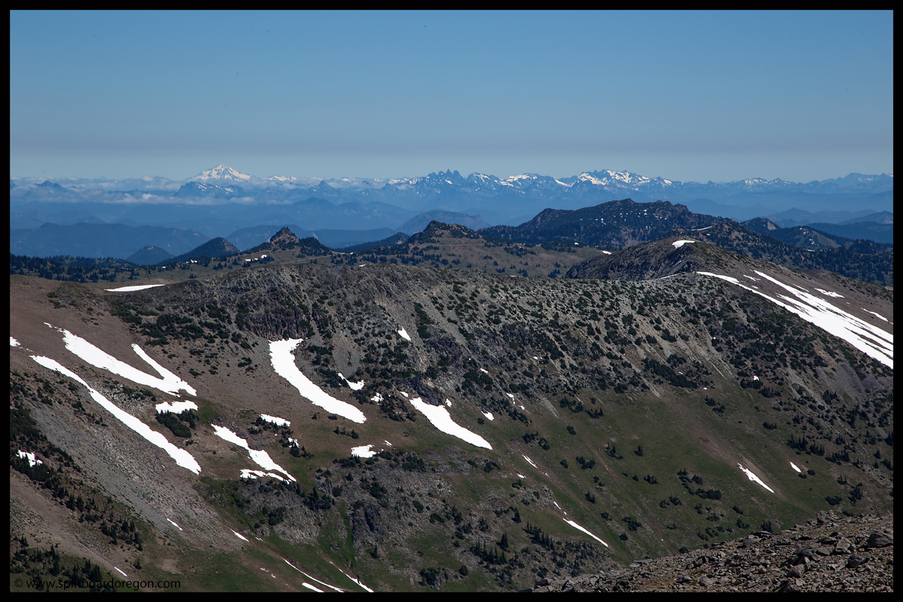
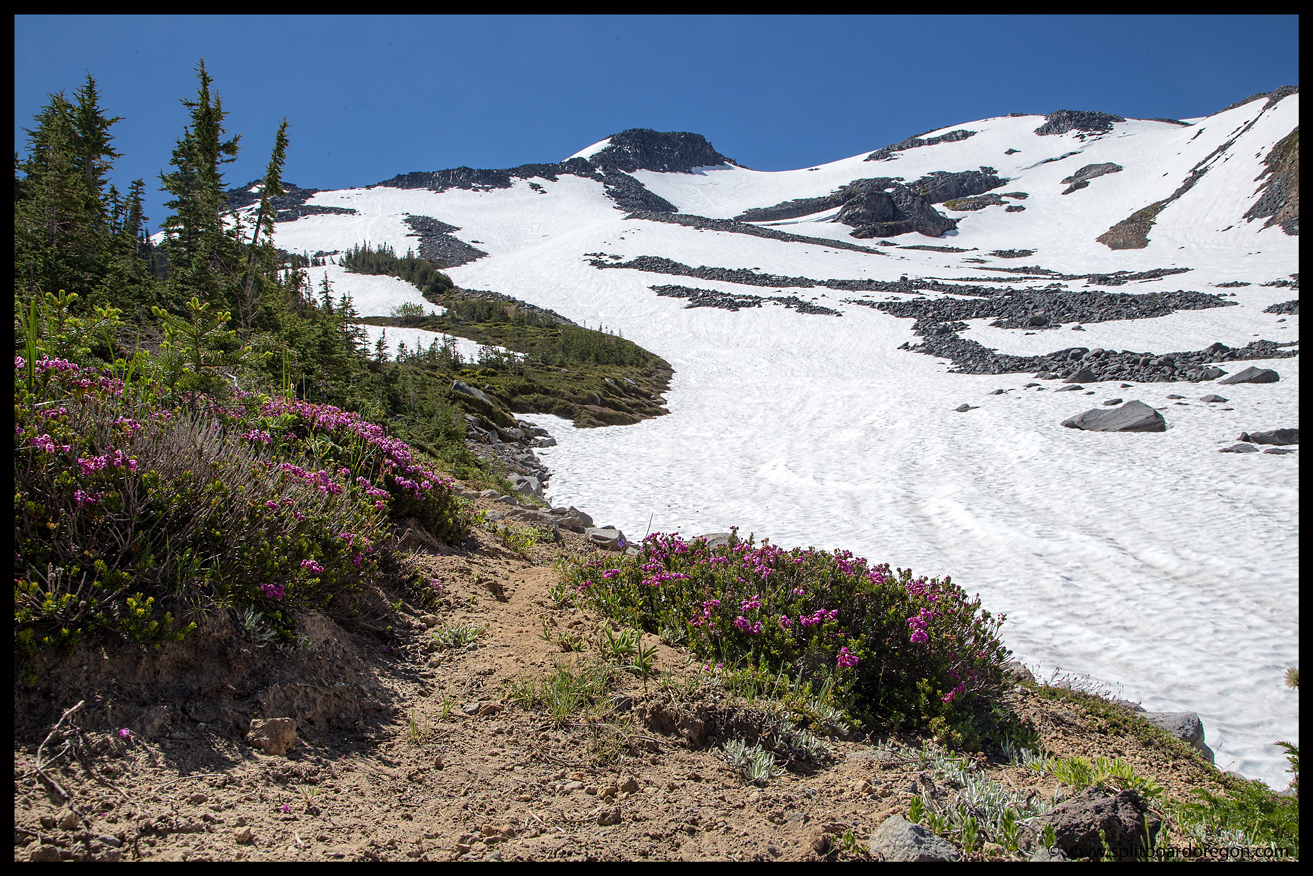
Day three dawned sunny and clear, and after a quick breakfast we left camp around 8:00 to ski the lower Fryingpan.  The snow was a bit firm, and crampons and ice axes were necessary, and for the first time on the trip I was glad to have brought them along.  As we climbed, the views to the north became better and better.  Eventually, Glacier Peak to the north poked out.  Another objective to put on the list for a future trip!

Looking out to Glacier Peak

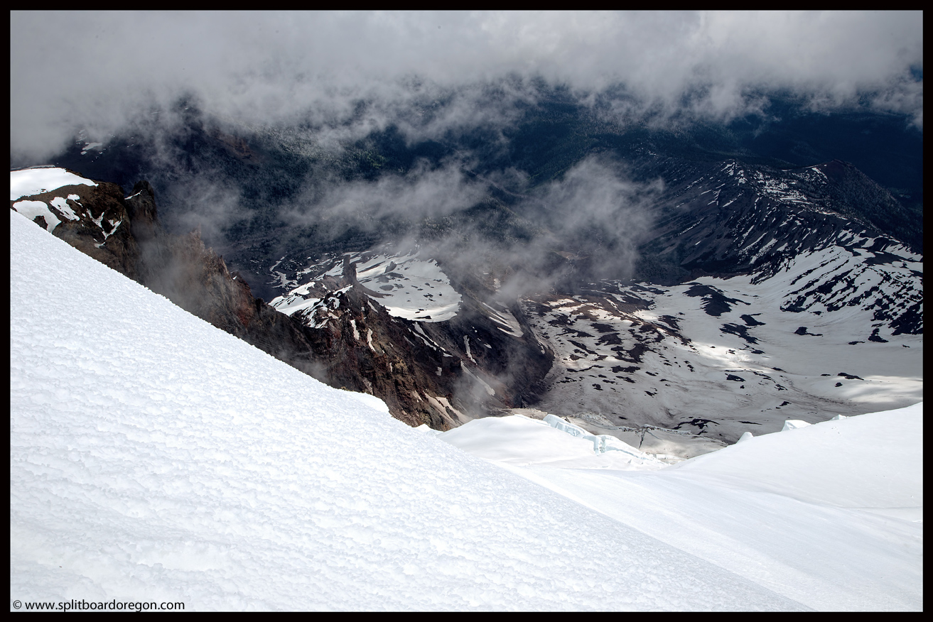
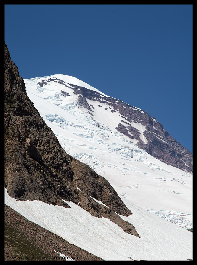
From this side of the Fryingpan, the Emmons Glacier looms large.  Looking out onto the glacial mass, I could see the climbing route up the Emmons and made a mental note that sometime in the near future I needed to snowboard from the summit of Mt Rainier.  Around 11:00, we reached what would be our high point for the day.  Before strapping in, we snapped a few photos of the surrounding scenery and then dropped…

Our day 3 high point
Riding on the Fryingpan with the Emmons as a backdrop

The turns were sweet, smooth corn, and we worked our way down the slope to the rollover where it steepened.  Then, a long heelside traverse followed, to make an end run around a huge glide crack mid-slope that would have spelled trouble if one of us fell.  After that, the slope opened up again to excellent corn snow….

More July corn

We milked the turns all the way down to an elevation that was a few hundred feet below our campsite at Summerland.  Looking around, the beauty of Mt Rainier was obvious.  Big, large glaciers were punctuated by blue skies and wildflower lined canyons.  It’s easy to see why this place was designated national park status…

The Emmons
Looking down Fryingpan Creek from our low point
Tracks in the bowl

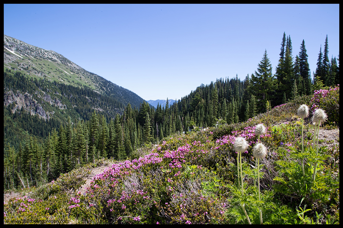
After the short hike back to camp, we set about breaking down our camp and getting gear packed for the hike out.  A round of backcountry margaritas were in order to celebrate a great trip, and then we hit the trail for the wildflower filled hike out.

The trail out

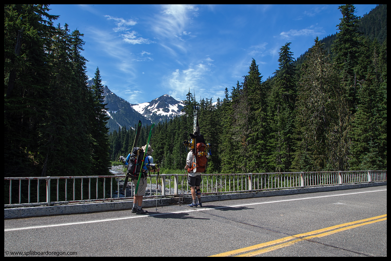
A few hours later we were drinking cold Rainier at the car, feeling blessed to have had such a great trip on a great mountain.  Sitting there enjoying a fresh garden salad and cold beer, I’d have to say that July in the Pacific Northwest has got to be the best!  Here’s a parting shot from the trip…

Matt & the Emmons


June 5, 2015 – Mt Adams, Avalanche Glacier Headwall

Conditions were shaping up just right for a trip to Mt Adams, and with both Morgan and Joe game to give the Avalanche Glacier Headwall a try, I knew it would be a great trip.  Joe and I left the Southern Willamette Valley on Thursday afternoon just in time to hit rush hour traffic through Portland, but eventually we made it through and found smooth sailing east bound on I-84.  We worked our way to the town of Trout Lake, grabbed a couple of climbing permits, and headed for the South Climb trailhead.  The mountain had been shrouded in clouds for most of our drive, but did pop out for a view as we neared the trailhead….

The mountain on the drive in

The parking area at Cold Springs was relatively quiet, and we found a nice place to camp for the evening.  I enjoyed a fresh salad from the garden for dinner, along with a cold beer.  While waiting for Morgan to arrive, we met fellow splitters Jeff and Kelly, and enjoyed their company around the campfire for a couple of hours.  Kelly even made smores.  Morgan arrived around 10:00 pm, and we hit the sack around 10:30, hoping to get on the trail the next morning around 6:30 am.

I was up at 5:30 am on Friday morning, and after a power breakfast of cereal and a banana, Joe and I hit the trail right at 6:30 am, with Morgan shortly behind.  After a mile and a half or so, we reached treeline and started up below the Crescent Glacier.  The views back to the south towards Mt Hood weren’t too shabby either…

Mt Adams & the Crescent Glacier
Looking south at Mt Hood

We continued climbing, and worked our way up to climbers left of the Crescent Glaicier, following an old somewhat melted out bootpack.  Morgan caught up with us before we gained the ridge, and the three of us continued up the slopes below Pikers Peak.  Looking west, the snow coverage on Mt St Helens looked more like late July than early August…

St Helens
St Helens

Around 8500 feet, I switched to skins, joining Morgan who was already sliding uphill.  Joe continued booting.  Around 9200 feet, it was time for a quick rest and some lunch before tackling the 2000 foot Suksdorf Ridge below Pikers Peak.  As we climbed, the completely blue sky started to develop a few whispy clouds.  By the time we were nearing the top of Suksdorf, the clouds had thickened considerably, and were threatening to ruin our visibility.

Hiking below Pikers
Joe hiking below Pikers
Morgan climbing Pikers
Morgan on Suksdorf Ridge

As luck would have it, we topped out on Pikers in a whiteout around 11:30 am, so it was time to chill for a half hour to see if conditions improved.  Morgan drank the beer he was hoping to drink on the summit as a sacrifice, and soon a sucker hole formed so we packed up and skinned off towards the summit.  Of course the clouds rolled back in, and most of the climb to the top was in limited visibility.  The clouds did break periodically however, affording excellent views down onto the Klickitat Glacier and back towards Pikers…

More Klickitat
Looking down onto the Klickitat Glacier
Looking back at Pikers Peak
Pikers Peak from below the summit

Around 1:45 pm or so, Joe and reached the 12,276 foot summit of Mt Adams.  Morgan elected to turn back partway up and checkout our line to ensure it would go rather than fight the clouds.  A really nice window in the clouds around 2:00 pm let Joe and I rip corn from the summit, and we rode down towards Morgan, who was ready to rip the headwall of the Avalanche Glacier.  When we met back up with Morgan, we discussed our line and proceeded to drop in to rip 3000 feet of steep corn.  Morgan dropped first, and made big smooth turns on the lower angle slopes above the headwall…

Morgan dropping in
Morgan dropping in

We stopped briefly at the rollover, and then cranked out dozens of turns on the 45 degree face.  Morgan shredded while I fired pictures with the camera….

Ripping the headwall
Morgan
Morgan

Joe dropped next, and skied the line like a knife through butter, making effortless turns down the perfect pitch.  Once Joe was down, I put the camera back in my chest pouch and enjoyed perfect turns down the face for nearly a thousand feet.

Joe
Joe cruising on Mt Adams
Joe
Skiing the Avalanche Glacier Headwall

The line kept going and going, so we kept shredding.  Morgan found some nice turns on the northerly side of the headwall, and proceeded to rip while I captured the below shot of him in the sun and shadows….

Morgan
Morgan
Looking back up the headwall
Looking back up the headwall from halfway down

We rode the lower half of the line with the camera put away, just enjoying the excellent June turns.  At the bottom, we traversed across some avalanche debris and discussed our exit strategy.  Looking back up the slope, a good chunk of our line was still in view at left….

The Line
The Line
Joe
Joe headed down and out

More turns followed on the lower Avalanche Glacier, and then it was time for the final traverse out. I snapped a few more pictures of the guys before we departed….

Morgan stoked after shredding the headwall
Heading out
Morgan & Joe

Joe and I skied down as far as we could to the round the mountain trail, and were able to link turns down to around 6800 feet.  Morgan headed back around the mountain to pick up his trail shoes, and the three of us met up later at the trailhead.

Headin' home
Headin’ home on the round the mountain trail

By 5:00 pm, we were back at the car enjoying a cold beer, stoked after a day of climbing 7000 feet and riding around 5600 feet in a really poor snow year.  Joe and I wolfed down dinner, finished our beers, and bid Morgan farewell, heading out to spend a couple of days on Mt Jefferson.  As expected, Mt Adams delivered, and I’m already looking forward to a return trip.  Here’s a parting shot looking down at the large cracks of the Klickitat Glacier…

Mt Adam's Klickatat Glacier
Mt Adam’s Klickatat Glacier


January 17, 2013 – Mt St Helens, Worm Flows

For the first time in three and a half years, in the never ending search for optimal snow conditions, I found myself venturing outside the state of Oregon looking for corn snow in the middle of January. I’d been eyeballing the weather forecast all week, and conditions appeared right to try and tackle the Worm Flows on the south side of Mt St Helens.

I woke up just before my alarm at 3:30, and was on the road by 4:00, heading north on Interstate 5 towards Portland to pickup Ron. After a brief stop to pickup a climbing permit in Cougar, we pulled into the Marble Mountain trailhead a few minutes before 7:30 and found Joe, who’d spent the night there and was planning on skiing with us for the day. After donning ski boots and packs, we started skinning through the snow covered forest roads towards the mountain over an incredible mid-January base of 72 inches at 2600 feet. Soon, we popped out near the treeline and the mountain was in full view in the sunshine. Remarkably, the temperature was pushing 50 degrees – a stark contrast to the valley fog and freezing temperatures at home. Stripped down to nothing but my base layer, I still found myself sweating as we started climbing the steeper pitches of the 5500 vertical foot climb to the summit rim.

Skinning on St Helens
Joe booting up St Helens

I was digging the traction provided by my nylon/mohair mix Black Diamond skins I received as a Christmas gift, but was happier with the glide, which allowed me to keep up with the skiers with less effort than normal. After a quick break for lunch around 6000 feet, Ron and I resumed skinning while Joe booted.

Joe enjoying a quick rest
Ron on the approach

The views from the upper mountain were excellent, with Mt Adams looming large to the west and Mt Hood visible to the south. The snow was starting to corn nicely, and a couple of splitboarders descended down from above us around 11:30. Their turns looked good, but I figured another couple of hours would be primo. For the last 1000 feet, both Ron and I switched to crampons and booted the final pitch to the summit rim.

Looking into the crater from the summit rim
Mt Rainer from the summit rim

From the summit rim, the views were incredible. Not a wisp of wind was detectable on the summit, and looking down into the steaming crater was such a treat. Spirit Lake was incredibly blue, and looking north Mt Rainier dominated the skyline, with Goat Rocks and the Olympics also in full view. We crept up to the edge of the cornice on the rim as close as we dared and snapped several photos. Below is a picture of Ron looking to the east with the summit rim and Mt Adams in the background….

Ron with Mt Adams
Ron with Mt Adams
Enjoying the rim views

Travel time to the summit rim from the parking lot took about 5 hours, so we lounged around a bit soaking in the sun’s rays and enjoying the views. Looking down into the massive crater, I could only imagine how much destruction took place back in 1980 when the mountain erupted. The amount of material moved in a matter of minutes was ridiculous….

Looking downs into St Helen's crater
Looking downs into St Helen’s crater
Zoomed view of Ron with Mt Adams

A few minutes before 2:00, conditions looked prime to begin making turns. After putting the split back in board mode. and repacking our gear, it was time to ride. We elected to drop the main bowl off the summit rim with the thought of riding Swift Creek all the way down if conditions looked good in the canyon. I dropped in first, and the snow was excellent. I could tell after several turns that it was going to be one long ride back to the car! Ron and Joe followed, and I snapped a few photos as they cruised down.

The Crater Rim
Ron cruising on the upper mountain
Corn turns on St Helens
Corn turns in the sunshine

The snowfields seemed to go on and on, as we linked turn after turn in the warm sunshine. After a few thousand feet or so, we made the decision to cruise into the Swift Creek drainage and made that our descent line down the rest of the mountain. Swift Creek is nice in that you can cruise down into the canyon and then back out to the larger snowfields on the east side pretty easily.

Joe harvesting the corn
Enjoying a mid-winter corn harvest!
Ron and Joe in Swift Creek on St Helens

Lower down in Swift Creek, the snow remained firm on the shady east facing side of the canyon wall, but started to turn from corn to mush on the sunnier west facing slopes. I snapped a few photos of Joe cruising through the canyon, including the two shots below. The first image is looking south with Mt Hood in the background and the second is a bit more abstract….

Joe skiing Swift Creek on St Helens
Playing on the canyon wall

After about 30minutes, several thousand feet of corn turns and plenty of big grins, we finally exited the canyon at a point back down near the gentler slopes above treeline. At this point, our legs were starting to grow a bit weary after a full day of climbing and riding, so we took a quick break, drank some water, snapped a few photos and continued down for more turns.

Joe and Ron near the bottom of Swift Creek above treeline
Ron looking back at our ski route

The runout from Chocolate Falls to the car was pretty taxing on the legs due to the sticky snow and long day. The upper section was really mushy due to the warm temps while the snow on the lower section on the road below treeline had started to refreeze and was a mixture of skin, snowshoe and foot tracks, requiring us to pay attention or risk taking a digger. We passed a few people on snowshoes on the way out, and were able to ride right to the parking lot without taking the boards off, making for a great descent of nearly 5500 feet on the day! Celebratory brews from Deschutes hit the spot at the parking lot as we changed out of sweat soaked clothes.

Joe and Ron looking on after a great run

Ron and I bid farewell to Joe, who was heading north for a day of lift skiing with family in Washington the next day, and headed south to Portland for a well earned burger and Terminator Stout at McMenamin’s. Portland traffic was congested as usual, but I missed the majority of rush hour at the pub, and was able to make great time back to the southern Willamette Valley. After such a great day, I’m pretty sure it won’t be another three and a half years before I head out of state again in search of good turns…….it may not even be three and a half months! Here’s a parting shot of the mountain from the drive home….

St Helens on the drive home

Here’s a parting shot from the day….

Matt & Ron on the Summit Rim


July 13-14, 2009, Fryingpan Glacier, Mt Rainier

Looking back on the turns I made on the Fryingpan Glacier in July of 2009, I have to say they definitely rate up there as some of the best backcountry turns I’ve ever experienced……perfect texture, perfect weather & perfect scenery!

Lower Fryingpan Glacier, Mt Rainier

I had been dreaming of snowboarding on Mt Rainier for several seasons when I finally decided to make it happen.  I met my old ski buddy Andrew at PDX mid-Sunday morning and we headed north on I-5 after a brief stop at REI and the Mountainshop in Portland.  Andrew hadn’t been on skis in 5 years, but not to worry –  he didn’t miss a beat.  We camped near the mountain Sunday night after terrible traffic in Olympia.  Early Monday morning, we headed into Mount Rainier National Park, got our permits from the White River Ranger Station, and parked at the Fryingpan trailhead at approximately 3900 feet. The weather was cloudy and misting, which made the 4 mile hike very pleasant.  Our load was heavy carrying our boards and overnight gear, but we saw lots of wildlife and flowers in the 4 miles to Summerland, including a bull Elk and a coyote.

We made it to Summerland and pitched our bivy and tent.  That afternoon, we set out to harvest some of the corn east of camp to get Andrew’s legs under him. A 35 degree pitch in the fog isn’t exactly a warm up run after not skiing for 5 years.  We hiked about 500 vertical feet up the nice snowfield, dug a pit at the top of the moat to enable us to get skis and boards on, then made nice creamy turns down to the trail.  I held my breath for the first few turns Andrew made, but after that I knew he would be all right, as he appeared to not miss a beat from 5 years ago.  We made a couple more laps to round out the afternoon.  There were several Marmots out along the trail on the way back to camp, and we lounged on our bivies for awhile before the weather finally cleared.  Here’s a shot of our turns from our camp….

July turns above Summerland

The forecast for Tuesday was mostly sunny, so we hit the bivy sack shortly after dark to prepare for the next days adventure. Tuesday morning dawned clear and we left camp at about 6 am. The views of the mountain were excellent.

Andrew booting towards Goat Bowl

Hiking up through the first bowl outside of camp we saw a bunch of mountain goats.  I counted 35.  They happened to be near our line of ascent, so we hiked somewhat close to a few of them, including this one behind me……..

A mountain goat in goat bowl!

We spend considerable time pondering how to get out of the bowl and up onto the glacier above.  The only good route appeared to be a steep snow chute directly in front of us, which we were able to climb with crampons and ice axes.  Once through the chute, we traversed over to the  bottom of a big snow finger coming down off the Fryingpan Glacier.  From this vantage point, we could see Adams, Hood & St Helens to the south.

Hiking on the lower Fryingpan

We stopped for a rest to soak in the views and power up with some gatorade and Gu.  There weren’t any crevasses showing on the Fryingpan Glacier, and the snow was surprisingly smooth.  We topped out at Whitman Crest at an elevation of approximately 9150 feet, after scrambling the last 50 feet over bare loose rock.

Little Tahoma from Whitman Crest

The views were well worth the effort, and  we soaked them in for a bit before heading down for the corn harvest.  Here’s a shot looking down canyon over the Fryingpan Glacier to the east and ultimately to the trailhead way below.

Fryingpan Glacier from Whitman Crest

The turns down the Fryingpan were fast and smooth, and we shot quite a bit of video.  Andrew was racing along like he’d never stopped skiing and it was pure fun.  Rolling over to rider’s right, we descended the way we climbed, carving every inch of the perfect corn.  Here’s several shots of the good stuff below the rollover off the main Fryingpan proper……

Andrew carving turns
Corn turns on the Fryingpan

We were able to connect snowfields all the way down through the Goat Bowl to within 1/4 mile of the trail.  Overall, this was one of the finest rides of the year, and definitely one of the most scenic.

Turns in the lower Goat Bowl
Creek crossing on the return to Summerland

Back at camp, we packed up after some freeze dried lunch, and hit the trail out so we could try the Muir snowfield on Wednesday.  The slog out was brutal with the heavy packs, but very scenic.

Headin’ out
Andrew with Mt Rainier & Little Tahoma

We were definitely happy to be back at the truck to some fresh food and ice cold beer.

Overall, the snow quality rocked, and the trip exceeded my expectations. I can’t wait to check out a different aspect of the mountain soon – the potential for late season splitting is endless.

Our packs at the trailhead